West Virginia is, just as they say, almost heaven. A playground for the outdoor enthusiast, it offers hiking, biking, white-water rafting, ATV trails, and endless adventure. All this can be had against a backdrop of jaw-dropping scenery: Blue Ridge Mountains! And holed up in the simple accommodations of the little town of Matewan, no one today would guess at the decades of violent struggle that played out in these parts.
Images courtesy West Virginia Tourism Bureau
But, life is old there – older than the trees. So, while your socks are drying and you’re airing out your boots, take a moment to nose around town, and discover for yourself the dark and dusty history painted on the sky!
Introduction
Matewan lies on the banks of the Tug Fork of the Big Sandy, the meandering river that separates West Virginia from Kentucky but was unsuccessful in separating the legendary, though very real, feuding Hatfields and McCoys.
Significantly the area around Matewan also served as the setting for the West Virginia Mine Wars, a series of confrontations which comprised the single largest insurrection in U.S. history, outside of the Civil War.
It was a pivotal event that determined the course of the development of labor and industry in America. And it presented a tale so action-packed and dramatic that it became the subject of a 1987 movie by the same name.
(The movie “Matewan” was filmed in the nearby town of Thurmond, WV. Because Thurmond was a virtual ghost town by the 1950s – today, it has a population of 5 – it still looked very much like it did in the 1920s. And with no one there to interfere with filming, it made the perfect movie set.)
Owe Your Soul to the Company Store
Typical company store; image is in the public domain.
Although coal was discovered in the area in 1742, West Virginia’s southern coal fields weren’t developed until around 1870, with the onset of the Industrial Revolution. Since the locations of coal mines were, at the time, mostly remote and uninhabited, coal companies built entire towns to service their miners: a company store, churches, schools and recreational facilities, and provided housing (and collected rent).
Miners often needed advances on wages not yet earned, to cover rent. But, for the sake of safety and convenience, coal companies generally didn’t keep large sums of cash on hand. Instead, they often paid miners such advances in ‘scrip.’ Scrip was the coal company’s own currency and was, therefore, only valid at the company store and at other company holdings.
Scrip
While this paternal approach sounds somewhat idyllic – almost like a contemporary planned community – it frequently led to abuses. As a practical matter, some miners were never able to dig out from under debt, and scrip became their permanent currency. Not surprisingly, many miners felt themselves indentured servants of their mine company employer.
You load 16 tons, what do you get?
—Merle travis, lyricist
The West Virginia Mine Wars Museum, located on the ground floor of the Matewan National Bank at 401 Mate Street, Matewan, WV houses displays and artifacts representing West Virginia’s mining history, the Matewan Massacre, and the Battle of Blair Mountain.
For those who want to dive deeper into this fascinating episode in U.S. history, follow West Virginia’s “Coal Heritage Trail.” You will find additional information and several itineraries on their site.
Additionally, working conditions at the mines were appalling. Hours were long. The work was backbreaking, and unlike today, there were no safety regulations to protect the miners. The mine operators provided little, if any, medical care, and deaths – from accidents and black lung disease – occurred with frightening regularity.
Entrance to a coal mine, ca. 1908. Note that the unprotected live wire (upper right) was only shoulder high in places inside the mine. Notice also the boy on the left. Child labor was frequently used at mines. Image courtesy the Library of Congress.
Early Attempts at Unionizing
Typical mine camp tent on display at the West Virginia Mine Wars Museum
In the late-1800s, miners began attempts to level the playing field by unionizing, and in 1890, the United Mine Workers union was founded. Mine operators, however, responded by firing union members and blacklisting them from employment at other mines. Because these miners lived in company-owned housing, they were also promptly evicted and often had to resort to moving their families into tents.
Mine operators employed another tactic in undermining attempts to unionize. They often hired 1/3 Anglo American, 1/3 African American, and 1/3 immigrant (Scotch-Irish, Italian or East European) labor, believing that these groups would be too suspicious and distrustful of each other to find common ground.
West Virginia miners, ca. 1947; image courtesy the National Park Service.
However, attempts at unionizing and conflicts between miners and company owners continued for decades and escalated into the first workers’ strike in 1912 – 1913. Miners demanded better working conditions, pay commensurate with the inherent dangers, the right to be paid in legal tender, an end to child labor, and recognition of the United Mine Workers (UMW) union.
Shift supervisor watches, stick in hand, as children pick impurities out of the coal in a screen room at Maltby Breaker, Wilkes-Barre, PA, ca. 1906. Breaker boys typically worked 10 hours a day, 6 days per week. Children made ideal employees: they could be paid less and were less likely to form unions. Unable to attend school, these children fell victim to a cycle of poverty; image courtesy Creative Commons.
Be sure also to stop by the Matewan Replica Depot, which houses a Welcome Center and Museum. It is located at 328 WV-49, Matewan, WV 25678. There you can view some Hatfield and McCoy memorabilia or pick up information about the Hatfield and McCoy ATV trails.
ATV along the Hatfield and McCoy Trails near Matewan, West Virginia; image courtesy West Virginia Tourism Bureau. Tourists can rent ATVs in town and gain access to a lengthy and intricate trail system, rated at varying difficulty levels.
Enter Baldwin-Felts
The mining companies refused to meet the workers’ demands. Instead, they hired the Baldwin-Felts Detective Agency to guard the mines and break up strikes.
The City Hall and Lock-up at 75 First Avenue. The building that Sid Hatfield used during his stint as Sheriff has been restored. Come take a look.
The Baldwin-Felts Detective Agency had been founded in the early 1890s to investigate train wrecks, robberies, and thefts. By the 1910s, the incidents of railroad crimes had decreased, and Baldwin-Felts hired out as private security forces – some might say ‘thugs’ – for mining companies. Law enforcement at the mines, like everything else in the company town, was under the control of the mine company. Using Baldwin-Felts agents, mine operators met strikes, and even attempts to unionize, with force.
The Matewan Massacre
The Coal House Museum in Williamson, Mingo County. Built in 1933, it was constructed using coal masonry. Image courtesy Badagnani, Creative Commons.
The most infamous of the confrontations between Baldwin-Felts agents and miners occurred in Matewan, West Virginia on May 19, 1920. Miners there had been attempting to unionize, and Albert Felts had previously unsuccessfully tried to bribe Mayor Cabell Testerman to place machine guns on roofs throughout the town.
On this date, twelve Baldwin-Felts agents evicted a woman and her children at gunpoint while her husband was away. They threw the family’s belongings out in the rain. Miners who witnessed the event were rightfully indignant.
Two typical West Virginia coal mining families. Anglo-American, African-American, and immigrant families were kept segregated in coal camps.
Sid Hatfield
Unbeknown to the agents, armed miners were stationed in windows, doorways, and on rooftops throughout town. As the agents went to the train station to leave town, Police Chief Sid Hatfied* and several deputized miners attempted to arrest them. Albert Felts responded with an arrest warrant of his own – this one for Chief Hatfield. Someone alerted Mayor Testerman to the stalemate. He took one look at the Baldwin-Felts warrant and declared that “this is a bogus warrant.”
*Sid Hatfield was a distant relative of the Hatfield clan, infamous for the Hatfield and McCoy Feud.
With those words, a gunfight erupted. No one knows for certain who fired first, but Chief Hatfield shot Albert Felts. When the smoke lifted, the exchange had left three miners and seven Baldwin-Felts agents dead. Mayor Testerman and Albert and Lee Felts were among the dead.
The seven Baldwin-Felts agents killed in the exchange. Albert Felts is top center. Image courtesy West Virginia University.
The gunfight became known as the Matewan Massacre and symbolized a triumph for the heretofore demoralized mine workers. The union minors immediately elevated Sid Hatfield to hero status. However, tensions between miners and coal companies continued to escalate in the aftermath of the Matewan Massacre.
An Assassination
Sid Hatfield
The 1921 murder trial of Sid Hatfield and his interviews with reporters shone a national spotlight on the plight of the miners. Hatfield was acquitted by an impartial jury. Still, 80% of mine companies reopened with replacement miners who signed “yellow dog” contracts – contracts in which the minors agreed not to join a union. Growing conflict between union and non-union miners was quelled by the imposition of martial law.
Sid Hatfield’s grave in Pike County, KY
On August 1st of that year, Hatfield traveled to the McDowell County courthouse to stand trial, accused of having dynamited a structure used for loading coal. As he walked up the courthouse steps, accompanied by his friend Ed Chambers and their wives, several Baldwin-Felts agents standing at the top of the stairs fired at them. Hatfield and Chambers were killed, and their bodies were shipped back to Matewan.
The Battle of Blair Mountain
Sheriff Don Chafin
The assassination of Sid Hatfield (and the absence of any legal action against the assassins) ignited the Battle of Blair Mountain, in which 7,000 armed miners marched on Logan County. Meanwhile, the Logan County Coal Operators Association assembled a private armed force of nearly 2,000 men, lead by Sheriff Don Chafin.
Although Chafin’s men were outnumbered, they had better weapons, including private planes hired to drop surplus explosives and poison gas bombs left over from WWI on the unsuspecting miners. Sporadic gun battles continued until September 2nd, when Federal troops arrived, putting an end to the conflict.
State Police and mine guards on Blair Mountain
Up to 30 deaths were reported on Chafin’s side. Between 50 and 100 deaths were reported on the miners’ side. In the aftermath of the Battle, 985 miners were indicted for murder, conspiracy, accessory to murder, and treason. Many of those received prison sentences.
While the miners lost the Battle of Blair Mountain, they ultimately won the Mine Wars. The Battle raised awareness of the dangerous conditions in the West Virginia coal fields, changed union tactics, ushered in safety regulations, and ultimately led to the establishment of the AFL (American Federation of Labor) and CIO (Congress of Industrial Organizations).
Today, the Blair Mountain Battlefield is on the National Register of Historic Places.
A young George Washington Carver ponders the natural world at the George Washington Carver National Monument; image courtesy NPS.
In Search of the Immortals
by Ria Nicholas
George Washington Carver (1864 – 1943) at work in his lab. Image is in the public domain.
I have to admit, I’ve always been a bit nerdy when it comes to science – not that I’m an expert, mind you. I’ve just always admired those who are. I trace the origins of my fetish to the legendary Carl Sagan who made science accessible to the masses. For me (and countless others) he transformed the subject from incomprehensible gibberish into something I could actually visualize and grasp – especially through his book and television series: Cosmos.
So it’s only natural that I should look for an opportunity to bring a bit of science into my history blog. And, since this month is Black History Month (as if the contributions of Black Americans should be relegated to a single month), I’m taking advantage of the occasion to offer a nod to just a few of my favorite African American scientists – and, of course, to the travel destinations where you can go in search of their genius.
George Washington Carver – So Much More Than Peanuts!
Birthplace of George Washington Carver; image courtesy NPS.
When we consider African American contributions to the body of science, we traditionally recall the incomparable George Washington Carver. Though he was born into slavery, he became the first Black student at Iowa State, where he earned a master’s degree in botany. Later, in 1896, he joined Booker T. Washington’s Tuskegee Institute to head the school’s Agriculture Department.
Moses Carver House, the boyhood home of George Washington Carver: image courtesy Osbornb
Known for his intelligence, native curiosity, and skills in agricultural science, he overcame incredible disadvantages to eventually collaborate with Henry Ford, to correspond with Mahatma Gandhi, and to serve as a consultant to the Roosevelt administrations. During his career, Carver developed more than 300 food, industrial, and commercial products we take for granted today, including plant-based plastics, paints, dyes, soap, glue, and synthetic rubber. He also revolutionized agricultural practices, introducing crop rotation to Southern farms to restore the soil – a vital practice for combating the devastation of the Dust Bowl.
So significant were Carver’s contributions to the nation, that when he died, FDR signed legislation establishing the George Washington Carver National Monument, the first ever non-presidential national monument. Located in Diamond, Missouri, it invites you to stroll through a museum of Carver exhibits, take guided trail tours, and visit the George Washington Carver birthplace cabin site, among other activities.
George Washington Carver Museum in Tuskegee, Alabama; image courtesy Jessamyn (Creative Commons).
Of course, you could also visit the George Washington Carver Museum at the Tuskegee Institute National Historic Site in Alabama. The Museum is located near The Oaks (historic home of Booker T. Washington). For additional things to see and do in Tuskegee, see the article titled Tuskegee Institute: A Roll-Call of Self-Made Men.
Mission Specialist Mae Jemison Keeps Hailing Frequencies Open
Mae Jemison; image courtesy NASA.
Another giant among African American science over-achievers is Dr. Mae Jemison, engineer, physician, and former NASA astronaut, who served as a mission specialist aboard the Space Shuttle Endeavor. Jemison made history as the first black woman in space. A graduate of Stanford University, with degrees in chemical engineering, African studies, and African American studies, she earned her medical degree from Cornell. She served as a doctor in the Peace Corps in Liberia and Sierra Leon, and later established her own private practice, before signing on with NASA’s astronaut program.
Throughout her eight day mission in space, she began communications on her shift with the salute “Hailing frequencies open”, a regular line from the fictional character Lieutenant Commander Uhura, Black female communications officer in the groundbreaking TV series, Star Trek. (Jemison even appeared in an episode of Star Trek: The Next Generation!)
NASA’s Johnson Space Center – Space Center Houston; image courtesy ilovebutter
Never one to rest on her laurels, Jemison also founded a technology research company and a non-profit educational foundation. The author of several children’s books, she has made numerous television appearances, received several honorary doctorates, and has been inducted into the National Women’s Hall of Fame and into the International Space Hall of Fame.
Historic Seneca Knitting Mill; image courtesy Doug Kerr through Creative Commons. (The image has been edited.)
The National Women’s Hall of Fame is located on the 1st floor of the historic 1844 Seneca Knitting Mill on the Seneca-Cayuga branch of the Erie Canal at 1 Canal Street in Seneca Falls, New York. There you will find introductory exhibits to the vision for the Hall once renovations to the Mill are complete.
The International Space Hall of Fame is part of the New Mexico Museum of Space History Campus at 3198 State Route 2001 in Alamogordo, New Mexico. Dedicated in 1976, the New Mexico Museum of Space History is an affiliate of the Smithsonian Museum and celebrates the significant role New Mexico has played in the development of the U.S. Space Program and the exploration of space with displays of important space history artifacts.
Image courtesy the International Space Hall of Fame
Another great way to experience all things NASA and celebrate the achievements of Mae Jemison is to visit Space Center Houston at 1601 NASA Parkway in Houston, Texas. Here you can get a glimpse of Mission Control, gaze at moon rocks, and marvel at the history of rocketry from Mercury, America’s first human space flight program (1958-1963), through Artemis, our ongoing program to return humans to the moon.
The Real McCoy – Elijah McCoy, That Is
Elijah McCoy
Elijah McCoy was born in Canada in 1844. His parents had fled slavery in Kentucky via the Underground Railroad but, three years later, returned to the United States to settle in Michigan. Since Elijah always showed a strong interest in mechanics, his parents sent him, at the age of 15, to study in Scotland. He returned as a certified mechanical engineer. However, he was prevented from securing a position as an engineer in the United States due to racial barriers. Instead, he went to work for the Michigan Central Railroad as a fireman, tending the boilers on locomotives, or as an oiler, working on engines in the roundhouse. Since railroads, at the time, were vital to transportation and commerce, he put his intellectual skills to work as a ferroequinologist (one who studies iron horses), inventing ever more efficient ways of keeping the locomotives’ moving parts lubricated.
Durango & Silverton Narrow Gage Railroad; image by Ria Nicholas
Over his lifetime, McCoy earned more than 60 patents, most having to do with lubrication systems. However, he is also credited with the invention of the folding ironing board, a lawn sprinkler, and other machines. He truly was “The Real McCoy”!
While I’m unaware of a museum dedicated to his inventions, there are several 19th century tourist railroads around the country where you can experience the working environment of Elijah McCoy. Some of the country’s top rated tourist railroads include the Durango & Silverton Narrow Gage Railroad in Colorado, the Cumbres & Toltec Scenic Railroad in New Mexico, and the Cass Scenic Railroad in West Virginia. A train ride on any of these will transport you in time while treating you to some of the most jaw-dropping scenery America has to offer. Additionally, you can tour the Age of Steam Roundhouse Museum at 213 Smokey Lane Rd. SW in Sugarcreek, Ohio (about 54 miles south of Akron) from April through November. “Age of Steam” is the first full-size, working roundhouse built since the 1950s. It’s 18 stalls house a variety of vintage locomotives and train cars and will give you an idea of what work in a roundhouse was like for Elijah McCoy.
Image courtesy the Age of Steam Roundhouse Museum
The Cosmic Mind of Neil deGrasse Tyson
Neil deGrasse Tyson; image courtesy NASA Goddard Space Flight Center
Certainly you have seen Neil deGrasse Tyson on TV, explaining the wonders of the universe! A planetary scientist and astrophysicist, he studied at America’s top universities, including Harvard, UT Austin, and Columbia and was a post doctoral research associate at Princeton. He also oversaw the $210 million reconstruction project of the Hayden Planetarium, part of the American Museum of Natural History. Here Tyson serves as a research associate in the Department of Astrophysics, which he founded. Tyson is also a prolific author and science communicator, having hosted podcasts and television programs – including, among others, Cosmos: A Spacetime Odyssey, a successor to Carl Sagan’s original series. Tyson is the recipient of the National Academy of Sciences’ Public Welfare Medal.
American Museum of Natural History; image courtesy Smart Destinations (Creative Commons)
“Knowing where you came from is no less important than knowing where you are going.”
— Neil deGrasse Tyson
The American Museum of Natural History is located at 200 Central Park West in New York City. From gems & minerals to dinosaurs – of course! – to human evolution to Worlds Beyond Earth and more, this museum’s exhibits will absolutely amaze!
The Immortal Henrietta Lacks – Mother of Modern Medicine
One of the most incredible contributions to medical science was made by Henrietta Lacks. We know little about her life, except that her mother died when Henrietta was only four. She grew up poor and gave birth to five children – the first when she was only 14 years old. In January of 1951, she went to Johns Hopkins Hospital, where she was diagnosed with cervical cancer. She died there in October of the same year.
So how did she earn the moniker “Mother of Modern Medicine“? And how did someone who died at the early age of 31 attain immortality?
During her treatment course, a sample of Henrietta Lack’s tumor cells was harvested through a biopsy and sent to the medical research lab of Dr. George Gey. The doctor had been collecting tumor cells from Johns Hopkins’ patients for some time in order to study cancer and viruses. However, while most of these cells died within a couple of days, Henrietta Lacks’ cells didn’t die. From these unusual cells, Dr. Gey was able to isolate a specific cell, multiply it, and create a strain he called “HeLa” cells (“He” from Henrietta and “La” from Lacks).
This article is sponsored by RiaNicholasDesigns.com – reclaimed wood tables and upcycled chairs
Soon after Dr. Gey isolated this strain, Dr. Jonas Salk was able to use HeLa cells to develop a vaccine for polio, a mid-twentieth century medical horror that paralyzed tens of thousands of victims – and killed thousands more – each year. Interest in HeLa cells took off from there. In the ensuing years, over 10,000 patents involving HeLa cells have been registered. Today, these remarkable cells are used to study AIDS, Parkinson’s Disease, the effects of poisons and radiation, the human genome, cancer, viruses and vaccines – including the COVID-19 vaccine.
It was standard practice in the 1950s to harvest discarded cells from patients without their knowledge or consent. Henrietta Lacks’ family was unaware of her remarkable contributions to medicine until the 1970s. However, she became the subject of a 1998 documentary, and in 2017 HBO aired a biopic on her life. In 2018, a portrait of Henrietta Lacks (above), by Kadir Nelson, went on display at the Smithsonian Museum’s National Portrait Gallery and National Museum of African American History and Culture at the National Mall in Washington, D.C.
National Museum of American History, part of the Smithsonian Institution in Washington, D.C.; image courtesy the Library of Congress
Her life, death, and subsequent immortality went on to become the subject of a New York Times Bestseller by Rebecca Skloot titled The Immortal Life of Henrietta Lacks. You can purchase this book at the Mütter Museum of the College of Physicians of Philadelphia (among other places). The College of Physicians of Philadelphia was started in 1787 and the Mütter Museum opened in 1863. It is one of our country’s foremost medical museums, with its sometimes grotesque but always fascinating collection that you can preview here. The Mütter Museum is located at 19 South 22nd Street in Philadelphia, Pennsylvania.
Image courtesy the Mütter Museum
I hope you enjoyed our little foray into the realm of science and its interface with American History. Of course we only scratched the surface! Please leave a comment letting me know about your favorite scientist or figure in African American history.
When planning a romantic escape, Texas may not be the first state to come to mind. But, while Texas doesn’t have the reputation of Paris or Venice when it comes to l’amour, the state does lay claim to everything bigger and better – and that includes its diversity of love nests. Here is a brief introduction to 10 of the Lone Star State’s dreamiest accommodations:
For an experience that’s truly out of this world, you’ll want to touch down at Basecamp Terlingua. Of course you’ll have to pass through an airlock to access your transparent module. But air conditioning, a queen bed, coffee maker, mini-fridge, and indoor bathroom – no, that part isn’t see-through – propel you into a comfortable orbit. Why on Earth would you want to stay in a transparent bubble? Because the remote location of these otherworldly accommodations rewards you with some of the best stargazing in the lower 48! By day, you’ll encounter the rugged romance of the desert and survey the hardscrabble landscape of the Chisos Mountains. But by night, you’ll launch into the cosmos from the comfort of your bed to pluck a falling star from the bedazzled arc of the Milky Way.
To check availability, preview the details of your experience, and book your stay, go to Basecamp Terlingua. (Basecamp Terlingua donates a portion of revenues to Sierra Club, World Wildlife Federation, and the Wounded Warrior Project monthly.)
Known as ‘Ghost Town Texas’ ever since the Chisos Mines went bust, the silent ruins of the old mine town await you. Watch out for rattlers as you ramble through them, then head into the ‘new’ town for dinner and a show at the Starlight Theatre Restaurant and Saloon. You might want to order the chili. Terlingua, the universally acknowledged chili capital of the world, even holds two competing chili cook-offs the first weekend in November. And of course nearby Big Bend National Park offers up some the West’s most scenic drives and incredible day hikes. For the more adventurous traveler, take a raft trip through one of Big Bend’s spectacular canyons.
2. A BOAT AND BREAKFAST IN KEMAH
Marina with Kemah Boardwalk rides in background; image courtesy Jim Thompson.
There’s something crisp and upbeat about a marina. Gleaming white boats lined up in neat rows. Cleansing breezes and snapping canvas. The expectancy of pending adventure. Even if you’re a total landlubber, you can sense it: the proverbial call of the sea.
Fortunately, you don’t need sailing experience to enjoy a night on the water aboard a sailboat. Unless you choose to combine your stay with a chartered day cruise, your vessel will remain safely moored to a dock at the marina. Below deck, prepare a dinner for two in a fully equipped galley, then relax in the cabin with a margarita, or head topside to bask in the warm salt-sea air, the cacophony of gulls, and the last sprightly rays of sunlight dancing on the water. Later, get nautical as you and your first mate retire to your berth and drift off to sleep to the gentle rocking of the waves.
Founded in 1898, Kemah is located halfway between Houston and Galveston, both of which offer more dining and entertainment options than can be recounted here. You won’t need to stray far from your lodgings to stroll the KemahBoardwalk, a year-round amusement park, dubbed “Houston’s Coney Island.” Located right on the waters of Galveston Bay, roller coasters, Ferris wheels, carousels, and other rides compete for your attention with a variety of shops and eateries. Or head to the center of town, to the Lighthouse District, to wander through boutiques and galleries or take a horse-drawn carriage ride.
3. A TRAIN CAR IN FREDERICKSBURG
Imagine the relaxed pace and genteel ambiance of a vintage 1894 Pullman Palace Train Car built to transport wealthy businessmen and heads of state in luxury and comfort. Now permanently tied down away from the main-line in Fredericksburg, it beckons you to book a romantic sojourn aboard. Lounge together in the wood-paneled drawing room, prepare a snack in the stainless steel galley, or soak in a claw-footed tub with a flute of champagne before making your way to the ‘presidential suite,’ once occupied by President Theodore Roosevelt. Isn’t it time to finally check your baggage, make that connection, and get your relationship back on the right track?
Fredericksburg, founded by German settlers in 1846 and originally called Friedrichsburg, is steeped in German heritage. No trip there would be complete without dining at one of the local Biergartens. But if beer isn’t your beverage for this romantic occasion, you can pop the cork on more than a dozen tour companies that stand ready to whisk you away to the tasting rooms of some of the Hill Country’s finest wineries. Browse Fredericksburg’s many boutiques and galleries, or if nature is your muse, hike to the top of nearby Enchanted Rock. Then cap off the day – Texas style – with a steak, live music, and some boot-stompin’ fun at Crossroads Saloon & Steakhouse. Is it any wonder that CNN Travel listed Fredericksburg among “6 of America’s most romantic small towns?”
Sshh! Was that an owl? Hark to the sounds of the night as you nestle into bed high up in the canopy of an old-growth cypress tree that sways above a spring-fed ravine. Let the lullaby of katydids soothe you to sleep and the chirping of birds rouse you at dawn. Sip your morning cup of joe as you survey your surroundings from the dappled shade of your wooden perch, and cross to and from your personal tree house via a suspension bridge.
When you are ready to hit the ground, head over to the Stone House Vineyard, a limestone winery situated on a bluff overlooking the crystalline waters of Lake Travis. You can select from several wine tasting options, accompanied, if you like, with one of their light fare platters. Feeling even more down to earth? Head to Opie’s Barbecue instead. Opie’s, once featured in Texas Monthly, is located in a big metal shed with a gravel parking lot and pit cookers out front. But the aroma will make you want to slap your momma. And, since Spicewood is home to Willie Nelson, you just might spy the ‘red-headed stranger’ out on the road again.
Clinging to the rim of the second largest canyon system in the United States, three primitive-looking stone cabins resemble druid shrines more than they do guest lodgings. Built in the 1930s by the Civilian Conservation Corps, they stand vigil over a dramatic carved and layered landscape at Palo Duro Canyon State Park. Under the seemingly random piles of rocks you’ll find simple yet comfortable furnishings – a queen size bed, microwave, coffee maker, mini-fridge and three-piece bath. Outside, fire up the grill and set the picnic table for two. Here you’ll find what you really came for: the view! As the sun sinks toward the horizon, the canyon’s colorful ribbons of rock begin to glow in vibrant shades of pink, lavender, and gold. After dark, follow the constellations across the sky or cozy up in front of the fireplace.
The cabins are 90 years old. Palo Duro Canyon’s colorful striations, however, represent 230 million years of geologic history. View them from the vantage point of your saddle on a guided horseback trail ride from Old West Stables, located farther north in the canyon. If you are visiting in June to August, take in a BBQ chuck wagon dinner and a show – song, dance, humor, special effects, and fireworks – that tells the history of Panhandle settlers, at the Pioneer Amphitheater, an outdoor venue nestled at the base of the canyon.
Images courtesy the Cultural Foundation of the Texas Panhandle
6. A HAUNTED HOTEL IN RIO GRANDE CITY
Image courtesy LaBorde House. (Image has been edited.)
The Red Room, the most haunted room in the hotel; image courtesy La Borde House,
Both guests and staff at this brooding Victorian hotel have reported paranormal activity, including footsteps, unexplained children’s laughter, and even full apparitions. This inn, built in the 1890s in accord with actual Parisian architectural plans, hides a tragic past. Its history runs heavy with stories of girls who drowned in a well on the premises, rumors of prostitution, and the apparent suicide of the owner, Francois LaBorde. Today, the hotel welcomes guests with its fully restored splendor, boasting period correct antique furnishings and intricately corbelled brickwork. A hand-carved lion gargoyle stands guard at the interior courtyard fountain. Strangely, LaBorde House also hides a dank and mysterious underground tunnel. Sweet dreams!
Book a sleepless night at LaBorde House visittheir Facebook pageor call (956) 487-5101.
Things To Do In The Rio Grande Valley:
Spread out over approximately 120 miles from Rio Grande City to the coast, the unique habitats of the lower Rio Grande Valley offer many ways to connect with nature and wildlife. Destinations worth mentioning include the Bentsen-Rio Grande Valley State Park, Laguna Atascosa National Wildlife Refuge, and Santa Ana National Wildlife Refuge.
Hundreds of species of birds live in, or pass through, the area, making it a mecca for birders. If you prefer more structure, you’ll find the 26-acre Gladys Porter Zoo, with its various interactive experiences, in Brownsville.
While in the area, make a reservation to visit the historic 1852 Port Isabel Lighthouse, then cross over the causeway to South Padre Island to take a romantic stroll on the beach.
The Daisy Airstream; image courtesy Andy Heatwole,
You’ll flip your lid over these groovy digs in whimsical Wimberley. Set along the banks of Smith Creek, the adventure of camping, the charm of a bygone era, and the comfort of a real bed converge in a shiny silver ‘egg.’ In addition to glamping in a completely renovated vintage “Daisy” Airstream, you can freshen up under the elms in a private outdoor shower for two or meander down to the creek as you explore the 10 acre property. Later, throw a shrimp on the barbie and dine al fresco on the wooden deck. You’ll have it made in the shade in this natural setting, relaxing in the hot tub. Then turn on the string lights and roast marshmallows by the fire pit, knowing that a cozy bed awaits when you are ready.
After emerging from your ‘egg,’ wander Wimberley Square, and duck into eclectic shops, such as “Kiss the Cook,” “Shop the Treehouse,” or “Pickle Street Boutique.” Then savor contemporary dining with a Texas flair at the Leaning Pear, where fresh seasonal and local food is served in an idyllic hill country setting. Later, head to the Rocky River Ranch to catch a flick. Established in the 1940s, the Corral Theatre, Wimberley’s unique walk-in outdoor movie theater, still offers first run movies at an affordable (cash only) price. Watch the stars on the screen under the stars in the sky! Movies begin at dark on Fridays, Saturdays, and Sundays. Come early to snag a chair, or bring your own.
Limestone blocks, rough hewn cedar, and abundant wildlife on 500 spectacular acres of Hill Country canyons – nothing could better embody the spirit of Texas. Anchored by a 4,000 square foot log cabin lodge, the 7 Canyons Ranch also offers secluded and more modest accommodations for your private couple’s retreat. Vintage Western or cowhide furniture, rough clapboard cabinetry, antler fixtures, and touches of corrugated metal provide all the comforts of home while reminding you that you’re in cowboy country. Expansive covered porches, with their inevitable rockers, invite you to relax. Bring your binoculars to see how many species of birds you can identify, or head to the High Tower in the late evening to spot elk, bison, or zebra. After your safari, ease into that porch rocker, kick off your boots, and sit back while the sun sets over the distant hills.
To peruse available amenities and book your stay, contact 7 Canyons Ranch.
With a population of about 30 permanent residents, you would think there isn’t anything to do in Tarpley. You’d be wrong. Begin by nurturing your inner cowboy with a trail ride at the Cross G Ranch in nearby Bandera. They will select your specially trained horse and saddle based on your level of experience, then train you as well. Happy trails! And once you have worked up a sweat, plunge into the cold and crystal clear waters of the Medina River. The Medina River Company offers tube and kayak rentals and shuttle service.
By then you will have worked up an appetite. Mac and Ernie’s Roadside Eatery caught the attention of the Food Network, where their unique cuisine was featured in the premier episode of ‘Diners, Drive-Ins and Dives’ with Guy Fieri. The diner also appeared on ‘Bizarre Foods‘ with Andrew Zimmern on The Travel Channel. Go for dinner (5 pm to 9 pm) to try some of their more unusual fare: Chicken Kebab with Dr. Pepper BBQ Sauce or Ancho Chili Honey Basted Quail, for example. Bon appetit!
9. THE SLAMMER IN CLIFTON
Stark white-washed cinder block walls and iron bars may not sound arresting, but for a fine you and a cell mate can stay in solitary confinement at The Cell Block, a real 1930s jail in Clifton, Texas.
The cell is simply furnished, of course. No TV. But this isn’t cruel and unusual. You will have records – vinyl that is – to entertain you. You can listen to such classics as ‘Folsom Prison’ or ‘Back on the Chain Gang.’ With the railroad only a couple of blocks away, you can even hear the train a comin’. And, in remembrance of all those who once slept off a bender here, there are complimentary libations in the form of a private label: The Cell Block’s Tempranillo wine. Liberate a drop or two while you plot your game of dominoes using an inlaid, handcrafted wooden set. Or steal away to the ‘Prison Yard’ on the rooftop deck and do some time observing Clifton’s Art Alley, a transformational space where positive street art is encouraged and supported.
What sorts of get-away cars were the usual suspects driving in the years since The Cell Block was built? Visit the Clifton Classic Chassis Auto Museum most weekends to peruse their collection of classic cars from the 1940s through the 1980s. While in the museum mood, explore the Bosque Arts Center, housed in an unassuming brick building, the sole surviving structure of the former Clifton Lutheran College that was destroyed by fire in 1925. Or you might relish a play or musical at the Tin Building Theatre, an annex of the Arts Center. With luck, you’ll catch one of their main stage shows, complete with a dinner performance.
Inside “The Quarters” at La Bahia; image courtesy The Quarters
Presidio La Bahia is steeped in history dating from its construction at Goliad in 1747. The oldest standing fort west of the Mississippi, it played a key role in Spanish colonialism, the American Revolution, and in the first and second Texas Revolutions. Notably it was the unfortunate sight of the ignominious Goliad Massacre on the heels of Colonel Fannin’s defeat at Coleto. Here Santa Ana ordered the execution of all prisoners of war. The rich and haunting history of the Presidio envelops you when you book a stay at The Quarters, the one-time apartments of the fort’s officers. Within the impenetrable stone walls, you will have two bedrooms, a great room with fireplace, a kitchen, and a bathroom with shower at your disposal. After-hours, you may access the Presidio’s inner courtyard and wander among the ghosts of her past as you have this historic Spanish Colonial Mission all to yourself.
To enlist for a night or two at the fort, contact The Quartershere.
Mission of Nuestra Señora del Espiritu Santo de Zuniga ; image courtesy Gottabme
Presidio La Bahia was a military fort built to protect the Mission of Nuestra Señora del Espiritu Santo de Zuniga as part of Spain’s colonial expansion into Texas. Be sure to tour the chapel of the restored and whitewashed Franciscan mission, located across the river from La Bahia, in Goliad State Park and Historic Site. Then walk south on the Angel of Goliad Trail to explore the birthplace of General Ignacio Zaragoza, who defeated the French at the Battle of Puebla in 1862 and who is honored in the celebration of Cinco de Mayo. Just east of La Bahia, you can visit the Fannin Memorial Monument, which marks the common burial site of Colonel Fannin and his men.
Goliad is also just a 1 hour 10 minute drive from Corpus Christi, which offers miles of sun-drenched beaches, tours of the USS Lexington aircraft carrier, and the Texas State Aquarium, among other attractions.
Texas is vast and varied. It encompasses beaches and swamps, hills and prairies, deserts and mountains. Spanish, Mexican, French, German, English and Native American cultures have all left their mark on the land and have produced an incredible array of wildly different and romantic destinations to revive your spirit and your relationship. Come visit, y’all.
For most of us, the names Hatfield and McCoy call up caricatures of hatin’ hillbillies and backwoods bickering – feuding families who just couldn’t get along. In fact, they were real people, spurred on by real historical events, and we can take a peek at their shameful shenanigans in two fabulous locations.
Pikeville, Kentucky
The mountains of eastern Kentucky undulate among shrouds of mist. They are dotted with rugged outcroppings and torn by breathtaking chasms. You may just want to get lost in the woods, engaged in the many outdoor recreational activities available there.
Breath-taking scenery and fun family activities abound in eastern Kentucky; image courtesy Kentucky Tourism.
But if you’re just a little bit curious about the Famous Feud, then you may want to start at the Pikeville-Pike County Visitors Center for directions to a self-guided driving tour of the major sites where the Feud played out, both in Kentucky and in nearby West Virginia. The Visitor Center can also provide an audio CD or USB with narration about the families’ pitiless propensities. The Pikeville-Pike County Visitors Center is located at 831 Hambley Blvd., Pikeville, KY 41501.
While in Pikeville, also visit the Big Sandy Heritage Center Museum. It houses the largest collection of historical Hatfield and McCoy artifacts in the world! The Big Sandy Heritage Center Museum is located on the 4th floor of the Hall of Justice Building at 172 Division St., Pikeville, KY 41501.
Pikeville, KY Feuding Bears poke fun at the Hog Trial incident; image courtesy history.ky.gov.
The Hatfield-McCoy Heritage Days typically occur in Pike County, Kentucky every September over a 3-day weekend. This event brings Hatfield and McCoy descendants back to Pike County to celebrate the long-standing peace between the families. The festival includes foot races, reenactments, food, a farmers market, music, a chance to actually meet the families, and more.
If you prefer a lighthearted, fictionalized version of the story, then try the Hatfield and McCoy Dinner Show at 119 Music Rd., Pigeon Forge, TN 37863. The ‘All You Can Eat’ southern home-style feast is accompanied by a two-hour musical comedy based on the Feud and designed to keep you in stitches. You may want to book your reservations in advance.
Pigeon Forge and Gatlinburg (its neighbor 8 miles to the south) are both veritable family playgrounds, with multiple entertainment options. These include Dollywood, mountain coasters, Ripley’s Aquarium of the Smokies, the Titanic Museum, and much, much more. And for the outdoor enthusiast, Gatlinburg also serves as a gateway to the Great Smoky Mountains National Park.
Book your stay at Two Feathers Cabin, just 1 mile behind Dollywood in Pigeon Forge, TN!
But wait! There’s more! Far from hijinks and hissy fits, this violent clash of clans was symptomatic of an era of systemic lawlessness that swept the nation in the wake of war. The interactions were far more complex than I had imagined, and the repercussions were much more far reaching.
Introduction to Gang Warfare:
“Devil Anse” Hatfield
While we associate gang warfare with contemporary urban decay, disenfranchised youth, and the scourge of drug trafficking, ‘gangs’ have actually been around since time immemorial. In our example, the suspension of the court system during the Civil War and the lack of law enforcement at that time opened the door for clans of lawless backwoodsmen to fill the void by taking the law into their own hands. Once they gained a foothold, they proliferated like a stubborn weed.
These factions frequently came into conflict with one another. The Feud between the Hatfields and McCoys was exceptionally virulent. It escalated to the point that it garnered national attention and wormed its way into the American psyche. But it was by no means unique*.
* Many American blood feuds arose during, or on the heels of, the Civil War. Another famous feud you may have heard of played out in Tombstone, Arizona between Wyatt Earp and friends and the Clanton gang.
Subscribe to get more articles. It’s free:
Introduction to the Families:
Across the Tug Fork of the Big Sandy River that divides Kentucky from West Virginia, two Appalachian families once engaged in a decades-long feud. It unleashed such unrelenting violence that the families have been condemned to be chained to one another for all eternity. The mere mention of their names, the Hatfields and McCoys, calls up images of undying rancor and resentment.
Randolph “Old Randall”McCoy
The patriarch of the Hatfield Family was William Anderson Hatfield, aptly called “Devil Anse.” He officially made his income in the timber industry, but bootlegging moonshine amounted to a significant sideline.
The McCoy family, at the time, was headed by the equally cantankerous Randolph McCoy, known locally as “Old Randall.” He earned a respectable living farming the land.
The Hatfields lived mostly in West Virginia, a state firmly aligned with the Confederacy. The McCoy family lived mostly in Kentucky, technically a neutral state, though most of the McCoys also pledged their loyalty to the Southern cause. The river formed an ineffectual dividing line between them.
The Railroad Depot replica in Matewan, West Virginia houses the town’s Welcome Center and their Hatfield and McCoy Museum at 100 Bridge St., Matewan, WV, 25678; image courtesy West Virginia Tourism Bureau.
I say that one family lived “mostly” in one state, while the other lived “mostly” in another, not just because of the serpentine state boundary. There was just enough inter-marriage between these highly fertile, feuding families to make it difficult to keep their lineage – and their respective sides – straight.
Today, of course, the families who once nursed such a vehement grudge against one another, stand united in friendship. They look back on the sins of their fathers, shake their heads, and sigh. They invite us to visit their beautiful home states, see the relics of their families’ collective past, and walk in the footsteps of those murdering miscreants.
Meet the Hatfields:
The actual Hatfield Family
Meet the McCoys:
Cast from Hatfields and McCoys Dinner Feud in Pigeon Forge, Tennessee; image courtesy MyPigeonForge.com
The Prelude:
Pike County, KY offers a variety of outdoor activities; image courtesy Kentucky Tourism.
Many historians consider the first unholy skirmishes between members of these two rancorous clans as separate from the Feud – motivated more by political loyalties than by family ties, and occurring under the auspices of war. But the players are the same, so the events could be seen as the opening salvo of the barrage of violence to come.
Other historians view the Feud as an unintended result of the Civil War. As stated, with court systems and law enforcement effectively suspended between 1861 and 1865, backwoods families grew accustomed to enforcing their own rules. By the end of the War, some of these family clans had grown stronger than law enforcement agencies. In many cases, the distinction between outlaw and lawman had become blurred, as in the case of Wyatt Earp out West. Once these individuals or families attained power, they frequently refused to back down.
Confederate ‘Stars and Bars’ flag
1861: The Civil War was on! William Anderson (“Devil Anse”) Hatfield served two years in the Confederate army, but returned home to West Virginia where he joined a local Confederate militia, known as the “Logan Wildcats,” in order to protect his home turf.
1862: The Pike County Home Guards, a Union militia outfit out of Kentucky, busied itself spying on and stealing horses from the Logan Wildcats. In the process, one unit of the Pike County Home Guards, Commanded by William Francis, shot a friend of Devil Anse. Although the friend survived the attack, a rumor circulated that Devil Ansevowed revenge.
Union Infantry flag courtesy Bardstown Civil War Museum, Bardstown, KY.
Uriah Runyon commanded another unit of the Pike County Home Guards. Among the members of that unit we find Asa Harmon McCoy, a Union veteran and brother of Randolph “Old Randall”McCoy.
1863: In a tit-for-tat move, the Confederate Home Guards killed William Francis, and Devil Anse Hatfield took credit for the deed.
Randolph “Old Randall” McCoy
That same year, Randolph McCoy, who also fought on the side of the Confederacy, was captured in Pike County, Kentucky and sent to a Union prison camp. He languished as a POW for the remainder of the war. Records are unclear about whether RandolphMcCoy and Devil Anse served in the same unit.
Asa Harmon McCoy (Old Randall’s brother)
1864: ‘Rebels’ killed Uriah Runyon.
1865: Union veteran Asa Harmon McCoy (the brother of RandolphMcCoy) suffered an injury. His return home to Confederate territory was met with distrust. The Logan Wildcats, now headed by Confederate veteran Devil AnseHatfield and his uncle, James Vance, hedged their bets by killing Asa Harmon McCoy. No charges were brought.
(The Union Army continued to fight home guards – both Union and Confederate home guards – long after the War ended.)
The Timber Dispute:
1870: Perry Cline (more about him below) and Devil Anse were neighbors. Cline cut some timber on his own land; however Devil Anse claimed it was his. To avoid confrontation with the formidable Devil Anse, Cline sold him his 5,000 acres and moved to Pike County.
ATV along the Hatfield and McCoy Trails near Matewan, West Virginia; image courtesy West Virginia Tourism Bureau. Tourists can rent ATVs in town and gain access to a lengthy and intricate trail system, rated at varying difficulty levels.
The Hog Trial Incident:
After an intermission of over a decade, the Feud ignited in earnest- over a pig!
Visit ‘Preacher Anse’s‘ ‘Hog Trial Cabin’ near Matewan, WV
1878: Floyd Hatfield (cousin to Devil Anse) was in possession of a hog. Old Randallclaimed that Floyd had stolen the hog from him. The two took their dispute to Justice of the Peace “Preacher Anse” Hatfield (not to be confused with Devil Anse) and a jury of six Hatfields and six McCoys. Bill Staton, a relative of both families, earned the animosity of the McCoy family when he testified in favor of Floyd Hatfield. In any event, evidence showed that the hog had not been stolen, and the jury ruled in favor of Floyd Hatfield.
1880: Paris and his uncle, SamMcCoy, encountered Bill Staton while hunting in the woods. Staton shot Paris, and Sam shot Staton. (Could it have been because of lingering animosity over the hog incident?) The McCoys were acquitted on grounds of self defense.
The Love Triangle:
The Hatfield / McCoy Feud inspired the popular TV game show “Family Feud,” and descendants of the two families actually appeared as contestants.
1881: In a move straight from a Shakespearean drama, Roseanna McCoy, the daughter of Old Randall, entered into a romantic relationship with Johnse Hatfield, the son of Devil Anse. Around this time, the Sheriff of Pike County appointed Randall’s son TolbertMcCoyto execute arrest warrants on Johnse Hatfield on a weapons charge and charges of bootlegging. Apparently Roseanna hurried to Devil Anse under cover of darkness to alert him to the arrest. Never one to miss out on a confrontation, DevilAnse organized an armed rescue mission to surround the McCoys and recover Johnse. Johnse, in return, demonstrated his love and undying gratitude by abandoning the pregnant Rosanna in order to marry her cousin, “Hellcat” Nancy McCoy (daughter of the late Asa Harmon McCoy).
1882: In August of 1882, several Hatfields crossed over into Kentucky to impose themselves on the election there. During the event, an argument ensued between the large and powerful “Big” Ellison Hatfield, and TolbertMcCoy, who was a man of small stature. The argument escalated into a physical fight, and Tolbert quickly found himself outmatched, even after he wielded a knife. One of Tolbert’s brothers rushed to his aid. They stabbed Ellison 26 times and shot him once for good measure. While the shot ended his rampage, Ellison didn’t die immediately and was taken back to his home.
Image courtesy West Virginia State Archives
Pike County authorities arrested the McCoyboys. But when Devil Ansereceived news of the assault on his brother, he dispatched his men to intercept the constables. Hatfield’sgang took the McCoybrothers by force and held them captive. When Ellison Hatfieldsuccumbed to his injuries two or three days later, the Hatfieldclan tied Tolbert, and his brothers, Pharmer, and Randolph “Bud” McCoy, Jr., to some paw-paw trees and shot them full of holes. An estimated 50 bullets were expended in exacting their revenge. One of the McCoy boys, who was only 14 years old at the time, hadn’t been directly involved in the election day fight.
Cap Hatfield
Twenty-three of Hatfield’smen were indicted for the brutal murders, but the Hatfields were sufficiently numerous and powerful to evade and resist arrest for the next five years.
1886: Jeff McCoykilled a mail carrier by the name of Fred Wolford.
Constable Cap Hatfield(Devil Anse’sson) and his friend, Tom Wallace, apparently felt professionally compelled to kill Jeff McCoywhile he was on the run.
1887: Tom Wallace was found dead.
Perry Cline
Angry that no arrests had been made in the murder case of the three McCoyboys, the McCoyfamilytook their cause to Perry Cline. (Remember him from The Timber Dispute?) Cline was the brother of Asa Harmon McCoy’s widow. He used his political connections to renew the charges and offered a reward for the capture of the Hatfields. Cline also caused “Bad” Frank Phillips and other bounty hunters to be brought into the pursuit. They captured, arrested, and jailedDevil Anse’s brother Valentine “Wall” Hatfield and two others.
The New Year’s Day Massacre:
1888: Outraged by the arrests, Devil Ansehatched a plan to rid himself of the McCoyproblem once and for all: Johnseand Cap Hatfieldand James Vance (Devil Anse’s uncle, whose resume includes having killed Asa Harmon McCoyback in 1865) led several members of the Hatfieldclan to surround, shoot up, and set fire to the McCoycabin as the family slept inside.
Their motive was to drive Old Randall into the open. Old Randall’s son Calvin McCoyand daughter Alifair McCoywere killed during the raid. His wife Sally was badly injured. The rest of the family escaped into the woods.
Hatfield and McCoy Dinner Theater (from the side) in Pigeon Forge, Tennessee; image courtesy bogdanstepniak (Creative Commons)
After the attack,Old Randallmoved his family to Pikeville, Kentucky to avoid further raids.
Pike County Deputy Sheriff, “Bad” Frank Philips, formed a posse, including “Bud” McCoyand Old Randall’sson, James McCoy. They set off to track down Devil Anse’smen. But Devil Ansewas ready, and a gun battle ensued. The posse killed James Vanceand three other Hatfieldsupporters and returned eight members of the Hatfieldclan to Kentucky, where they were indicted for murder.
A Measure Of Justice:
Ellison “Cottontop” Mounts
1889: Because of questions of due process and proper extradition, the case made its way all the way to the United States Supreme Court. The ruling was 7 to 2 in favor of Kentucky, and the case went to trial. Seven of the eight Hatfieldclan members captured received life sentences for the murders of Tolbert, Pharmer, Randolph “Bud”, Calvin and Alifair McCoy. One, Ellison “Cottontop” Mounts, received the death sentence, possibly because he was mentally challenged and could serve as a handy scapegoat, possibly because he confessed.
1890: Ellison “Cottontop” Mountswas hanged. His last words were, “They made me do it! The Hatfieldsmade me do it!”
The Hanging of “Cottontop” Mounts
What In the Sam Hill Was Going On?:
Samuel E. Hill
At one point, the governors of both Kentucky and West Virginia were drawn into the conflict, threatening to invade each other’s states with their respective militias. Kentucky Governor S. B. Buckner sent Adjutant General Sam Hill to investigate and report on the Feud. So next time you hear someone exclaim, “What in the Sam Hill is going on?!,” you’ll know where that expression originated.
Epilogue:
Johnse Hatfield fled to the Pacific Northwest, abandoning his wife, Nancy. “Bad” Frank Phillips moved from Pikeville to Peter Creek when the McCoys blamed him for two murders. Nancy McCoy Hatfield moved in with “Bad” Frank, and after both she and Frank were indicted for adultery, she was able to obtain a divorce from Johnse to marry Frank.
“Bad” Frank Phillips
According to family history, “Bad” Frank Phillips had once ridden with the James-Younger Gang. The rumor is supported by the fact that he and Nancy named one of their sons ‘Jesse James’ Phillips. It is also supported by Frank’s tough and relentless nature. In the end, he died of complications after being shot through the hips during a quarrel. He was only 36.
Frank’s wife, known as “Hellcat” Nancy, died of tuberculosis three years later. She, too, was only 36.
Johnse Hatfield returned home, but was apprehended, tried and convicted of the murder of Alifair McCoy in 1900. He received a life sentence but was freed six years later when he saved the life of a prison guard.
Wooden statue of Randall McCoy in Hardy, Kentucky (Pike County) was carved by Travis Williams.
Granite statue of William Anderson “Devil Anse” Hatfield in Logan County, West Virginia.
Old Randalldied in 1914 from injuries sustained when he fell into a cooking fire. He was 89.
Devil Anse Hatfield died in 1921 of natural causes at the age of 81.
The Hatfields and McCoys Today:
June 14, 2003:Bo and Ron McCoy and Reo Hatfield signed an official truce between the two families, and subsequently the Governors of Kentucky and West Virginia signed proclamations declaring June 14th Hatfield and McCoy Reconciliation Day.
This excellent Video features three descendants of the Hatfields and McCoys as they explain the cause, evolution, and resolution to the Feud and the legacy of love and forgiveness that they represent today.
Bourbon Street in the French Quarter of New Orleans; image courtesy Lars Plougmann
“Laissez les bon temps rouler!” with Pirate Jean Lafitte
By Ria Nicholas
The city of New Orleans has seen a lot of history since its founding in 1718. But it is, perhaps, the nefarious pirate Jean Lafitte who has left the most indelible mark upon the Crescent City. Whether that mark be for better or worse, I will leave to your judgment. Here are 10 destinations he may have “touched” . . .
. . . and the wild history behind it all, for those who crave a little more.
At the corner of Bourbon Street and St. Philip, in the old-worldly French Quarter, squats an ancient brick and plaster structure known as Lafitte’s Blacksmith Shop Bar.
“Lafitte’s Blacksmith Shop” (941 Bourbon Street, New Orleans, LA 70116); image left courtesy Yair Haklai; image right of voodoo daiquiries courtesy Lafitte’s Blacksmith Shop
Subscribe to more articles. It’s free:
Jean Lafitte. Image is in the public domain.
Was this establishment, in fact, frequented by the infamous pirate Jean Lafitte? The Blacksmith Shop was owned, at the time, by the family of a record-shy “entrepreneur” and a privateer reputed to command a ship in Lafitte’s fleet. The building would have served as a logical front for illicit smuggling negotiations. The present owners describe the legend as “a gumbo of truth.” But the mere possibility of a clandestine connection sparks our imagination and feeds our obsession with the darker side of humanity.
Built sometime in the early 1700s, Lafitte’s Blacksmith Shop is said to be the oldest structure used as a bar in the United States. This intimate pub famously – and appropriately – serves “hurricanes*” and “voodoo daiquiris,” among other libations. Lafitte’s Blacksmith Shop also acts as a popular piano bar, supplying live entertainment.
* The “Hurricane” cocktail was invented at Pat O’Brien’s, also a New Orleans staple.
JEAN LAFITTE – THE BEGINNING: No one knows exactly when or where Jean Lafitte was born. He seems to have arrived this side of hell sometime around 1780, a number of years after the Blacksmith Shop was built. And, depending on how much credibility you want to assign to various experts and documents, you may choose from among several likely birthplaces, including: Bordeaux, France; Orduña, Spain; and Westchester, New York. To me, the French colony of Saint-Domingue (now Haiti) seems the most probable candidate.
Général Toussaint Louverture, leader of the successful Haitian Revolution. Image is in the public domain.
His childhood, if ever he had one, remains equally obscure. Perhaps he spent it on Saint-Domingue or in New Orleans or mostly aboard ships owned by his father, a trader. If he grew up on Saint-Domingue, he may have escaped to New Orleans as a result of the Haitian Revolution. (Haiti was the second colony in the “New World” to gain its independence, as a slave revolt there overthrew the French regime.)
We do know that, beginning roughly in 1805, Jean and his older brother Pierre were running a thriving “import business” out of a warehouse in New Orleans.
To put into context the subsequent crimes and misdemeanors that defined Lafitte’s life, we have to appreciate the fluid and tumultuous times in which he pursued his vocation:
1791 – 1804: the Haitian Revolution (Saint-Domingue)
1803 – 1815: the Napoleonic Wars (Various European coalitions battle each other and intercept American trade.)
1812 – 1815: the War of 1812 (U.S. vs. Britain – a/k/a “American Revolution, part II”)
Photos above left and center are by Ria Nicholas. The 1920 painting, above right, believed to be of the “First Queen of Voodoo,” Marie Laveau (1794–1881), is by Frank Schneider & based on an 1835 painting by George Catlin. (Image is in the public domain.) Marie Laveau’s House of Voodoo is located at 739 Bourbon St., New Orleans, LA 70116.
Marie Laveau’s House of Voodoo accommodates a spiritual shop and museum in the building once occupied by the “Second Queen of Voodoo” (b. 1827; d. ~1895). She and her mother, the “First Queen of Voodoo,” Marie Laveau (1794–1881), exercised great influence over their followers. New Orleans Voodoo, a blend of West African rituals and Catholicism, was largely imported into New Orleans with the slave trade and by followers fleeing the Haitian Revolution. Marie Laveau’s offers a variety of gifts and apparel, as well as psychic readings and more. Jean Lafitte, though older, was a contemporary of Marie Laveau, was a slave trader and smuggler operating out of New Orleans, and was possibly born and raised on Saint-Domingue. He was probably passingly familiar with the rituals of voodoo.
Sign up for more articles. It’s free:
Napoleon Bonaparte on horseback. Image is in the public domain.
THE NAPOLEONIC WARS:As the Lafitte business was gearing up in New Orleans, so were the Napoleonic Wars in Europe. With Britain and France embroiled in a bitter clash overseas, both of their navies began targeting neutral American merchant ships in order to disrupt each others’ trade. They routinely seized American cargo as “contraband,” accusing American merchant marines of trading with “enemy nations.”
Additionally, the Brits made a nasty habit of impressing American sailors into their Royal Navy. Between 1793 and 1812, the British kidnapped more than 15,000 American citizens and forced them to fight for England in their ongoing European wars.
In 1807 Congress responded to these naval threats by enacting a law (the “Embargo Act”), which barred American ships from docking at any foreign port and imposed an embargo on all goods imported into the United States.
In other words, the United States shot itself in the proverbial foot! While this Act had virtually no effect on England or France, the Embargo Act devastated the U.S. shipping industry and threatened to bankrupt American merchants who depended on international trade. The Embargo Act also inadvertently brought about a positive public attitude toward smuggling.
Royal Street; image courtesy MusikAnimal (Image has been cropped.)
From the beginning, Royal Street’s proximity to the Mississippi River docks made it a likely center for trade and commerce, and it is quite possible, even probable, that Jean Lafitte delivered smuggled goods to merchants who operated here. Today, this upscale thoroughfare, which stretches from Canal Street to Esplanade Avenue, is lined with exclusive salons, antique shops, and art galleries. Fine imports and hand-crafted furniture vie for attention with rare coins, fine jewelry, and historic memorabilia.
The Louisiana Purchase (in white), including New Orleans, was acquired by the U.S. in 1803
BARATARIAN BUCCANEERS:Ever the opportunist, Lafitte structured his “import business” around the Embargo Act! In fact, Jean and his brother made an art form out of smuggling foreign goods into New Orleans.
First, with the U.S. growing more serious about enforcing the Embargo, Lafitte moved his operation from the newly American (formerly French – then Spanish – then French) city of New Orleans to Barataria, one of an isolated smattering of sea-level islands dotting the coastal marshes along the Mississippi Delta.
This was his scheme: Lafitte carried legal (domestic) goods into New Orleans and returned to Barataria with supplies. However, he didn’t list those supplies on his ship’s manifest during the return trip. Instead, he listed illegal contraband he had stored at Barataria. (He knew that customs agents were only concerned about goods being smuggled intothe country. They didn’t bother to read ship’s manifests of goods coming outof New Orleans. They routinely signed and approved those manifests.) Now that the false manifest was signed and approved, Lafitte could use it to “legally” bring the contraband into New Orleans.
The French Market dates back to a time when Native Americans met on the natural levee of the Mississippi River to trade their wares. When New Orleans was settled by Europeans, its original trading posts were open air markets. The first French Market building was constructed in 1771 but destroyed by a hurricane in 1812. The following year it was replaced by the structure which now houses Café du Monde. The building was originally a meat market. It is conceivable that Lafittepurchased some of his supplies for Barataria there. In 1822, a vegetable market was added. More shops were built in 1833, and over the years, various agencies have made renovations, additions, and improvements to the market. Today, the French Market is a thriving, bustling center for commerce.
Beignets at Café du Monde, located at 800 Decatur Street; image courtesy Pburka
Café du Monde was established in 1862, well after Jean Lafitte’s death, in the French Market’s old meat market building. With its world-famous Beignets and Café au Lait, it is THE place for a leisurely cup of coffee, dessert, and people watching. Just be prepared to wait in line, since it can get quite crowded during busy times.
By 1810, Lafitte had grown his smuggling venture into a profitable success.
Just a block from Royal Street, Bourbon Street, too, stretches through 13 blocks of the French Quarter, from Canal Street to Esplanade Avenue. But if Royal Street is the epicenter of upscale shopping, then Bourbon Street is the place to “laissez les bons temps rouler!” (Let the good times roll!)
Bourbon Street comes to life at night; image courtesy MusikAnimal
The street dates back to the founding of New Orleans in 1718 and was named for the then-ruling Bourbon family of France, not for the liquor so often consumed there. (Perhaps Lafittehoisted a tankard or two to his success on Bourbon Street?) Like much of the rest of the French Quarter, Bourbon Street’s architecture dates to a time after the Great New Orleans Fire of 1788. At this time, the city was a Spanish colony and was rebuilt in a Spanish style. In addition to New Orleans’ world-famous Mardi Gras celebrations, usually held after Epiphany and culminating the day before Ash Wednesday, visitors here may find a number of year-round entertainment options, including restaurants, pubs and jazz clubs, and a vibrant LGBT nightlife scene past the “Lavender Line,” where St. Ann Street crosses Bourbon.
In addition to Jean Lafitte’s Blacksmith Shop, you will find the Old Absinthe House, (240 Bourbon St.) built in 1806 as a family-owned importing firm, on Bourbon Street. The second floor of the structure is rumored to have been the meeting place where Jean Lafitte and General Andrew Jackson negotiated for the pirate’s support in the Battle of New Orleans. (More on that below.) In 1815, the ground floor was converted into a saloon. Later, in 1874, mixologist Cayetano Ferrer created his famous Absinthe House Frappe here. You can still order the beverage in the same ground floor saloon today.
Maison Bourbon at 641 Bourbon St, New Orleans, LA 70130; photo by Ria Nicholas
Maison Bourbon was built circa 1799 at the corner of Bourbon and St. Peter Streets, and it is likely that Lafitte passed by the building on his trips into New Orleans. Today, Maison Bourbon houses one of the Quarter’s oldest live jazz clubs and prides itself on preserving “America’s music” in the tradition of Louis Armstrong. Harry Connick, Jr. got his start here.
THE PIRATE LAFITTE:Emboldened by success, and apparently desirous of a bigger cut of the action, Lafitte expanded his smuggling enterprise to include piracy.
Sign up for more articles. It’s free:
In 1812, Lafitte purchased a schooner and hired a captain to support his acquisition of goods. The schooner soon seized a brigantine and its cargo and began adding to Lafitte’s growing fleet and ill-gotten inventory.
A substantial portion of Lafitte’s “business,” both in New Orleans and later on Galveston Island*, involved the slave trade. In 1807, the United States passed a law forbidding the import of slaves – though, tragically and illogically, not the possession or domestic trading of slaves. The law, which established fines and prison sentences for anyone caught in the international slave trade, also contained a loophole diabolically suited to Lafitte’s self-serving enterprises.
Ratherthan freeing illegally imported slaves – either in the U.S. or back in Africa – the law provided that they would be sold on the American slave market, the profits inuring to the state where they were sold. Moreover – and here is where Lafitte saw his opportunity – naval ships that seized such illegal “cargo” would share in the proceeds of their sale.
This was his scheme: Lafitte would capture foreign slave ships, take the slaves to New Orleans and turn them over to U.S. Customs. His representative (a straw man) would then purchase them at auction. Lafitte would collect half the proceeds of the sale – his legal finders fee. He would then own the slaves legally and resell them at full price on the slave market, pocketing a handsome profit. (If my explanation of the process sounds cold and calculating, then I have done my job well. Empathy and Compassion never attended slave auctions.)
Pirates in Pirate’s Alley; image courtesy Bart Everson (Image has been cropped.)
A narrow 600-foot alleyway, running between St. Louis Cathedral and the Cabildo goes by the intriguing name “Pirate’s Alley.” Legend holds that Jean Lafitte conducted business meetings in its shadows – though this is unlikely, considering the proximity of the local jail. Here you can visit the house where William Faulkner penned his first novel, Soldiers’ Pay. The Alley is also home to the “lab” where Momus Alexander Morgus “the Great” created his “Mad Scientist” sketches, which served as lead-ins to corny vintage science fiction and horror movies. Finally, Pirate’s Alley acts as a popular, if atypical, wedding venue.
THE WAR OF 1812:In light of the dismal failure of the Embargo Act and the ongoing British practice of kidnapping Americans, President James Madison eventually declared war on Great Britain, the mightiest naval power in the world.
King George III of Great Britain. Image is in the public domain.
Within two years, with the defeat of Napoleon at Waterloo in 1814, Britain was able to turn all of its resources against the United States. Britain soon successfully blockaded ports up and down the eastern seaboard and the Gulf of Mexico, crushing the U.S. economy.
In August of that year, British forces marched on Washington, D.C., captured the city, and burned the White House (then called the Presidential Mansion), the Capitol, and most other government buildings. Apparently, utter destruction of the Capitol was only averted by a torrential rain storm.
At about this time, an English ship arrived at Barataria, bearing a persuasive letter, addressed to Jean Lafitte, from none other than King George III. The letter offered Lafitte and his men British citizenship and lands in the British colonies – on two conditions:
1. Lafitte was to return all Spanish ships he had seized to Spain, currently Britain’s ally; and
2. Lafitte would agree to use his ample resources to assist Great Britain in winning the war against the U.S.
Britain’s plan was to capture New Orleans, then move up the Mississippi River, and, in concert with British forces in Canada*, “shove the Americans into the Atlantic Ocean.”
If Lafitte refused, the letter warned, the Royal Navy had orders to capture Barataria and put an end to the smuggling.
Lafitte weighed his options and chose to side with the United States.
* Find suggestions for a variety of things to do at Put-In-Bay, Ohio on Lake Erie – and a little history behind America’s response to British forces there during the War of 1812 – in our article titled “Sun, Fun, and the Battle We Won At Put-In-Bay, Ohio!“
Inside Napoleon House restaurant (located at 500 Chartres St.). Photo by Ria Nicholas
The Muffuletta, New Orlean’s quintessential sandwich.
Napoleon House, at the corner of Chartres and St. Louis Streets, is the former home and business of Nicolas Girod, mayor of New Orleans. He was instrumental in raising a militia – including Jean Lafitte and his men – to help General Andrew Jackson defend the city during the Battle of New Orleans. The House derives its name from the legend that Girod and Lafitte conspired to smuggle Napoleon Bonaparte here from his exile. Built in 1794 and expanded to its current size circa 1815, it currently houses a popular restaurant know for its Muffuletta sandwiches. You might also recognize Napoleon House from its cameo appearances in movies such as “JFK,” “Runaway Jury,” and “Earthbound.”
In December of 1814, the Royal Navy launched its attack on New Orleans.
Major General Andrew Jackson. Image is in the public domain.
OLD HICKORY AND THE HELLISH BANDIT:Major General Andrew Jackson rushed to the defense of the city, and Jean Lafitte volunteered to assist him. By 1814, Lafitte and his privateers – about 1,000 of them – had amassed a fleet of more than 100 vessels.
“I ask you, Louisianans, can we place any confidence in the honor of men who have courted an alliance with pirates and robbers?”
— General Andrew Jackson
Jackson, whose nickname, “Old Hickory,” implies that he was as tough and shrewd as Lafitte, expressed skepticism at the offer. But he literally needed all hands on deck at the Battle of New Orleans.
Lafitte and the Baratarians had massive amounts of gunpowder and munitions squirreled away in the swamps. Moreover, they knew how to maneuver ships and man artillery. And they were familiar with the maze of barrier islands and salt-grass marshes of the Delta. Lafitte, whom Jackson originally described as a “hellish bandit,” proved so valuable during the ensuing battle that he became Jackson’s unofficial aid-de-camp.
On January 8, 1815, Jackson, with his relatively small ragtag militia of pirates, frontiersmen, free blacks, and Choctaw Indians, repelled a force of 8,000 trained British troops at the Battle of New Orleans. (Both sides were unaware that a peace treaty had been signed at Ghent, Belgium only days before.)
Originally called “Place d’Armes,” NOLA’s Jackson Square bears the name of Andrew Jackson*, in recognition and appreciation of his leadership during the Battle of New Orleans.
Jackson Square, 701 Decatur St, New Orleans, LA 70116; image courtesy Royalpt78.
The Square sits directly in front of the St. Louis Cathedral and dates back to 1721. Designed after the traditional squares in Paris, its proximity to the Mississippi River made it an ideal open-air market place and military parade ground. Today, the Square draws artists and street performers. The church distinguishes itself as the oldest cathedral in continual use in the United States.
* At the time of this writing, there is a push to remove the statue of General Jackson from Jackson Square. Proponents of the removal cite the fact that Andrew Jackson was a strong supporter of slavery and profited greatly by the institution. He personally owned and traded as many 160 slaves and was known to treat them harshly. He was also an anti-abolitionist, intercepting anti-slavery literature and referring to abolitionists as people who should “atone for this wicked attempt with their lives.” Additionally, President Jackson was a vigorous proponent of westward expansion, including the forcible removal of Native Americans from their lands. Policies he supported resulted in the “Trail of Tears,” as well as untold loss of lives and the virtual obliteration of Native cultures.
Built between 1795 and 1799, the Cabildo houses the site where the Louisiana Purchase transfer was ratified in 1803. It was the seat of New Orleans’ government until 1853, when it became the location of the Louisiana State Supreme Court. Today, it contains the Louisiana State Museum, featuring a comprehensive exhibit on Louisiana’s early history.
The Presbytère, built from 1791 to 1813, matches the Cabildo but flanks St. Louis Cathedral on the opposite side. Originally intended to house clergy, it was never employed for that purpose. Instead, it operated as a commercial building until 1834, when it started serving as the Louisiana Supreme Court building. Today, it comprises part of the Louisiana State Museum with two permanent exhibits: “Mardi Gras: It’s Carnival Time in Louisiana” and “Living with Hurricanes: Katrina and Beyond.” Certainly Jean Lafitte would have crossed Jackson Square many times and been familiar with these buildings during his time in New Orleans.
For his part in defending the United States, Lafitte received a full presidential pardon from President James Madison and . . . promptly resumed his chosen career.
PIRATE TO THE END:In 1816, the Lafitte brothers signed on as spies for Spain during the Mexican War for Independence, and Jean Lafitte relocated to Galveston Island* in Spanish Texas. Shortly after his arrival, the revolutionaries left the island, and Lafitte established a pirate camp he called Campeche. Controlled from Maison Rouge, Lafitte’s two-story, red-painted headquarters, his Galveston Island colony grew to more than 120 separate structures and over 2,000 residents. At the height of its success, it took in millions of dollars annually from stolen and smuggled goods and slaves.
Lafitte’s stay on Galveston lasted a brief three years before hostilities with local Karankawa Indians, the ravages of a hurricane, and a further assault from the U.S. Navy ousted him. He ordered the remaining structures of his camp burned to the ground and left.
A couple of years later, he was mortally wounded when, through a fatal miscalculation, he engaged in a skirmish with a heavily armed ship off the coast of Central America.
Lafitte was wickedly intelligent, diabolically creative, viciously cunning, and brutally bold. We must be on guard against idolizing him! We must never forget that he was also fickle, self-serving, and inhumane, with loyalties that shifted capriciously with the winds of his own fortune. He was a consummate schemer, scammer, slaver, and smuggler. And, to the very last, he was a pirate!
Travel Tips
Accommodations:
New Orleans’ French Quarter provides many hotel choices, including familiar brands such as Best Western, Omni, Hyatt, and Ritz-Carlton, as well as boutique hotels, such as the Andrew Jackson Hotel at 919 Royal Street. Alternatively, you could choose from a variety of vacation rental options. There is literally an accommodation for every budget.
The French Quarter also offers many outstanding restaurants and bars in addition to the ones covered in this article. One I feel compelled to recommend, though it didn’t fit under the ‘umbrella’ of the Lafitte story, is Pat O’Brien’s at 718 St. Peter, New Orleans, LA 70116. Its Courtyard Restaurant with flaming fountain is connected to the bar where the hurricane cocktail was invented.
Of course there’s more – too much for me to cover in one post. The area beckons you to explore on foot to discover its many hidden treasures. Countless additional attractions, both historic and modern, await you around every corner. We would love to hear from you about your favorite culinary and entertainment experiences in the French Quarter!
A warm climate dominates New Orleans, with average temperatures ranging from a low of 47°F (8.33°C) in January to a high of 92°F (33.33°C) in July and August, although it can get hotter or colder. Summers can feel oppressively hot, with humidity hovering near 100%. Average rainfall is also highest during the summer months, June – September. Hurricane season lasts from June 1st to November 30th, and New Orleans experiences its fair share, so keep an eye on weather forecasts when planning your trip.
Safety:
While the French Quarter is considered generally safe (not totally safe), several surrounding areas have higher violent crime rates. When walking, especially at night, it is best not to stray from the French Quarter. And when indulging in adult beverages, make sure you are still able to keep track of your personal belongings.
Jim and I rented bicycles to get around the island, but you can also rent golf carts.
Head Over Heals With Historical Lake Erie
By Ria Nicholas
View from the ferry; photo by Ria Nicholas. While one of the two ferry services allows you to bring your car, it isn’t recommended.
South Bass Island is the southernmost member of a small archipelago in the shallow waters of Lake Erie’s western end. There the charming community of Put-In-Bay makes the perfect summer get-away: away from the city and the oppressive summer heat. Although the island is accessible by boat or small plane, we chose instead the 20 minute ferry ride from Catawba Island*. The ferry makes it possible to bring your car, however, if you do, here are some guidelines to keep in mind. You won’t actually need a car to get around Put-In-Bay. Most attractions are within walking distance, and there are plenty of other convenient options for getting around.
*Catawba Island is the name of a township. It isn’t actually an island.
From active outdoor recreation, to romance, to entertainment for young families, or memorable senior moments, Put-In-Bay seems to have something for everyone!
Once on the island, Jim and I rented kayaks and paddled out onto Lake Erie. The water was crystalline, fresh, and cool, but not too cold. Because of ship traffic on the lake, we hugged the shore, paddling in and around rock formations known as sea stacks. We enjoyed riding out the occasional but impressive wakes made by passing ships.
Benson Ford ship house, from kayak.
Looming above us on a cliff, as if tossed there by an exceptionally large wave, sat the Benson Ford Shiphouse looking down on us. This particular nod to the area’s maritime history was once the forecastle of a cargo ship built in 1924 for Henry Ford and the Ford Motor Company. Today, it serves as a private vacation home that has been featured in various magazines and on several television programs, including HGTV’s “Extreme Homes.“
South Bass Island is a paradise for travelers interested in water-based outdoor adventure. Other activities available at Put-In-Bay include chartering a fishing boat, renting jet skis, and parasailing over the lake, where you can take in stunning views from high above the water.
View of Lake Erie from a Boardwalk restaurant deck; photo by Ria Nicholas.
Back on shore, we stopped at a restaurant, one of several overlooking the harbor and marina at Put-In-Bay’s famous Boardwalk. Afterwards, we rented bicycles for a leisurely self-guided tour of the 5 by 2.5 mile island. (Renting a golf cart is another popular option for getting around.)
The island is dotted with quaint, colorful wooden houses and larger Victorian mansions, many of them of historical significance.
As we made our rounds, we were surprised to come across a vineyard. In fact, Put-In-Bay is home to a couple of wineries. German immigrant, Gustav Heineman was the first to establish the industry here, and Heineman’s Winery has been producing wine since 1888. Heineman’s also offers tours of its Crystal Cave, with crystals up to 3 feet in length.
From vineyard to winery, Jim contemplates his selection at the shop. Photos by Ria Nicholas
Doller House; photo by Ria Nicholas
Wine Tasting!
Another option is the Put-In-Bay Winery, which hosts wine tastings at the historic Doller House and offers tours of the House and Island Life Museum.
Image courtesy visitputinbay.org
For family fun, visit Perry’s Cave Family Fun Center. Named for Oliver Hazard Perry (more about him below!), the centerpiece of this attraction is – as the name suggests – a cave. Rumored to have been discovered in 1813 by Commodore Perry himself, the cave is home to an underground lake that rises and falls with the tides of Lake Erie. The Fun Center also offers a maze, miniature golf course, gemstone mining, a rock wall, a butterfly house, and more.
Another excellent destination, the South Bass Island Lighthouse serves up a heaping helping of history and nostalgia. Commissioned in 1890, its first keeper finally lighted its oil lamp in 1897. Soon after, the lantern room was fitted with a Fresnel lens. Since then, a collection of snakes in the basement, a bizarre suicide (or was it murder?), the keeper’s sudden descent into madness, and, years later, a tragic, fatal fall have all stirred up rumors of paranormal activity at the lighthouse.
Today, the facility belongs to The Ohio State University, and visitors come to tour the lighthouse and relax among the monarch butterflies, which visit its summer gardens.
For more on lighthouses, see our article: “Saving America’s Epic Lighthouses.” You can also visit the Marblehead Lighthouse, a 20 minute drive from Catawba Island. The image, left, is of Marblehead, which also boasts a museum in the keeper’s cottage, as well as a reconstructed vintage rescue station with boat. Image by Ria Nicholas.
In addition to the lighthouse tour, history and science lovers may choose from among several of The Ohio State University’s other educational adventure tours, including the Aquatic Visitors Center, Stone Lab’s Lake Erie Science Tours, or a visit to Cooke’s Castle on Gibraltar Island. Cooke’s Castle was constructed in 1863 / 1864 by Civil War financier, Jay Cooke, as a summer residence on the islet in the bay. It is on the National Register of Historic Landmarks.
Subscribe to our blog. It’s free:
If you are fortunate enough to visit the island during very select days of the year, you may also be able to catch a ride aboard an historic 1928 Ford Tri-Motor airplane! Debuted in 1926, the Tri-Motor was considered the first dedicated passenger airliner, marking the beginning of commercial flight as we know it.
The Ford Tri-Motor flies over South Bass Island. Note the Perry Peace Memorial in the background. Image courtesy the Liberty Aviation Museum.
On other days, when the airplane isn’t on tour, you can visit the Tri-Motor (and other vintage aircraft, vehicles, and watercraft) at the Liberty Aviation Museum in Port Clinton, Ohio, a short 15 minute drive from Catawba Island on the mainland.
Put-In-Bay
The iconic Round House Barhas been in business here since 1873! It is THE place on the island to enjoy adult beverages and live music. Here Mike “Mad Dog” Adams and his country rock comedy performances have been a staple for over 40 years. Don’t even think about entering the place unless you are over the age of 21. Photo by Ria Nicholas
Put-In-Bay presents a variety of accommodations. The 26 rooms of the Victorian era Park Hotel are furnished with period antiques, area rugs, and wallpaper. The hotel was the first in the area to offer “beds having spring mattresses,” instead of straw-stuffed pallets. Today, the hotel provides all the modern conveniences amid gracious historical ambiance. Photo by Ria Nicholas
The friendly and welcoming atmosphere of this relaxed tourist village belies its original claim to fame. During the Napoleonic Wars in Europe (1803-1815: ultimately Britain vs. France), both Britain and France disrupted American merchant shipping. Britain, in particular, also kidnapped American merchant marines and impressed them into service in the British Royal Navy. When diplomacy failed to correct this problem, President James Madison declared war on Great Britain (the War of 1812)*.
Oliver Hazard Perry’s second flagship, the fully restored Brig Niagara under full sail, off of South Bass Island (Put-In-Bay), Ohio on Lake Erie. The ship is normally docked at the Erie Maritime Museum in Erie, Pennsylvania, where they offer day sails. Image courtesy Lance Woodworth
* See our article titled “Tour the French Quarter With NOLA’s Original Bad Boy!” to learn more about how the Napoleonic Wars and the War of 1812 affected New Orleans – and find out about some cool places to visit there!
But Britain’s Navy was the most powerful in the world. After the Duke of Wellington defeated Napoleon at Waterloo, England’s King George III turned his entire military strength against the fledgling United States.
King George III; image is in the public domain.
His plan was to mobilize British forces in Canada and, together with troops traveling up the Mississippi River from New Orleans, to “shove the Americans into the Atlantic Ocean.” In fact, the British managed to march on Washington, D.C., capture the city, and burn the Presidential Mansion (it wasn’t called ‘White House’ yet), the Capitol, and many other government buildings. Only a freak rain storm saved the capital from utter destruction.
Subscribe to our blog. It’s free:
Oliver Hazard Perry
Meanwhile, Britain controlled all of the Great Lakes, and the Americans sustained a series of humiliating losses in battles and skirmishes around the region. Eventually an American fleet under the leadership of 27-year-old Master Commandant Oliver Perry (not to be confused with his younger brother, Commodore Matthew Perry) secured a victory against Captain Robert Barclay that turned the tide. Perry’s success in the “Battle of Lake Erie” made it possible for General William Henry Harrison to invade Canada and defeat the British at the River Thames in Ontario in October 1813. It was a significant turning point in the war.
Dear General [Harrison]— We have met the enemy and they are ours; two ships, two brigs, one schooner and one sloop. Yours with great respect and esteem,
—O.H. Perry
Perry’s Victory and International Peace Memorial, a 352-foot granite Greek Doric column, commemorates Commodore Oliver Perry’s victory in the Battle of Lake Erie. The structure is open every day during the summer season, and, on a clear day, you can glimpse Canada from the observation deck.
Commodore O. H. Perry’s Victory and International Peace Memorial at Put-In-Bay affords an awesome view of Lake Erie; image courtesy Alvintrusty (Creative Commons).
Put-In-Bay has now been a summer resort for more than 100 years, complete with restaurants, live music, hotels, boating, fishing, parasailing, golf cart rentals, caves and, of course, the Perry Peace Memorial.
Travel Tips
While Put-In-Bay doesn’t close (it’s a community), the tourist season runs April 1st to October 31st. Average high and low temperatures are as follows:
JAN
FEB
MAR
APR
MAY
JUN
JUL
AUG
SEP
OCT
NOV
DEC
31°
34°
43°
55°
67°
77°
82°
81°
74°
61°
48°
37°
18°
20°
29°
39°
51°
61°
67°
66°
59°
48°
37°
26°
At times, Lake Erie freezes over, making it impossible to access – or leave – the island by boat.
During the summer months, the island is accessible via ferry boat from Catawba Island, Ohio by way of the Miller Ferry.
Lighthouses have guided sailors away from danger and toward safe harbors since before Homer’s mythical monsters Scylla and Charybdis terrorized the seas of classical Greece. Today, however, it is the lighthouses themselves that are endangered. Made obsolete by modern GPS technology and radar beacons, many lighthouses have fallen into disuse and disrepair. Simultaneously, the public’s love of lighthouses has grown in inverse proportion to their usefulness. Enter the National Park Service, the U.S. Lighthouse Society, and a plethora of other organizations dedicated to the restoration and preservation of America’s lighthouses for the enjoyment of future generations.
Lighthouses grace all four of our U.S. coastlines – Atlantic, Pacific, Gulf Coast, and Great Lakes – and each is as unique as your fingerprints. You, too, can play a part in saving lighthouses from extinction by visiting them, paying admission, or purchasing souvenirs, where applicable.
Cape Lookout, NCAlcatraz, CABolivar Peninsula, TXChicago Harbor, ILTop Left:Atlantic Coast – Cape Lookout Lighthouse, North Carolina ; image courtesy Jarek Tuszyński. Image has been cropped. Top Center:Pacific Coast – The Alcatraz lighthouse, California (“Alcatraz Island photo D Ramey Logan.jpg from Wikimedia Commons by D Ramey Logan, CC-BY-SA 3.0.) Top Right:Gulf Coast – Bolivar Lighthouse, Texas; image courtesy Jim Evans. Bottom:Great Lakes – Light at William E. Dever Crib (left) connected via a footbridge to the Carter H. Harrison Crib (right) off North Avenue Beach northeast of downtown Chicago, Illinois; image courtesy David B. Gleason through CC BY-SA 4.0. Image has been cropped. (The cribs pump water from the lake through a 20′ diameter tunnel to a water purification plant near Chicago’s Navy Pier.)
Boston Light In Massachusetts:
The first lighthouse in what is now the United States was the “Boston Light,” built in Boston Harbor in 1716. Throughout the back-and-forth course of the American Revolution (1775-1783), American Patriots burned the lighthouse – twice – and the British eventually blew it up. However, the United States rebuilt the Light in 1784, one year after the end of the American Revolution, and today it remains the oldest lighthouse still standing in the United States.
Take a 3-Lighthouse Tour, including the Boston Light, America’s oldest lighthouse; image courtesy Abhinaba Basu . Image has been cropped.
Lighthouses were so important to the success of the nation that the 9th Act of Congress created the United States Lighthouse Establishment (USLHE) in 1790, placing all lighthouses under federal control. You can get a closer look at Boston Light (as well as Long Island Light and Graves Light) by taking a two-hour boat tour. (For more about Boston itself, see our article “No Passport? No Problem!” and scroll down to the section on “England.”)
If you like lighthouses, too, then read on. Represented here is just a smattering of the roughly 700 lighthouses from around the country – at some of which you can actually spend the night!
Heceta Head Lighthouse In Oregon:
Perched 150 feet above the blue Pacific, the lighthouse and the bluff on which it sits bear the name of Spanish sailor Don Bruno Heceta [ha-SEE-ta], who first made note of the area during his 1775 journey north from what is now Mexico. The lighthouse was built there in 1894 on a landscape laid barren by forest fire – completely different from the lush forested backdrop we see today.
During the 1930s, construction of the Oregon Coast Highway brought an end to the loneliness of the lighthouse. Since 1995, a duplex on the premises, known as “Heceta House,” has operated as a unique B & B, serving a spectacular seven course gourmet breakfast. As you can imagine, the views from Heceta Head are jaw dropping both day and night.
Thomas Point Lighthouse In Maryland (Florida?):
Left: Thomas Point Lighthouse, Chesapeake Bay; image is in the public domain. Right: Katie’s Light on Amelia’s Island, Florida; image courtesy Katie’s Light
The Thomas Point screw-pile light (top left) was erected on a shoal in the Chesapeake Bay in 1875, replacing an earlier onshore lighthouse. Cast iron ice breakers, clusters of pilings, and piles of rip rap protect it from winter ice flows. Today, the Thomas Point Lighthouse is registered as a National Historic Landmark, and you can book a tour to see the inside of it. But you can’t spend the night there. The closest you can come is to book a stay at Katie’s Light (top right), a comfortable Florida beach-front vacation rental cottage that sleeps up to 6 adults and 2 children. While Katie’s Light isn’t actually a lighthouse, its design is based on the Thomas Point Lighthouse in Maryland. Katies’ Light is located on Florida’s Amelia Island, where you can find another real lighthouse (right), Florida’s oldest and the only one to survive without major rebuilding.
Marblehead Lighthouse In Ohio:
The Marblehead Lighthouse, built in 1821, is the oldest continuously operating lighthouse on the Great Lakes. With Commodore Oliver Hazzard Perry’s defeat of the British fleet in the Battle of Lake Erie in 1813 (part of the War of 1812), the United States gained possession of large portions of the Great Lakes. In 1819 Congress approved $5,000 for construction of the lighthouse on the shores of Lake Erie to mark the entrance to Sandusky Bay.
Marblehead Lighthouse and Keeper’s House / Museum – Photos by Ria Nicholas
The quaint Victorian era Keeper’s Cottage now houses a museum. Construction of a replica of the 1876 U.S. Lifesaving Station was completed in 2016 and features an authentically restored 27-foot Coast Guard rescue boat complete with launching railway.
Execution Rocks Lighthouse In New York:
Execution Rocks Lighthouse, New York; image courtesy Ginger10180
Equidistant from New Rochelle and Port Washington in New York’s Long Island Sound, this lighthouse teeters on its tiny island. Since the 1850s, the lighthouse has guarded Long Island’s splendid mansions and also a macabre secret. According to legend, the British chained prisoners to the island’s rocks during the Revolutionary War and let the high tide do their dirty work. More likely, the island received its disquieting name due to the many shipwrecks it caused. Either way, so-called paranormal activity at the lighthouse earned it a place on the Travel Channel’s show, Ghost Adventures in 2009. If you have the courage to spend the night there, you can! Make arrangements here.
As in other locations around the globe, large bonfires served as original ‘lighthouses,’ guiding mariners safely to shore. But after two large vessels ran aground off Oahu in 1893 and 1897, plans were made to place lighthouses there. The Diamond Head Lighthouse was constructed of concrete in 1899. When the concrete started to crack, the lighthouse was rebuilt in 1917. The 55′ structure stands 147 feet above the island’s spectacular turquoise surf. While the lighthouse isn’t open to the public, it can be seen from Diamond Head Road.
Bass Harbor Head Lighthouse In Maine:
Bass Harbor Head Lighthouse; image courtesy Chandra Hari
The brick Bass Harbor Head Lighthouse was built on its stone foundation in 1858 in what is now Acadia National Park. A fog bell was later added, as was a boat landing in 1894. The lighthouse, which is listed on the National Register of Historic Places, partners with a keeper’s house, which appears in its original form. An exterior glimpse of both (the structures serve as a private residence) is accessible via footpath to an observation area that also affords stunning panoramic views of the harbor. From there you can continue along a path that takes you to stairs, which descend along the cliff face. Just note that the ascent back to the top is strenuous.
Dry Tortugas Lighthouses In Florida:
The 1826 lighthouse on Garden Key was insufficient to prevent shipwrecks, and so-called ‘wreckers’ continued to make a good living running rescue operations and salvage missions in the surrounding 80-square-mile smattering of reefs and shoals. So, in 1856, Congress appropriated $35,000 for construction of a second, more powerful lighthouse on Loggerhead Key, also in the Dry Tortugas.
Lighthouse on Loggerhead Key. Image is in the public domain.
Replacement lighthouse at Fort Jefferson on Garden Key in the Dry Tortugas. Image is in the public domain.
As the name implies, Loggerhead Key is a gathering place for loggerhead sea turtles to come ashore to lay their eggs. The slow-moving, two-hundred to five-hundred pound turtles proved easy to capture and provided “turtle soup” for the keeper’s family and inhabitants at Fort Jefferson on Garden Key. A hurricane in 1873 severely damaged both towers, and the lighthouse on Garden Key was replaced. Repairs at the Loggerhead Lighthouse were so effective that plans for replacement were abandoned. All seven keys of the Dry Tortugas and their surrounding reefs now fall within the Dry Tortugas National Park, and the loggerhead turtles that lay their eggs here are protected by law.
Frying Pan Tower In North Carolina:
This decommissioned Coast Guard light station, located 32 miles offshore from Cape Fear and 130-odd feet above the Atlantic swells, was once dubbed the “Most Dangerous Hotel In the World.” Consisting of a modified Texas drilling platform, the 1964 structure replaced the U.S. Coastguard lightships that had been marking the treacherous Frying Pan Shoals, on and off, since 1854.
Image courtesy the Frying Pan Tower
Whether the danger at the Tower is a matter of fact or a question of perception, the Frying Pan does offer three queen and five twin bedrooms for volunteers to stay the night. The Frying Pan Tower Restoration Project can always use a hand with ongoing maintenance and restoration chores aboard the station. But it doesn’t have to be all work. Recreation opportunities abound, including fishing, skeet-shooting with biodegradable clay ‘pigeons,’ playing corn hole, snorkeling or scuba diving the protected reef below, or hitting golf balls made of fish food off the 73′ x 73′ helipad. And the stargazing is said to be amazing! Soon the Tower will add an ecotourism adventure for those who wish to help but not volunteer. Check their site regularly for updates.
Eldred Rock, an islet in Lynn Canal, was named by naturalist Marcus Baker, co-founder of the National Geographic Society, in honor of his wife, Sarah Eldred. The onset of the Klondike Gold Rush in 1896 brought about an influx of prospectors and an increase in ship traffic through Alaska’s inside passage to Skagway. As a result, Congress approved $100,000 in 1900 to construct lighthouses in Southeast Alaskan waters. Eldred Rock was the last of twelve lighthouses built here between 1902 and 1906. Never having been rebuilt, the lighthouse is the last octagonal structure of its kind remaining in Alaska. Today, the Eldred Rock Lighthouse Preservation Association leases the lighthouse from the U.S. Coastguard, with the ultimate goal of establishing a visitor center and maritime museum there. Stay tuned!
Split Rock Lighthouse In Minnesota
Split Rock Lighthouse, bathed in spectacular autumn colors; image courtesy kkmarais
Though Lake Superior serves as a graveyard for some 350 ships, this number represents only a small fraction of the estimated 10,000 shipwrecks in the Great Lakes region. Never-the-less, one vicious November gale in 1905 disabled or destroyed 29 ships there and claimed 78 lives. This single episode, more than any other, prompted the U.S. Lighthouse Service to erect the Split Rock Lighthouse, a feature which today dramatically anchors a Minnesota State Park. Here the lighthouse clings to a cliff edge on Lake Superior’s North Shore, overlooking what novelist James Oliver Curwood once called “the most dangerous piece of water in the world.” Split Rock provides visitors a variety of trip packages, from leisurely self-guided walkabouts to detailed docent-guided tours. Additionally, the State Park offers camping, hiking, and other outdoor adventure.
The Texas War for Independence (1835/36) bypassed Point Isabel. But the area gained attention in 1846, when General Zachary Taylor moved his troops here in anticipation of hostilities leading up to the Mexican-American War. Casualties from the battles of Palo Alto and Resaca de la Palma were brought to Point Isabel, which also served as an American supply depot. As heavy shipping traffic in the region continued, Congress authorized construction of the lighthouse. Built in 1852 out of bricks brought by schooner from New Orleans, the lighthouse and its 16-mile beacon guided ships into the harbor and into the Rio Grande River. By 1905, the Port Isabel Lighthouse was permanently retired. Today, the lighthouse, the surrounding Park, and the replica Keeper’s Cottage Visitor Center are all open to the public for self-guided tours.
Pigeon Point Lighthouse In California:
Built in 1872, the 115-foot tall Pigeon Point Lighthouse on the California coast is one of the tallest lighthouses in America. Its Fresnel [fray-NEL] lens, alone, stands 16 feet tall and weights 2,000 pounds!
Left: Pigeon Point Lighthouse; image courtesy Rhododendrites. Image has been cropped. Center: Fresnel lens at Pigeon Point Lighthouse; image courtesy Roͬͬ͠͠͡͠͠͠͠͠͠͠͠sͬͬ͠͠͠͠͠͠͠͠͠aͬͬ͠͠͠͠͠͠͠ Menkman. Right: Fresnel lens in action at Pigeon Point Lighthouse; image courtesy Deirdresm. Image has been cropped.
Invented by French physicist Augustin-Jean Fresnel in 1821, Fresnel lenses make use of a series of concentric grooves that act as individual refracting surfaces. These bend the scattered light rays emitted from a relatively moderate source, such as an oil lamp, and concentrate them into powerful beams that are visible from many miles out at sea. The Fresnel lenses revolutionized maritime travel, as the beams either assisted sailors in navigating to safe harbor or warned them of the impending danger of rocks and shoals. While the interior of the lighthouse itself is off limits pending repairs, visitors can stay at the Pigeon Point Lighthouse Hostel on the grounds. From there you may spy seals or even whales as they frolic beyond the surf.
St. Augustine Lighthouse In Florida:
As early as 1586 a Spanish watchtower marked the north end of Anastasia Island, as documented by the 1589 map published by Italian cartographer Giovanni Battista Boazio. The watchtower underwent a series of metamorphoses and bore witness to a host of human dramas, from the 1739 establishment of a nearby community for escaped slaves, to the cession of Florida to Great Britain, then back to Spain, and eventually to the United States.
St. Augustine Lighthouse. Image left is in the public domain. Image right courtesy WordRidden.
Several archival references confirm the existence of a lighthouse of sorts on Anastasia Island during the British period (1763-1783). Following the Civil War, rising sea levels encroached on the existing lighthouse, and a ‘new’ St. Augustine Lighthouse was completed in 1874 at its current location. Today, visitors can tour the lighthouse and enjoy a number of interactive and educational displays. (For more about St. Augustine itself, see our article “No Passport? No Problem!” and scroll down to the section on “Spain.”)
Nubble Lighthouse In Maine:
The Nubble (or Cape Neddick) Light, the most photographed lighthouse in the U.S., distinguishes itself as the only one ever to leave Earth’s orbit! That is to say that a digital image of this American classic is, even now, hurtling through interstellar space aboard the Voyager II spacecraft. NASA honored this quintessentially American lighthouse, together with the Taj Mahal, the Great Wall of China, and others, to represent Earth and to educate potential aliens about our shared culture.
Cape Neddick Lighthouse; image courtesy Michael Murphy. Image has been cropped.
From the beginning, Nubble Lighthouse has enjoyed great popularity, attracting hoards of tourists. The Light’s first keeper, who served until 1885, supplemented his income by having his son ferry sightseers to the island for a fee.
“Visitors are not allowed to visit the lighthouse at York Nubble between the hours of 6 P.M. and 10 A.M.; but at other times the son of the keeper will row you over and back in his boat for ten cents.”
—The Portsmouth Journal
Despite inflation and the fact that several keepers were dismissed, the practice of transporting tourists to the island continued at the same rate for many years. At times 200 to 300 people roamed the grounds, with only the keeper’s wife to serve as docent – and protect the property! Through the years, keepers came and went, but one of the island’s most famous residents was a 20-pound tomcat named Sambo Tonkus. After consuming all of the mice on the island, he was regularly seen swimming back and forth to the mainland to fetch his rodent repast.
Tybee Island Lighthouse In Georgia:
Tybee Island Lighthouse; image courtesy Winkelvi. Image has been cropped.
Tybee Island Lighthouse, the oldest and tallest lighthouse in Georgia, acts as the centerpiece of an entire museum complex. The lighthouse, whose history dates back to 1736, is joined by three keeper’s cottages, a summer kitchen (1812), a military battery (1899), and a raised cottage that showcases Tybee’s 1900s architecture. The summer kitchen houses archaeological finds, while the military battery plays home to the Tybee Island Museum. Here you can learn about the Euchee tribe and the history of Fort Screven. While on the Island, you can also visit the Tybee Island Marine Science Center. Just be aware that ticket purchases and parking for the Marine Science Center are separate from those of the lighthouse. Tybee Island is also just a short trip away from Savannah’s Historic District! (For more about Savannah itself, see our article “No Passport? No Problem!” and scroll down to the section on “France.”)
Southwest Reef Lighthouse In Louisiana:
The Southwest Reef Lighthouse; image courtesy Patrick Feller.
The Southwest Reef Lighthouse stands, rather smugly, on the western bank of the Atchafalaya River in Everett S. Berry Lighthouse Park, Berwick, Louisiana. But it wasn’t always sitting high and dry. The Southwest Reef Lighthouse was originally placed atop four vertical piles screwed into the shoal at the end of Southwest Reef in Atchafalaya Bay in 1856. Its history – with respect to how the lighthouse came about, its contentious role in the Civil War, and the circumstances of its eventual deactivation – parallels that of many other lighthouses around the country.
The Southwest Reef Lighthouse in its original location. Image is in the public domain.
And most lighthouses were built at the ends of narrow points, on islands, or on shoals. Like that of other lighthouses, the location of the Southwest Reef Lighthouse was separate from society. Perhaps we can pause for a moment to try to imagine the life of a lighthouse keeper, especially before the advent of electricity. There was no distraction from telephones, radio, television, or computers. No emails, no text messaging, and no FaceTime – virtual or actual. Even print media were far removed in space and time. The isolation was intense, and the loneliness must have been palpable!
Battery Point Lighthouse In California:
Theophilus Magruder and his friend, James Marshall, arrived in Oregon in 1845 in search of opportunity. The pair soon went their separate ways. In 1848, Marshall went to work building a sawmill in California for John Sutter. While hard at work, he came upon flakes of gold, a discovery that triggered the California Gold Rush. The subsequent mad influx of immigrants pouring into California from land and sea prompted the need for a series of lighthouses along the coast, including the Battery Point Lighthouse, built at Crescent City in 1856. Its first keeper was none other than Theophilus Magruder. He was offered an annual salary of $1,000, but by 1859 that amount was reduced by 40%, prompting Magruder to resign.
Battery Point Lighthouse; image courtesy Anita Ritenour. Image has been cropped.
A little more than 100 years later, in 1964, the keeper and his family were trapped – but safe – in the lighthouse as a tsunami hit the California coast, wreaking havoc on the mainland. Today, tourists may visit the lighthouse and its museum in March through October, but only during low tide, when the island is accessible.
Again, the examples introduced here comprise only a fraction of the nation’s beautiful and intriguing lighthouses. Though they have much in common, each light has its own unique story, and each is worthy of preservation.
If you would like to share any photos of a lighthouse you love, please send them to us, together with the name and location of the lighthouse.
Board a vintage steam train from Durango to Silverton
Rent a Jeep and head into the mountains – and so much more!
Ride an Iron Horse Into a Storied Past!
by Ria Nicholas
The historic western mining town of Silverton, Colorado lies frozen in time in a high valley of the River of Lost Souls*. With only one paved road – a spur of the Million Dollar Highway** – and a year-round population hovering at just 600, Silverton’s economy, though largely based on outdoor adventure, still benefits from the regular arrival of vintage narrow gauge steam trains from Durango.
Spanish explorers, who passed through this Ute Indian territory in the 1700s, were followed by trappers and mountain men, making camp and carrying back rumors of rich veins of silver and gold.
Ute Indians and agents in Washington, DC after conclusion of the 1873 Brunot Agreement in which Ute Indians sold the rights to a portion of their land to the U.S. Image is in the public domain.
Captain Charles Baker, however, was the first to actually discover gold here in 1860, near the confluence of Cement Creek and Mineral Creek with the upper Animas River.
1884 Yankee Girl MineTreasure Mountain Mine at Picayune GulchWe enjoyed exploring the mountains around Silverton, where we located several historic mines. Photos by Ria Nicholas.
Prospectors in Cunningham Gulch, near Silverton. Image is in the public domain.
His find set off a short-lived “mini gold rush,” which was interrupted by the Civil War. Over the ensuing years, several mining towns gradually sprang up in the area, including Silverton, located in the eponymous “Baker’s Park.” Silverton, founded in 1874, was named for the rich deposits of silver found here. However, the treacherous journey into and out of the mountains, and the extreme isolation of the various mines, prevented prospectors from maximizing their success.
Then, beginning in 1882, the iron horses of William Jackson Palmer’s Denver & Rio Grande Railroad Company began to travel between Durango and Silverton. And from 1887 to 1891, Otto Mears built many miles of toll road (including the “Million Dollar Highway”) and three rail lines in the San Juans.
Two of them reached from Silverton into the surrounding mountains. These railroads serviced the gold and silver mines, and ore production skyrocketed from $97,000 in 1882 to over $2 million per year during the 1890s!
Top: Early photos show off Otto Mears’ “Million Dollar Highway,” built circa 1883. Today, this highway over Red Mountain Pass is paved and has a “snow shed” at an active avalanche chute, but the need to clear the road with snow plows means there are still no guard rails. Bottom: Silverton Railroad, and Silverton Northern Railroad were also built by Otto Mears. Images are in the public domain.
“Good time girls;” image is in the public domain.
With the attendant arrival of miners came the almost inevitable influx of prostitutes. In an era when women were excluded from the work force – at least from most jobs that provided a living wage – girls who were abandoned by their families because they had “lost their virtue,” often had no other practical option. Unlike workers in other vocations, “soiled doves” started their profession at the top of the career ladder and, as they aged, rapidly descended toward their ultimate demise. The tragic fate of a “painted lady” tended to follow a predictable course:
MOLLY DURANT Died Nov. 2, 1882 A “Fallen” Woman Suicide by morphine
–inscription on a silverton tombstone
Sign on the side of the Shady Lady Restaurant on “Notorious” Blair Street, Silverton, CO
Since some miners brought their wives and families to live with them, Silverton became informally partitioned between “respectable,” church-going residents at one end of town and the brothels, dance halls, and gambling houses at the other end. Though the “frail sisters” were harshly judged and ostracized by the community, they were also deemed a social necessity. And the routine fines levied against them served to line the town’s coffers.
By the 1910s, Silverton’s mines played out. But the narrow gauge trains, designed to handle the sharp curves and steep grades of the mountains, wisely traded their loads of ore for even more precious cargo: tourists!
Scenes at the 1880 Durango, Colorado depot, which is preserved in its original form. There is also a museum here! Photos by Ria Nicholas
Boots and bridge along the Animas River between Durango & Silverton; photo by Ria Nicholas
In a typical year, restored steam locomotives of the Durango & Silverton Narrow Gauge Railroad ferry 200,000 visitors from Durango, past the Hermosa Cliffs, through spectacular gorges carved by the turbulent Animas River, and into the wild frontier.
The D&SNGRR was registered as a National Historic Landmark in the 1960s, was designated the “#1 North American Train Trip” by National Geographic Traveler in 2010, and was named the “Best Train Experience” by Sunset Magazine in 2016. Yet, despite colorful travel brochures and even more colorful descriptions presented by others, NOTHING prepared us for the awesome experience of actually traveling aboard the train!
Click the link to start the video:
2 minute video compilation of train ride from Durango to Silverton
Video by Jim Zura. Music by Lacey Black. Lacey Black, a pianist, singer, and song writer, frequently performs at the Grand Imperial Hotel in Silverton and is one of the most sought-after musicians in Southwest Colorado. Her music is available on her website.
The Silverton Depot, a “temporary” structure build in 1882. Photo by Ria Nicholas
Arriving in town, the train crawled past the Silverton Depot, where the tracks veer onto E 12th Street and terminate. The engine heaved one last sigh after its arduous 3,000 foot ascent and deposited us directly into the heart of town.
Please subscribe to this blog. It’s free:
The Grand Imperial Hotel; photo by Jim Zura
A stone’s throw from the terminus, lively ragtime piano music spilled from the stately Grand Imperial Hotel. The 1883 structure was commissioned by a perfume importer and mill owner from New York. Originally known as the Thompson Block, the building provided offices on the second floor and commercial space on the ground floor. When mining waned, the building was sold and converted to a hotel. The Harper family, the current owners, recently renovated the hotel, restoring it to its Victorian glory.
Brothel turned restaurantA popular shopGreen StreetPhotos by Ria Nicholas
In the other direction, the well-worn gingerbread of one-time saloons and bordellos on ‘Notorious’ Blair Street pique a voyeuristic impulse. While the ‘ladies’ no longer ply their wares, quaint curio and souvenir shops wink and beckon from every direction.
Farther up Greene Street, Silverton’s only paved road, the San Juan County Historical Society’sMining Heritage Center preserves the region’s story and steeps patrons in local lore. Here we wandered through the museum, a portion of which resides in a reconstructed, historic, mine company boardinghouse.
San Juan County Historical Society’s Mining Heritage Center. Left: County Courthouse. Center, front: 1902 Jail. Center, back: The Mining Museum is housed, in part, in the reconstructed Caledonia Boardinghouse. Right: offices and archives. Image courtesy the San Juan County Historical Society.
Old Caledonia Boarding House before being moved; photo by Adam M.
The Caledonia Boardinghouse, which clung to loose talus at the top of nearby Minnie Gulch, was slowly being demolished by shifting rocks. Its owners graciously donated it to the Historical Society. A generous, anonymous financial donor insured that the structure was disassembled, moved, and reassembled at its current site. It now houses a portion of the Society’s extensive collection of gold and silver mining tools and techniques, from their primitive beginnings through early mechanization.
Image courtesy San Juan County Historical Society
The Heritage Center complex includes the fully restored 1902 County Jail House. At one time it was one of five jails in Silverton and the one where more hardened criminals were housed. We toured the cells – there is a main cell block and two separate cells, one for women and one for the “insane.” Photos and museum labels tell the stories of desperadoes, assassinated marshals, posses, vigilantes, and lynchings as par for the course in the early, turbulent years of this rough and tumble frontier town.
Tour Mayflower Mill (a/k/a Shenandoah-Dives Mill); image courtesy Plazak.
Among the Heritage Society’s several assets, we find the historic Mayflower Mill, located two miles northeast of Silverton and open to the public. The Mayflower Mill was the last and most advanced of the big mills – and the single longest running mill – to be built in the San Juans. It is one of very few such mills nationwide to be preserved from deterioration. You can witness first-hand how miners were able to extract gold, silver, and other ores from the hard rock in this complete processing mill.
Image courtesy The Old Hundred Mine Tour.
For more hands-on action, ride a mine train 1/3 mile into Galena Mountain with The Old Hundred Gold Mine Tour. Here you will follow a vein deep under ground to experience the life of a miner. Outside the mine, pan for gold, silver, and copper, and keep what you find! Panning is free when you purchase your tour ticket. From here you can also view the 1904 Old Hundred Boarding House perched on a sheer cliff 2,000 feet above the mine!
Images courtesy the Old Hundred Mine Tours.
Take Time to Grab a Bite!
The two-hour layover in Silverton was perfect for grabbing lunch and browsing a few stores before embarking on the return trip. Left: Our video producer, Jim Zura, ponders his choice at one of Silverton’s staples, The Pickle Barrel. Located in the oldest masonry structure in town, the building has served as a mercantile store, saloon, and ice cream parlor. Today, its hosts serve up hearty meals for lunch and dinner.
But with so much ‘treasure’ hidden in these mountains, those in the know will rent a Jeep or OHV and opt for an overnight stay.
We had our own Jeep, but you can also rent one from San Juan Backcountry. Image by Ria Nicholas
Red Mountain; photo by Ria Nicholas.
Remote Silverton spins a network of threads – nearly invisible trails – that reach up every narrow gulch. These rocky 4 x 4 roads lure adventure seekers. They simultaneously thrill and unnerve as they snake through jaw-dropping scenery. Unpaved single lanes, with their impossibly sharp switch-backs, consist of nothing more than old burro trails carved into the granite over a hundred years ago by miners eager in their quest for silver and gold.
Join a trail ride near Red Mountain, hosted by Action Adventures Trail Rides, based in Ouray, Colorado. (Ouray, which rightly bills itself as the “Switzerland of America,” sits 23 miles north of Silverton and is also definitely worth a visit!) Photo by Tim Frates.
These trails lead variously to forsaken mines or to ghost towns where weathered wooden shanties, abandoned for a hundred years, bear silent witness to forlorn hope in a time when ore was king.
Images from Animas Forks, a mining ghost town dating from 1873, near Silverton. Photos by Ria Nicholas.
The hauntingly beautiful ghost town of Animas Forks transported us in time. There we wandered among nine original cabins, persistent sentinels of the past, that dot the San Juan highlands twelve miles northeast of Silverton.
Image is in the public domain.Main Street. Before the railroad arrived in 1882, Image is in the public domain.
In 1879 William Duncan built a two-story wood-frame house in Animas Forks. This is the house before restoration efforts.
Here is the Duncan House after its comprehensive restoration. Photo by Ria Nicholas.
Duncan House; photo by Ria Nicholas
Animas Forks
Established in 1875 and sitting at an elevation of 11,500 feet, Animas Forks was occupied until about 1920. Its economy was based on speculative investments more than on ore production. Major fires in 1891 and 1913 destroyed many of the town’s buildings, but nine remain standing to attract tourists along the Alpine Loop Scenic Byway.
The lively town, which grew to a population of roughly 400 citizens at its peak, boasted a post office, sawmill, three general stores, a butcher, a blacksmith, a newspaper, a short-order restaurant, an unlicensed saloon, two boardinghouses, and, of course, a jail.
Then, in the mid-1880s, speculative mining ceased, businesses began to close, and people moved away. A fire that started in the kitchen of the Kalamazoo Hotel, destroyed 14 buildings and caused $20,000 in damages. Although a few gold mines in the area continued to operate, the town was all but abandoned.
In 1903, the Gold Prince Mine Company purchased several claims in the area and laid plans for a large mill to be built in Animas Forks. In 1904, the Silverton Northern Railroad reached the town, and the post office reopened. In 1905, a large workforce arrived to build the Gold Prince Mill, and the town briefly sprang back to life.
Unfortunately, the mill’s owners fell into bankruptcy two years later, in 1907, and by 1910 the mill closed. The town limped along for a few more years, until the mill’s final dismantling in 1917.
Today the site is owned by the US Bureau of Land Management (BLM) and has been listed on the National Register of Historic Places.
The ghost town of Animas Forks was stabilized and restored by the San Juan County Historical Society in cooperation with the Mountain Studies Institute, which partners with local communities to monitor and maintain the environment and cultural heritage of the San Juan Mountains.
Some trails begin deceptively, with a gentle incline, meandering through fragrant stands of conifers, before transmuting into mere ledges that fall away precipitously just beside the passenger door.
Pristine scenes from the Alpine Loop and Cunningham Gulch. Pack in / pack out, take only photos, and leave only footprints. Photos by Ria Nicholas.
These lead to 12,000-foot elevations, where the air is rarefied and Alpine meadows, bursting with vibrant wildflowers and streaked by patches of remnant snow, surprised us with a wandering flock of sheep.
Left: A curious sheep ‘hams it up’ for the camera. Center: Old mine train tracks lead to nowhere. Right: I’m standing on the Continental Divide, straddling the headwaters of the Rio Grande River.
This was our campsite at Molas Lake, 12 miles south of Silverton. If you have a Colorado fishing license, you can fish the lake. If not, hike (or mountain bike) the moderately difficult, 8 mile, out and back “Molas Trail” to the Animas River – one of many hiking trails in the area. Photo by Ria Nicholas.
Where silver once flowed through her veins, year-round tourism is now the lifeblood of Silverton. The old hardships presented by harsh winters and rugged terrain now offer adventure to tourists who want to test their mettle against the challenges of nature. Rail fans ride the rails, shoppers search for souvenirs instead of ore, and old “history buffs” like me lose themselves in the poignant vestiges of the past.
The heavy snow around Silverton, which proved so challenging to miners, offers winter sports enthusiasts everything from bunny slopes to extreme skiing opportunities. Above images courtesy the Silverton Snowmobile Club.Find some of the country’s most challenging slopes right here. Image courtesy Silverton Mountain.
And the citizens of Silverton, descendants of miners and frontiersmen, who spring from wiry stock as hard and rugged as the terrain and as warm as a spring snow melt, are nothing if not welcoming. They invite you to their high valley, that blooms and beckons visitors, awestruck by the riches of history and natural beauty.
* The ‘Rio de las Animas Perdidas,’ Animas River for short, means ‘River of Lost Souls’ in English. San Juan County, in which Silverton is located, is at the highest average elevation of any U.S. county.
**The “Million Dollar Highway” comprises the portion of Highway 550 that stretches north from Silverton, through the visually stunning Uncompahgre Gorge, to the town of Ouray. It is so named because of the enormous expense of building a highway through such difficult terrain.
Travel Tips:
Steam locomotives seem to kiss as they pass each other on their way in and out of Silverton. Photo by Ria Nicholas
Getting there: Although visitors can reach Silverton via a 48-mile scenic drive up U.S. 550 from Durango, Colorado, nothing beats a ride on the historic Durango & Silverton Narrow Gauge Railroad. For the train ride, plan for a full day: approximately 3 ½ hours each way, with a two-hour layover.
What to wear: Don’t forget to bring sunscreen and dress in layers or bring additional layers in a day pack. Temperatures are remarkably cooler at higher elevations. Be sure to include a rain jacket or poncho in your pack, since weather in the mountains is capricious. Remember to wear comfortable walking shoes, since there is only one paved road in town.
Image courtesy Handlebars Food & Saloon
Grab a bite: If you’re making the day trip by train, the layover provides time to eat, look around, and do a little souvenir shopping. However, you might consider eating first so that you aren’t under any time pressures. Depending on the length of your stay, you might want to have breakfast at the Coffee Bear, dinner at the Bent Elbow or The Pickle Barrel, or a steak at Handlebars Food & Saloon. Another of our favorites is the French dip at The Grand Imperial Hotel Restaurant & Saloon.
Historic Teller House Hotel will transport you in time. Image courtesy Rick Hackley.
Stay the night: For those lingering longer than the layover, Silverton offers a variety of places to stay. These include camp sites, vacation rentals, bed & breakfasts, the Triangle Motel, The Teller House Hotel, The Bent Elbow Hotel, and the Grand Imperial Hotel. (To add to the fun, the third floor of the Grand Imperial Hotel is rumored to be haunted.)
The above image of River Street in Savannah, Georgia is reminiscent of Paris, France. Image courtesy Savannah.com
Tour the World With an American History Road Trip!
By Ria Nicholas
As we go stir crazy due to COVID-19, we’re eager to pack our bags and get our travel on. But journeying abroad may still lie outside our comfort zone. Fortunately, there is plenty of “foreign” ambiance to explore right here in the U.S. See, taste, discover, and immerse yourself in the exotic sights, sounds, and cuisine of these fabulous American destinations!
Below, you will find information on more than Two Dozen Destinations, representing Twelve Foreign Countries:
So, in the spirit of international fun, let’s play a little game: See if you can guess which of the following four photos was taken in Germany? Once you have made your choice, scroll down for the answer.
#1#2#3#4
Germany (Answer):
Leavenworth, Washington channels the cheerful conviviality of Bavaria. Image courtesy the Leavenworth Chamber of Commerce
Image #1: Wilkommen to America! From snow-capped mountains to brightly painted façades, Leavenworth, Washington duplicates the Bavarian Alps to a tee. Formerly known as Icicle Flats, the town was built in 1890 on land previously used for hunting and fishing by the Yakama, Chinook, and Wenatchi Indian tribes. It grew into a thriving timber town – until the railroad bypassed it. In 1960, clever town leaders decided to reinvent the entire town, renovating it to look like Bavaria and creating a series of German-themed festivals. Leavenworth is now a top tourist destination in the Pacific Northwest, especially during the holiday season! While there, visit the Nutcracker Museum or the Reindeer Farm, sample the wines at the Icicle Ridge Winery, or celebrate one of the many festivals hosted there throughout the year.
Image #2: Nope, this is the U.S.A.! Originally inhabited by Cherokee Indians, the first non-Native settlers to the area arrived in 1807 and called their community White Oak Flats. In 1854, Radford Gatlin opened a grocery store and post office here, and the town was renamed Gatlinburg in his honor. Gatlin, as it turned out, was a Confederate sympathizer in a region of the country loyal to the Union, and the locals ran the community’s namesake out of town. However, they kept the name, and today, Gatlinburg, Tennessee (and its neighbor, Pigeon Forge) offer an amazing array of tourist attractions for visitors of all ages. One of them is riding the tram to “Ober Gatlinburg,” a Bavarian-themed ski area and amusement park. Others include taking in the view from the Space Needle, touring Ripley’s Aquarium of the Smokies, and playing among the trees at Anakeesta Mountaintop Park. Best of all, Gatlinburg is the gateway to Great Smoky Mountains National Park, offering miles and miles of scenic hiking trails.
Storybook charm of Helen, Georgia; image is in the public domain.
Image #3: This is still America! Step into a Brothers Grimm fairy tale as you walk the town plaza in Helen, Georgia. The history of this community parallels that of Leavenworth, Washington. Platted in 1912, Helen started off as a booming logging town. When the timber industry went bust, the people of Helen recreated their town as a Bavarian village in the Appalachian Mountains. The town’s zoning laws now require that every building, even national franchises, include a nod to southern German style. Today, a large part of Helen’s economy is based on the tourism industry. Adults might enjoy a visit to the Habersham Winery & Vineyards, one of the oldest wineries in Georgia or choose from over 200 specialty and import shops. Children – or the kid in all of us – will thrill to Charlemagne’s Kingdom, an Alpine Model Railroad Museum. If you’d rather ride than look at rails, try the Georgia Mountain Coaster, a gravity-powered roller coaster that will send you zipping through the trees.
Image #4: Wrong again; this is the United States! Hugging the banks of the Cass River, Frankenmuth, Michigan strives to emulate Neuendettelsau [noy-en-DET-tels-ou], Germany, from whence 15 settlers emigrated in 1845, seeking a new life in America. Seven years later, 80 cabins and farmhouses dotted the countryside, and in 1854, Frankenmuth residents formally organized as a township. German settlers continued arriving until WWII, and today the German language is still prevalent in signage and speech. Its distinctly German character is also apparent in the town’s architectural features. Visitors to Frankenmuth may enjoy a variety of German themed celebrations, including the first Oktoberfest outside of Munich to be sanctioned by the German Parliament and the City of Munich. Stroll through the Frankenmuth River Place Shopsto pick up a souvenir or grab a bite to eat. Authentic brats and local brews from Kern’s Sausages are bound to hit the spot. Then take a leisurely ride aboard the Bavarian Belle Riverboat for a one hour narrated historical tour.
Okay, I admit it. I didn’t play fair. None of the above photos were taken in Germany. But that only goes to show that you can get the feel of foreign travel right here in the U.S.A. No passport required. I promise not to cheat in any of the guessing games below!
The headline image at the top of this post looks like a street in Paris but is actually River Street in Savannah. The first city in Georgia, Savannah was established in 1733 when General James Oglethorpe and 120 passengers from the ship “Anne” landed at a bluff on the Savannah River. Oglethorpe named this 13th colony after King George II of England. Here, southern hospitality merges with a distinctly European flavor. This town is steeped in history and hauntings! To take it all in, join one of many available tours – by trolley with Hop-on Hop-off Tours, by bike with VBT, or on foot with GPS My City. For something different, you could also opt for an after-dark tour with Savannah Ghost Tours. Finally, you can take a Savannah Riverboat Cruiseon the Georgia Queen or Savannah River Queen. Or sign up for the Savannah Tybee Island Dolphin Cruise, which includes dolphin watching and a stop at Tybee Island Light Station, Georgia’s oldest and tallest lighthouse.
Courtyards in the French Quarter of New Orleans, Louisiana are like a sunny, tropical version of the old French traboules. Image courtesy David Ohmer.
Hidden courtyards in New Orleans’ French Quarter* seduce visitors with their flowers, fountains and old world charm. Indigenous people once referred to this area along the Mississippi River as Balbancha, “land of many tongues.” Jean Baptiste Le Moyne de Bienville founded the city he would call La Nouvelle-Orleans here in 1718. Soon after, in 1723, France ceded Louisiana to Spain. Then, in 1788 and again in 1794, major fires destroyed over a thousand old French buildings, and New Orleans was largely rebuilt in Spanish style. Today the French Quarter is best described as a mixture of French, Spanish and Creole influences. Offerings in Vieu Carre are plentiful and varied. Whether it’s grooving to jazz atMaison Bourbon, where Harry Connick, Jr. got his start, or rummaging through Marie Laveau’s House of Voodoofor that darkly unique gris gris souvenir, there’s plenty to keep you occupied. But New Orleans is really all about the food! So chow down on a Muffuletta sandwich at the Napoleon House, throw back a Hurricane at Pat O’Brien’s, and treat yourself to beignets and chickory at Café Du Monde.
Here’s another game: Can you guess which of the two images below is of Napa Valley, California and which is of a vineyard in France? Read on to find the answer.
Napa Valley vineyards in California recall similar vineyards in the French countryside.
Settler George Yount was the first to plant grapes in Napa Valley, California in 1839. Charles Krug founded the first commercial winery there in 1861. Then, beginning in the 1890s, a root louse killed 80% of the grapevines. Later, Prohibition (1920-1933) forced the closure of most of the remaining vineyards. Over the ensuing decades, wineries survived by collaborating and gradually rebuilding the industry. Today, Napa Valley is home to over 500 wineries. Of course, there are many vineyard and wine tasting tours in Napa Valley. What else is there to do? Billed as “a nature walk in the sky,” hot air balloon rides from Napa Valley Aloft offer stunning views of the lush, rolling landscape of the Valley. Rather stay on the ground? Then pamper yourself with theNapa Valley Wine Train (est. 1864). A gourmet restaurant on wheels, this luxurious vintage train will whisk you away on a full-day tour to some of the most celebrated wineries in California. (The top image is of a French vineyard; courtesy Aida Toromanovic. The bottom image is of Napa Valley, California; courtesy James Daisa.)
Charleston, South Carolina vibes the French Riviera; image courtesy Khanrak.
Can’t head to the French Riviera this year? Head to Charleston, South Carolina instead. In the Spring of 1670, the “Albemarle,” with 150 English colonists, indentured servants and slaves aboard, sailed into a harbor on the coast of what would become South Carolina. They established a settlement and called it Charles Town (later Charleston), after King Charles II of England. By 1672, they recognized the benefits of moving their settlement across the river to a peninsula they called “Oyster Point” because of the discarded oyster shells left there by Kiawah Indians. The town has since grown into a thriving port known for its southern hospitality and philosophy of religious tolerance. Bone up on Charleston’s history with an Old South Carriage Tour. Be sure to visit Charleston’s own French Quarter. Here the Powder Magazine, the oldest remaining building in Charleston, preserves history predating the American Revolution. The Old Slave Mart Museum presents the story of African Americans, and Waterfront Park, with its gardens, fountains, and walking paths, offers respite from the hustle and bustle of daily life.
For a smörgåsbord of Swedish atmosphere, plan your escape to Lindsborg, Kansas. Settled in the spring of 1869 by a group of Swedish immigrants from the Värmland province of Sweden, and led by Pastor Olaf Olsson, locals envisioned a community rich in culture, learning, religion, business, and farming. Visit the Höglun Dugout, a 6 ft. x 12 ft. stone-lined pit, where settlers Gustaf and Maria Höglund spent the summer of 1868, using their wagon as a roof . . .
. . . or head to Coronado Heights, where the Works Progress Administration castle casts a medieval looking shadow over the undulating hills. Wherever you wander around the town, you will come across colorful street art, including iconic Dala Horses. And whenever you choose to visit, you will probably be able to attend a festival of some kind, since there is something on the events calendar for practically every month of the year.
Please subscribe to our blog! It’s free:
Norway:
Stave churches were built from the 12th through 14th centuries and combined Christian and Nordic motifs with the concept of the Viking great hall. They were constructed of staves, or thick wooden posts, intricately carved. The choice of wood for these structures was likely due to an abundance of timber in the regions where they were erected.
Let’s play another game! Although typically associated with Norway, three of the stave churches shown below are located in the United States; only one is located in Norway. Can you figure out which one is the Norwegian stave church?
#1#2#3#4
Stavkirke on Washington Island, Wisconsin; image courtesy Dasparag.
Image #1: This one is American! Washington Island is one of a number of islands scattered across Green Bay in Wisconsin. Beginning in the 1600s, the area became central to the fur trade between Native Americans and French explorers. Later, in 1870 a Dane by the name of W.F. Wickman persuaded four bachelors from Iceland to move to Washington Island. They established the second oldest Icelandic settlement in America. Other immigrants, including Norwegians, Swedes, and Danes, followed. The Stavkirke, based on drawings of one built in Borgund, Norway in 1150 CE, was erected 1992 – 1995 to honor the community’s Scandinavian heritage. To see more of the island (or to go fishing), you can book a boat tour with Death’s Door Charters or rent a moped at Annie’s Island Mopeds. For a unique shopping and dining experience, drop by the Washington Islandlavender farm.
Stave church in Minot, North Dakota; image courtesy Bobak Ha’Eri
Image #2: This is another U.S. landmark! Scandinavian Heritage Park in Minot is home to the Gol Stave Church, a full-size replica of the 800-year-old stave church at Bygdoy Park Folk Museum in Oslo, Norway. Minot was founded in 1886, when the Great Northern Railroad ended its push through the state for the winter. A tent town sprung up over night, and the town site was established on land belonging to homesteader Erik Ramstad. He traded his real estate interests for a position as one of the city leaders. Other worthwhile destinations in Minot include the Roosevelt Park Zoo and vintage airplanes at the Dakota Territory Air Museum.
Image #4: Rapid City, South Dakota, founded in 1876, also boasts a Stavkirkebased on the medieval one in Borgund, Norway. Known as “Chapel In the Hills,” the church was built to expand upon the popularity of a local Lutheran preacher’s radio show. Since many of the settlers of the surrounding area were Norwegian Lutherans, the idea of a traditional stave church took shape. Of course the Black Hills of South Dakota are also rich in geology and Native American and history and culture. No vacation here would be complete without a side trip to the Crazy Horse Memorial or to Mount Rushmore. The stunning Devil’s Tower National Monumentis only a 1 hour and 40 minute drive to the northwest. Kids might also enjoy Dinosaur Park, a display of dino-sculptures atop a sandstone ridge where paleontologists have unearthed dinosaurs from the Late Jurassic and Early Cretaceous periods. The ridge affords a spectacular 100-mile view of the South Dakota Badlands.
The quaint Danish town in this photo is actually Solvang, California. A group of Danish immigrants moved here to escape the harsh winters of the Mid-west and founded the town in 1911. They built their community on 9,000 acres of the former Rancho San Carlos de Jonata. In 1946, promoters decided to redesign the facades of the town to re-create a Danish Village. Since then, Sunset Magazine named Solvang one of the “10 Most Beautiful Small Towns in the Western United States.” Today Solvang attracts over 1 million visitors a year. Take a self-guided walking tour to locate Solvang’s four wooden Danish windmills, the clock tower, the Hans Christian Andersen statue, and the Little Mermaid fountain.
Float away to Amsterdam in this canal boat in Georgetown, Washington D.C.; image courtesy Crisco 1492
Georgetown, an upscale neighborhood in Washington, D.C., is not named for our first president. Instead, it honors Britain’s King George II. It was laid out in 1751 on 60 acres of riverfront in what was then Maryland, just a few miles up the Potomac from Alexandria, Virginia. Washington D.C. didn’t exist at the time. By 1790, Georgetown was a thriving exporter of goods, with textile and flour mills, among other industries. In the early 1800s, Georgetown became the eastern terminus of the Chesapeake and Ohio Canal, used to transport coal and other goods. Defunct by 1920, the canal fell into disrepair. Fortunately, the National Park Service and the non-profit Georgetown Heritage organization have partnered to restore a one-mile section of the canal running through Georgetown. A new historical replica canal boat is tentatively scheduled for launch in the Fall of 2021 and may soon transport you down the canal and into the “Amsterdam” of your imagination. Alternatively, head to the Potomac River to rent a canoe, kayak, or stand-up paddle board at Key Bridge Boathouse. While at the river, pop into one of the waterfront restaurants, such as Fiola Mare for a gourmet meal. Stroll the gardens at Dumbarton Oaks or tour one of several historic homes.
The DeZwaan windmill in Holland, Michigan; image courtesy Christopher Major and Holland.org.
In 1847, a group of 60 men, women, and children escaped the religious oppression and economic deprivation in the country of Holland in Europe to establish the community of Holland on the banks of Lake Macatawa in Michigan. Those first years brought many hardships to the settlers, but through hard work they were able to transform their settlement into a thriving community, prompting Forbes to name Holland one of “America’s Prettiest Towns.” In 1927, a biology teacher at Holland High School suggested planting flowers as part of a beautification program, and the annual festival known as Tulip Time (early May) was born. Each year tulip bulbs imported from the Netherlands are planted and attract scores of tourists to Windmill Island Gardens. Here you will find costumed guides, an Amsterdam street organ, a hand-painted Dutch carousel, and the DeZwaan windmill, the only authentic Dutch windmill operating in the United States.
The story of Pella, Iowa is almost identical to that of Holland, Michigan. In the same year (1847), a group of Hollanders left the Netherlands to escape religious persecution. Led by Rev. Hendrik Pieter Scholte, who had been arrested for his lack of cooperation with the state-supported church, they set sail for Baltimore. They traveled through St. Louis before settling on the prairies of Iowa. These pilgrims called their new home Pella, the name taken from a biblical city of refuge. A prosperous, fastidious, and hard-working people, the settlers built their community in the style of their homeland. Like the community of Holland in Michigan, Pella preserves its history through tulip festivals, through their Historical Village and Windmill (at 12 stories tall, it’s the largest Dutch windmill in the U.S.), and through the Scholte House. However, while in Pella, you can also visit the boyhood home of Wyatt Earp of Tombstone, Arizona fame.
Left: This isn’t a London back alley. It’s Beacon Hill, Boston, Massachusetts; image courtesy Ian Howard. Right: This is Lovat Lane in London, England; image courtesy mumenthalers.
Beacon Hill, the oldest historic district in Boston, Massachusetts, started in 1630 as an area of country estates and rural houses. One of them is the Paul Revere House, from which Revere departed on his legendary “midnight ride.” The area remained pastoral through the time of the Revolutionary War. Then in 1795, the State House was built here. That year, several wealthy Bostonians formed an association to develop the area. Brick row houses, reminiscent of old London, populate Beacon Hill’s South Slope. These are marked by brick sidewalks and cobblestone streets, gaslights and doors with elaborate brass knockers, wrought iron railings and cheerful flower boxes. After slavery was abolished in Massachusetts in 1783, Beacon Hill’s North Slope became a center for black and white abolitionists. It also became an important stop on the Underground Railroad. It is the location of the Abiel Smith School, the nation’s oldest public school for African American children. There you will also find the famous African Meeting House, the oldest remaining black church building in the nation. The Meeting House was built by free African American artisans, and served as a recruitment center for African Americans enlisting in the 54th Massachusetts regiment in 1863. Both the Abiel Smith School and the African Meeting House belong to the Museum of African American History.
Ponce de León Hotel at Flagler College, St. Augustine, Florida; image courtesy of DXR.
St. Augustine was founded on September 8, 1565, by Spanish admiral Pedro Menéndez de Avilés, making the city the oldest permanent European settlement in the United States. The colony of Florida had been claimed for Spain by Ponce de León in 1513, and now the Spanish were back for the purpose of expelling French Huguenots who were trying to establish an outpost here. Menéndez was assisted in his efforts by a violent storm or hurricane, which disbursed and sank the French fleet. In 1586, Sir Francis Drake, serving as a privateer for England’s Queen Elizabeth I, raided and burned St. Augustine. But the Spaniards rebuilt it. In 1672, they constructed the oldest masonry fort in the United States. Castillo de San Marcos still stands watch over the city today. You will also want to tour the Ponce de León Hotel at Flagler College. In 1888, industrialist Henry Morrison Flagler established the hotel as the first of a series of luxury accommodations along the east coast of Florida. Next, stop in at Ponce de Leon’s Fountain of Youth Archaeological Park for a comprehensive overview of St. Augustine history.
Tarpon Springs began as a pioneer settlement on Florida’s Gulf side in 1875. As the story goes, Mary Ormond Boyer stood on the banks of Spring Bayou in 1880, saw a fish jump, and exclaimed, “Look at the tarpon spring!” And so the settlement got its name. The 1880s also saw the first immigrants from Greece, and the Greek industry of sponge diving took hold, turning Tarpon Springs into the “Sponge Capital of the World.” Today, bazouki music plays along the Dodecanese Boulevard, where shops are painted blue and white – the colors of the Greek flag. The seductive aroma of Greek cuisine, wafting from restaurants such as Mykonos*, beckons visitors to partake of Peloponnesian culinary delights. Visit the Tarpon Springs Aquarium and Animal Sanctuary to see alligators and pet baby sharks. Book a sunset cruise with Odyssey Cruises. And be sure to visit the Saint Nicholas Greek Orthodox Cathedral, patterned after St. Sofia’s in Constantinople.
*Mykonos Restaurtant, 628 Dodecanese Blvd, Tarpon Springs, FL 34689
Beginning in the mid-1800s, vast numbers of Chinese citizens began disbursing around the globe in search of a better life. As they settled into new cities, they aggregated into communities generically referred to as “Chinatown,” the largest of which took hold in San Francisco, California. In order to support themselves and their families back home, as well as repay their sponsors for their passage, Chinese laborers often were forced to accept work at lower wages and to work for longer hours. After surviving the initial hardships of immigration, a series of discriminatory laws, and the 1906 Earthquake, San Francisco’s Chinatown experienced a rebirth. Today, its 30 city blocks, packed with shops and restaurants, comprise one of the U.S.’s premier tourist attractions.
Replica of the gorgeous 950-year-old Byodo-In Temple of Uji, Japan, located in the town of Kahalu’u on the island of Oahu, Hawaii; image courtesy BrandonBerger025. (The image has been slightly cropped.)
Okay, so technically most of you can’t make a road trip here. You will need a plane ticket, since it isn’t located on the U.S. mainland. But, hey, you won’t need a passport! The original Byodo-In Temple was built 998 CE in the city of Uji in Kyoto Prefecture, Japan, and has its own complex history. A scaled-down replica of the Byodo-In Temple was built in Kahalu’u in 1968 to commemorate the 100-year anniversary of the island’s first Japanese immigrants. This non-practicing Buddhist temple invites visitors of all faiths to enjoy its beautifully manicured grounds, gardens, waterfalls and ponds. Head east from the temple, to find sun drenched beaches and to rent a kayak or snorkel gear at Kama’aina Kayak and Snorkel Eco-Ventures. Just to the north, you can visit 21 Degrees Estate, a real cacao farm, to learn about the chocolate making process and to taste the product.
Cathedral of St. Francis in Santa Fe’s downtown plaza; image courtesy Asaavedra32.
Chimayo, also known as “Lourdes of America,” has served as a center for worship and healing since long before its construction in 1813 and now attracts over 300,000 pilgrims each year. Pueblo Indians had inhabited the Sangre de Cristo Mountains since the 12th century, and sought the healing powers of the earth long before the arrival of the Spaniards. The Pueblo Indians briefly managed to expel the Spanish during the Pueblo Rebellion of 1680. After the Spaniards returned, various spiritual ‘revelations’ induced them to build the chapel dedicated to Our Lord of Esquipulas. El Santuario de Chimayo sits in the center of the small village of El Potrero, one of several settlements in the Santa Cruz Valley collectively called Chimayo. Only a 35-mile drive to the south, you will find the city of Santa Fe, renown for its adobe architecture. There you will find numerous art galleries and museums, including the Georgia O’Keeffe Museum.
Presidio de Santa Barbara, California; image is in the public domain.
The history of Santa Barbara begins 13,000 years ago with the earliest known Native American artifacts. The oldest human skeleton found in North America was unearthed on Santa Rosa Island, approximately 30 miles (48 km) from downtown Santa Barbara. In more recent times, peaceful hunter-gatherers, known as the Chumash people, inhabited the area. Representations of their culture count among many exhibits at the Santa Barbara Museum of Natural History. Although Portuguese and Spanish explorers passed through the region beginning in 1542, it wasn’t until the completion of Presidio de Santa Barbara in 1792 that a permanent Spanish settlement was established there. The earthquake of 1812 destroyed the original mission. The replacement mission and church, completed in 1833, survives to the present day. Digging your toes in the sand during a sunset walk along a Santa Barbara beach may be a given. Digging into some creative problem solving at the Wolf Museum of Exploration + Innovation (MOXI) might not have occurred to you, but this one-of-a-kind museum comes highly recommended as a fun STEM learning experience for kids of all ages. Adults will find comfort food and California wine at Cold Spring Tavern, which served as a real stagecoach stop over 100 years ago.
Tourists gather under the colorful restaurant umbrellas that line San Antonio’s River Walk; image courtesy Creative Commons.
A perpetual fiesta for the senses, this Texas town is a “muy caliente” tourist destination. In 1718, a Spanish expedition from Mexico established the Mission San Antonio de Valero (better known as the “Alamo“). The presidio, or military garrison, known as San Antonio de Béxar was established later the same year. Eventually a civilian settlement, today’s city of San Antonio grew up around the mission and presidio. Although San Antonio is primarily remembered for the Alamo, it offers a huge variety of attractions. Among them, its other historic missions are definitely worth a visit. Known as the Queen of the Missions, San José, which was founded in 1720 and completed in 1782, is also the largest. The River Walk, a special pedestrian walkway that snakes through the downtown area, is the heart and soul of San Antonio. Take a boat ride, shop, or dine river-side while being serenaded by a traveling mariachi band. For more shopping, excellent Tex-Mex food, and ice cold margaritas, head to “El Mercado,” San Antonio’s Historic Market Square. Consider staying at the Menger Hotel right next door to the Alamo. The Menger reigns as the oldest continuously operating hotel west of the Mississippi and Teddy Roosevelt once gathered his Rough Riders in the hotel bar here.
This concludes our American History Road Trip World Tour. Hopefully you are inspired to travel right here in the U.S. and support our awesome American destinations while still indulging your taste for the exotic. If you know of a U.S. destination that deserves attention, please contact us and share your stories and photos. You never know; they might just appear in a future post!
Image courtesy the Galveston Island Convention and Visitors Bureau
Make That Historic AND Epic!
By Ria Nicholas
This post is brought to you by RiaNicholasDesigns.com – rustic modern tables, featuring reclaimed wood and metal.
There’s something especially exhilarating about the Pleasure Pier at night. Thousands of colorful, twinkling lights elevate the experience into the realm of the surreal. A study in contrasts, the buzz and laughter of the crowd all but drown out the steady pulse of the darkly mysterious surf below.
When the Galveston Island Historic Pleasure Pier first replaced the iconic Flagship Hotel in Galveston, Texas in 2012, I didn’t realize its significance. The seven-story hotel, hovering over the surf on the 25th Street Pier, had captured my imagination since I was a child. I must admit I felt a little sad that Hurricane Ike had irreparably damaged it four years earlier. Its demolition seemed like the loss of a unique piece of Galveston history. And the sparkling new Pleasure Pier, though it looked extremely exciting, couldn’t really call itself ‘Historic,’ could it?
Subscribe to get email notifications of new posts. It’s free:
The “Texas Star Flyer” and Ferris wheel at the Galveston Island Historic Pleasure Pier; image courtesy Wikimedia Commons.
Galveston, Texas certainly is steeped in history. Besides miles of sun-drenched beaches, water parks, and museums, visitors can enjoy historical mansion tours, stroll the Strand, tour a display of WWII vessels, and even board one of the country’s oldest authentic, fully functioning tall ships.
Among family favorites, the Galveston Island Historic Pleasure Pier now perches over the surf where 25th Street terminates into Seawall Boulevard. Its 16 rides, midway games, retail shops, and wide selection of food venues sprawl the length of the 1,130 foot pier jutting into the Gulf of Mexico. The project, which opened in 2012, was the brainchild of hospitality tycoon Tilman Fertitta, who wanted “a project that will totally change Seawall Boulevard.” And that it did.
Photo by Ria Nicholas
Rides encompass everything from a classic carousel and the “Lil’ Captain Wheel” for the little ones to the 230-foot high “Texas Star Flyer” and the “Iron Shark” roller coaster” with its 100-foot, beyond-vertical drop for the bold and the brave.
Dining options on the Pier include traditional turkey legs, pizza, burgers, and sweets – and, of course, Texas’ very first Bubba Gump Shrimp Co., a family friendly American seafood restaurant inspired by none other than Forrest Gump!
To understand why the Pleasure Pier actually is historic, we have to rewind more than 100 years: In the second half of the 19th century, Galveston was arguably the most important city in Texas. Known as the “Wall Street of the South,” it rivaled the Port of New York City. But by the time the Great Hurricane of 1900 destroyed 3,600 buildings on the island, the nearby competitor city of Houston had already begun siphoning off some of Galveston’s shipping and transportation business. The loss of life, widespread homelessness, and destruction of infrastructure caused by the storm, now tipped the scale in favor of Houston.
The “Beach Hotel” sat directly on the beach between Tremont and 24th Street in Galveston, Texas, and was designed by noted architect Nicholas Clayton – who also designed Bishop’s Palace. Image is in the public domain.
Meanwhile, Galveston’s first foray into the tourism industry had consisted of little more than some questionable bathhouses. The magnificent four-story Beach Hotel that had been built in 1882, had mysteriously burned to the ground in 1898. But with the early 20th century advent of “pleasure piers” – such as the Santa Monica Pier, Chicago’s Navy Pier, and Coney Island’s Luna Park – Galveston business leaders recognized the advantages of re-imagining and revitalizing Galveston into the “Coney Island of the South.”
Left to right: Coney Island’s Luna Park (1903), Chicago’s Navy Pier (1916), Santa Monica Pier (1909); images are in the public domain.
Subscribe to get email notifications of new posts. It’s free:
Seawall with grade of island raised above beach level; image is in the public domain.
Another impulse behind such forward thinking must have been the construction of the protective Seawall on Galveston’s Gulf side and of the Snug Harbor Hotel, built on the Seawall in 1902. To convert day-trippers to overnight guests at this and subsequent hotels, the city needed a reason for visitors to stay until after dark. The key was a new, cutting-edge technology: electric lights! And Electric Park was born!
Galveston’s Electric Park (1906). By 1925 only half of all U.S. households had electric lights. Image is in the public domain.
To understand how impressive Electric Park was, we have to put it into context. Although Thomas Edison invented the light bulb in 1879, most homes in 1906 still used gas lights or candles for illumination. In fact, as late as 1925 only half of all American homes were equipped with electricity.
Image is in the public domain.
The Park took up an entire city block at 23rd and Seawall. It included an Aerial Swing, roller coaster, carnival games, concession stands, and more – all brightly lit with Thomas Edison’s newfangled electric light bulbs. In 1907, the neighboring “Chutes Park” opened to the public. Its main attraction, Mystic Rill, carried guests in little boats along a landscaped lazy river in a figure 8 around Electric Park. The playful end of the ride consisted of a steep incline and splashy “shoot-the-chute” drop.
Brilliant though it was, Electric Park was in the wrong place. The completion of the Seawall brought about the need to raise the grade of the island and therefore to raze Electric Park. In 1910, the rides were dismantled, and the buildings were demolished.
1940s Galveston Pleasure Pier; no known copyright restrictions.
But the concept of Galveston as a resort city remained, and the desire for entertainment lingered in the salt-sea air. In the 1940s, a pier was developed at 25th Street to serve as a recreational facility for military personnel and their families during WWII.
After the war, it was transformed into Galveston’s Pleasure Pier, complete with a ballroom, open-air movie theater, and carnival midway. The Pleasure Pier, the largest of its kind in the country, did its job serving as a major family attraction and boosting tourism in Galveston until 1961. Then Hurricane Carla, a category 4 storm, slammed into the Texas coast with unprecedented force and all but demolished the Pleasure Pier.
Flagship Hotel with storm damage; image courtesy Jim Zura.
Four years later, the Flagship Hotel opened its doors on the pier where the Pleasure Pier had once stood. The Flagship was the first hotel in North America to be built entirely over water, and for 40 years, the Flagship offered guests the unique experience of spending the night above the waves. Then, in 2008, Hurricane Ike made landfall.
Ike was a strong category 2 storm that carried with it a devastating 22-foot storm surge. The storm damage to the hotel provided its owner, Landry’s, Inc. (Tilman Fertitta), with the impetus and inspiration to have it demolished and replaced with today’s Pleasure Pier.
Photo by Ria Nicholas
So, as it turns out, the Galveston Island Historic Pleasure Pier really is historic . . . and, of course, epic!
Subscribe to get email notifications of new posts. It’s free:
The Galveston Island Historic Pleasure Pier is located at 2501 Seawall Blvd, Galveston, TX 77550. From Houston, head south on I-45 toward Galveston. Continue on I-45 until it turns into Broadway. Turn right on 25th Street until you reach the Pier.
Parking is limited in the area, and you should plan to pay. There is a Premium Paid Parking Lot across from the Pleasure Pier, next to Fish Tales restaurant, or you may find parking along Seawall Boulevard.
Tickets may be purchased for individual rides, together with purchasing a Walk-On Pass. All-day passes for unlimited rides cost around $27 for adults (at the time of this writing) without the need to purchase a Walk-On Pass. Family passes for up to $100 are also available. Height restrictions apply.
Jim Zura enjoying a nostalgic moment at the Museum’s radio studio.
Please welcome guest writer, Jim Zura. He has spent 30-plus years in broadcasting, beginning as radio personality ‘Jimmy Z’ with M105 Classic Rock in Cleveland, Ohio. After moving to Houston, Texas in 1983, he worked on the air at KILT-FM radio, before his segue into video production. Zura has worked with countless celebrities and has been a location shooter / producer for most major television networks and many corporations. He is the owner and CEO at ZuraProductions.com. —Ria Nicholas
From Morse Code to Social Media – In Just 150 Years!
By Jim Zura
Introduction
Vintage wire recorder / player at the Museum; photo by Ria Nicholas.
It took a quite a while, but the whole story of the evolution of social media can be traced at the Texas Museum of Broadcasting & Communications in Kilgore, Texas.
It wasn’t too long ago that broadcasting was solely the domain of Radio, TV and Cable. Now, thanks to the Internet and social media, you, too, are a broadcaster with worldwide transmission capabilities, right from your home!
Sign up to get more articles. It’s free:
Yes, the Internet is the most prominent means of communication and entertainment today. But what were its primordial origins? And how did it become our daily mainstay? And what exactly is meant by broadcasting, anyway?
‘Broadcasting’ simply refers to a way to transmit our communications from one place or person to another. Stay with me here, because your Internet searches and social media posts directly evolved from a fascinating story that you can trace at the Museum in Kilgore.
The Museum has an authentic vintage operating machine designed to train students in learning Morse Code. Photo by Jim Zura
Founders Chuck Conrad and Warren Willard, and Operations Manager Dana Pearce, are cordial hosts for this splendid tour through their amazing display of visual and interactive delights representing the progress of radio, television and recording methods since the beginning of media!
Morse Code was developed in the mid-1800s and, for the first time, enabled long-distance communication along the log poles that ran beside railroad lines (and also via flashing lights in maritime applications). This is the first example of “broadcasting”.
The evolution of recorded media paralleled the evolution of broadcasting. In fact, it was Morse Code that innovated the first recording technology: the Wheatstone Perforator, introduced in 1867. This device created perforations on a paper tape – the first example of “tape recording.”
Click on the link below to view the video:
RECORDED AUDIO: CONSUMERPRODUCTS
Phonographs and Gramophones
A model of the dog named Nipper, the mascot for RCA Victor, contemplates “His Master’s Voice” on one of dozens of vintage gramophones at the museum; photo by Ria Nicholas
While Thomas Edison is generally credited as the inventor of the phonograph, the perfection of his electric light bulb drew his attention away from this device. Many other innovators picked up the ball and ran with it (too many names and dates for this ‘short’ article).
The original recording devices employed a spinning drum, originally covered with tinfoil, which evolved into hard wax cylinders that could be removed from the device and played back elsewhere. (The original voicemail . . . or file sharing?)
This concept evolved into the flat-disc Gramophone, which could be more easily reproduced. Originally made of brittle Bakelite or shellac, and rotating at 78 RPM (revolutions per minute), vinyl records were becoming popular by the 1930’s. By this time 33 ⅓ RPM, Long Play records allowed for much longer recordings.
Left: Thomas Edison with phonograph, ca. 1877 (image is in public domain). Right: Operating wax cylinder recorder / player at the Texas Broadcast Museum (image by Jim Zura).
Vinyl Records
The 45-RPM “single” record came out in the 1950s and became the standard for radio station playlists and song popularity ratings such as the Billboard charts. All in all, vinyl records had quite a lifespan that lasted well into the 1990s, when the Compact Disc (CD) became the dominant format (although vinyl records have experienced a resurgence in popularity in recent years).
Evolution of Revolutions Per Minute (RPM): 78 (top), 33 1/3 (left), 45 (bottom), 200-500 (CD on right)
Of course, we can’t forget the evolution of other recorded media in the interim. Up until the mid-1960’s, the only way to listen to music in your car was to turn on the radio. Vinyl records were played on a turntable, where a stylus (needle) tracked through the record. While attempts were made to create a turntable that could be used in a moving car, nothing succeeded in preventing the bumps and vibrations in a car from skipping the stylus.
8-Track
Then came the 8-track tape cartridge. Inside, there was a continuous loop of ¼” audio tape, and it could hold an entire album of recorded music. During that era, factory installed in-the-dashboard 8-track players were standard in higher-end auto models.
Left: classic turntable; photo by Jim Zura. Right: obsolete 8-track player (in a 1978 AMC Matador, of all things); image courtesy CZmarlin (Creative Commons).
Cassette Tape
The ubiquitous Compact Cassette, probably the longest-lived format for personal music so far! Photo by Jim Zura.
Still, nothing lasts forever. In the early 1960’s the Compact Cassette was developed. It was intended for, and initially used in, dictation machines. At this time, the audio quality of both the tape and playback machines were not suitable for music. With advancements in the quality of those components, the Compact Cassette began overtaking the 8-track in the 1970’s.
SONY Walkman; image is in the public domain.
With the introduction of the Sony Walkman, a new era of playback portability ushered the Cassette in and the 8-track out. Additionally, users were now able to record their own song choices off of a record player or the radio (or even with live music) – the beginning of Mix Tapes!
CDs
All of these magnetic tape-based media were analog and worked by running linear tape across a playback / record head. Digital audio in the form of the CD spent the early 1980’s achieving critical mass. It was off to a slow start since the original consumer players cost $1,000, and product availability was limited. However, by 1991, CD sales had eclipsed both vinyl records and cassettes.
Sign up to get more articles. It’s free:
Streaming
After a 20-year life span, major retailers like Best Buy and Target began phasing out CD sales in 2018. With iTunes, Beatport, Amazon, eMusic, Spotify and numerous other Internet-based outlets, the way we enjoy music has taken yet another turn. (But to serious music aficionados, it seems crazy that CD’s have become obsolete. Many of the Internet-based music providers apply a good deal of compression to the music, making it inferior to the high dynamic range of the CD.)
RECORDED AUDIO MEDIA: PROFESSIONAL
Reel-to-Reel
Photo by Jim Zura
So far, our discussion of recorded audio media has focused on consumer-oriented formats. But behind the scenes, another format was at the root of technological improvements in the quality of recordings: the reel-to-reel tape. Originally experimented with in the first part of the 1900s, inherent distortion and inferior fidelity prevented its acceptance – that is, until right after World War II.
When the Allies took over Nazi Germany, they discovered advanced reel-to-reel tape machines in radio stations that applied a new technology (called AC / DC Bias) that greatly improved the quality (and has remained in use ever since).
This invention radically changed radio and audio recording techniques. Beginning with single channel ¼” (wide) magnetic tape, it advanced to stereo (two tracks), and by 1967 the Beatles were using four-track reel-to-reel recorders to produce “Sgt. Pepper’s . . . ” By the mid-1970s, two-inch reel-to-reel tape was capable of recording 24 tracks in the studio.
A small portion of the reel-to-reel tape machines on display at the museum. Photo by Jim Zura.
A 1/4″ audio tape splicing block. I bet I have made over 10,000 splices like this in my career!
Every radio station had several tape machines for producing commercials and playing recorded programs. The 1/4” tape could easily be edited by accurately cutting it with a razor blade and splicing it with special tape.
Portable machines were popular in schools and for training facilities. Upscale audiophiles made use of ¼” reel-to-reel tape machines for home use, but with limited product availability and expense of the hardware, this format was confined to specific consumers.
Digital Audio Tape
The concept of audio tape took one more step before becoming obsolete. Digital Audio Tape (DAT) was in use professionally in the 1990s but was phased out by 2005. Proponents of this format expected success in the retail consumer market, but it never took off.
BROADCASTING: RADIO
So far, we’ve taken a brief tour of the history of recorded audio media. (Brief??? Believe me, there’s a Universe full of info on this. Just google it.)
By 1900, the entire world was abuzz in technological advancements in the world of electronic communications, giving birth to the telephone (hard-wired) and radio (wireless). By the 1920’s, radio stations had been established in 88 countries!
The Broadcasting Museum has an amazing collection of vintage radios. Photo by Ria Nicholas.
Radio brought entertainment and news right into people’s homes and cars.
Transistor Radios
For the first time you could carry your Top 40 Radio with you! Photo by Jim Zura.
I remember being glued to the radio during my childhood in the 1960s, especially after seeing The Beatles on the Ed Sullivan Show in 1964. I was addicted to Top-40 Radio. When my older brother went to college, he generously left me his transistor radio. And the transistor radio was the holy grail that propelled popular music into being a predominant force.
Until then, radio listening in the home and car required a very bulky vacuum-tube radio. Huge tube radios only appeared in cars as a pricey option. Transistors replaced bulky vacuum tubes and helped mainstream America access rock-n-roll on the go. By the mid-1960s transistor radios became stock items in cars.
AM Radio
AM or FM? Throughout the 1960s, AM radio was the domain of Top 40. Most automobiles didn’t have FM, and that format was the domain of classical, easy listening and ethnic music.
Then came The Beatles “Sgt. Pepper’s” album. Arguably the first contemporary music Concept Album, it paved the way for many other musical artists, as young people’s listening habits expanded from just buying single records to buying albums. By the late 60s, artists began exploring longer format musical pieces, not just 3-minute singles. AM stations, however, competing to play the “most songs every hour,” stuck with the singles format.
FM Radio
Then, circa 1970, college radio stations began giving young audiences what they wanted, and the Album Oriented Rock format gained ground among radio listeners.
The Album Oriented Rock era; photo by Jim Zura.
Through the nature of electronics, the FM radio signal is much richer than AM, and since the progressive album rock featured more sophisticated musical arrangements, the demand for FM radios was on!
At the time, FM stations were not very highly rated, because the over-40-crowd audience didn’t consist of regular, loyal listeners. Many radio station owners had both an AM and an FM station. Encouraged by a new wave of knowledgeable DJs just getting out of college and who embraced the Album format, some station managers felt, “Let’s give them a shot. What have we got to lose?” After all, these entry-level radio announcers weren’t demanding much in the way of compensation.
As the 1970s progressed, FM music stations clearly surpassed AM in the ratings. Not just the rock genre, but country, pop, and what was then called the Black / Urban format also joined the fray.
Subscription and Streaming
Other than improvements in quality on both the transmitting and receiving ends, not much really changed until well into the 21st century, when subscription based providers, such as Sirius, and a plethora of Internet based podcasts and streamers came onboard.
RECORDED VIDEO MEDIA: PROFESSIONAL
If radio was great, television was even better. But before we get into the nuts and bolts of how TV was broadcast, let’s take a look at how visual media was recorded in the first place.
Kinescope
Kinescope; image courtesy Peter Lindell, Canada Science and Technology Museum
Originally, all TV programming was live, since there was not yet a means of recording the television signal. The first method of recording TV was with a Kinescope, which simply amounted to pointing a film camera at a TV monitor. The picture produced was of a very poor quality compared to what we see today.
Electronicam
The Electronicam – a hybrid TV / movie camera is on display at the Texas Broadcast Museum. Photo by Jim Zura.
In 1955, the DuMont Television Network developed the Electronicam, a combination live TV camera and conventional movie camera that simultaneously recorded the program on film for later distribution. The “Classic 39” episodes of Jackie Gleason’s “The Honeymooners” utilized this beast!
Jackie Gleason himself, checking out the Electronicam. “How sweet it is!” Image courtesy Clarke Ingram.
The Electronicam insured that those TV shows were preserved on pristine high quality film. And, this enabled the concept of reruns. Reversing the process – capturing movie film for TV broadcast – utilized a process called telecine, This special process accounts for the different frame rates: TV in the U.S. is 30 frames per second; movies are 24.
Videotape
The original videotape – reel-to-reel 2 inches wide. Photo by Jim Zura.
The first professional broadcast-quality videotape machines utilized two-inch wide video tape on reels. They were introduced by Ampex in 1956. It took into the 1960s before most local TV stations could afford such technology, but the national TV networks quickly took advantage of finally being able to record and edit quality television shows and re-broadcast them later and again.
Without going into technical detail, a quick laundry list of video tape formats launched from the downsizing of the video reel-to-reel tape format to the One-Inch (tape width), then onto a succession of Videocassette formats.
Some of the vintage studio TV cameras on display at the Texas Broadcast Museum. Photo by Ria Nicholas
While there were “portable” one-inch machines, valuable for instant turnaround news-gathering, they were still quite bulky and power hungry. The first truly portable videotape recording format was the Sony ¾” U-matic cassette, with its practical, portable recorders. This format won the hearts of TV news operations and also opened the door for Corporate Videos to flourish.
Sign up to get more articles. It’s free:
Sony Betacam
BetaSP, DVCAM, MiniDV are among the many professional formats that emerged during the 80s and 90s. Photo by Jim Zura.
Then Sony greatly increased the quality of the portable videocassette with the advent of Betacamand its successor BetacamSP. This was clearly the best format, and for many years it was the only format, that the TV networks accepted from us camera folks in the field. (This is not to be confused with the ill-fated Betamax consumer format.)
Digital HD TV
Through the 1980s, tape cassette formats included JVC’s S-VHS, Panasonic’s MII and DVCPro, Sony’s DVCAM and Digital Betacam (and others I won’t bore you with). But this would all go away with the advent and critical mass of High Definition (HD) Television. Prior to HD, the Standard definition resolution was a maximum of 720 by 480 pixels on your television screen. HD increased the resolution to 1920 by 1080 pixels. While there were initially tape-based attempts at recording and editing HD, they didn’t last long since HD is inherently a digital video format, and non-linear editing became the norm.
Many of us with career experience in tape-based formats were initially a bit skeptical: Could we trust that our work was recording on a digital camera card? Gosh, how many times have our computers had issues with “kernel panic”, “not responding” or external devices not being recognized? Well, we all made it through the early years of this century, and now we’ve long been enjoying the incredible advantages of the digital revolution in video.
Shooting on BetacamSP in the old days at a remote travel location often included heading back home on an airplane with several breadbox-sized cartons of tapes, containing a total of several hours of raw footage. And, rather than sending them through the security conveyor belt at the airport, we had to convince the TSA that these magnetic tapes could be destroyed by the scanner. We had to hand the tapes to the agents unscanned (which often proved to be difficult). Today, those hours of footage can be contained on a couple of camera cards that fit into my shirt pocket, and since they’re not magnetic there is no issue with security.
Left: 10 BetaSP field tapes = 5 hours of Standard Definition raw footage. Right: 3 digital camera cards = 5.5 hours of High Definition raw footage.
RECORDED VIDEO MEDIA: CONSUMER
The first consumer-grade videocassette players / recorders were launched in the mid 1970s but were not truly affordable until the early 1980s. This created another industry: movie rentals.
VHS vs. Betamax
The basic “format wars” of that time were between JVC’s VHS (Video Home System) and Sony’s Betamax. Here’s where Sony really miscalculated: At optimum quality, the VHS format provided for recordings of up to two hours. Conversely, at optimum quality, Betamax allowed for only 90 minutes.
Sony (Betamax) somehow missed the fact that the average timing of a Hollywood movie is 96 minutes. Oh, you could double the capacity of the Betamax by selecting the 180 minute option, but that greatly reduced picture quality. Sad, because the video quality of Betamax at its standard speed (90 minutes) was definitely superior to VHS.
Betamax and VHS tapes.
GoPro, DJI, etc.
As consumer camcorders became affordable to the average family beginning in the 1990s, more video formats entered the market. As the century turned, as with professional video, consumer video also became exclusively digital, and the SD card has since become the standard media. Formats? Well GoPro, DJI and other manufacturers offer the option of .mov (Apple) and .mp4 (everything else). Most editing software allows either one, or even a mix. (A more technical discussion would include AVI, H.264/265, WMV, FLV and others.)
LaserDisc
In the 1980s the 12-inch LaserDisc attempted to gain a place in the video market. This format provided a much higher quality picture than VHS tapes, and it was also the first example of Interactive Video. The end user could make choices during the program that would affect how the playback would branch to a selection of segments, and would affect the outcome.
This was an advantage for training programs; if the user got a question wrong, it would branch back to a review segment, and also keep a log for the trainer to review strengths and weaknesses. It was also touted as a way for movie directors to create branches based on user input, so the plot could change depending on the users’ choices. Despite these advantages, the cost of the players and disc production never reached critical mass, so they were not affordable for most consumers.
DVDs
DVD – About 2 hours of Standard Definition video.
It took most of the 1990s for digital video technology and agreement among the highly competitive manufacturers to create a unified format for the Digital Video Disc, which we know as the DVD. Using the same size disc as the already popular audio CD, the DVD could hold just over two hours of high-quality (albeit Standard Definition) video, and featured onscreen menus for interactive user choices.
Blu-ray
The DVD all but completely replaced VHS for video playback and recording. However, the DVD is limited to Standard Definition with a resolution of 720 by 480 pixels on your screen. As this century progressed, High Definition TV became more popular, and it isn’t possible to use the standard DVD format for HDTV. By the second decade of this century the Blu-ray Disc, with the HDTV resolution of 1920 by 1080 pixels, made its way into the consumer marketplace.
While Blu-ray players and movies are still readily available, with ever-increasing internet speeds and high quality streaming services, the age of physical video content is certainly waning.
4K and Beyond
4k video (3840 by 2160 pixels) is already popular in professional use, and as of this writing it is making its way into the consumer market, but content is limited. And, you can actually buy an 8K TV (7680 by 4320) at Best Buy today, but there is currently no practical consumer content available. Technically, there is a 16K (15,360 by 8,640) but that would be reserved for huge commercial display purposes.
Caption. Again, the Texas Museum of Broadcasting has fascinating examples of all of the above (except for 8K & 16K)!
BROADCASTING: TELEVISION
While there were earlier attempts at television broadcast, it wasn’t until after World War II that things really began to get under way. By 1949 there were 98 TV stations in 58 cities in the U.S.
Black & White
As stated earlier, in the beginning, all television was live, since cameras, transmitters and monitors predated the ability to record the TV signal. The development of TV is populated by dozens of inventors and technicians, but perhaps the most prominent were Vladimir Zworykin and Philo Farnsworth, who were embattled in a patent war in the 1930s. The Farnsworth Technology was acquired by RCA, which set the standard of a 525-line black-and-white system in 1941.
The Dumont Telecruiser, built in 1949, is meticulously restored at the Museum. Image courtesy Texas Broadcast Museum.
Image courtesy Texas Broadcast Museum.
Of course, World War II slowed down the development of consumer entertainment products. In 1949, DuMont Labs debuted its Telecruiser – a mobile TV remote production facility built into a in a Flxible (spelling is correct) bus-based vehicle! The Texas Broadcast Museum acquired the very first one built for KBTV-Channel 8 in Dallas! It is configured for three cameras and was in use until 1972. (It was later owned Tom Potter, a Kilgore oil tycoon.) It only has 14,400 miles on it, since it was only used locally. After meticulous restoration, it is the pride and joy of the Museum!
The KRLD-TV camera that televised the infamous historic moment when Jack Ruby shot Lee Harvey Oswald is on display at the Museum. Photo by Jim Zura.
The Telecruiser was used by WFAA Dallas and the ABC network for coverage of the aftermath of the Kennedy assassination in November 1963. And, the actual TV camera that broadcast the horrific moment when Jack Ruby shot Lee Harvey Oswald is also among the Museum’s camera collection.
Color TV
It wasn’t until the mid 1960s that color TV sets started selling in large numbers. In 1965 it was announced that over half of all network prime-time programming would be broadcast in color.
In most major cities, the “big three” networks (ABC, CBS & NBC) all had local affiliates, and by the late 60s PBS joined the lineup, along with a UHF station or two.
Cable TV
Cable TV began as a replacement for over-the-air TV programming in some rural areas and in mountainous cities, where the terrain created a challenge for TV reception. In 1948, cable services providing broadcast TV channels were installed in Arkansas, Oregon and Pennsylvania. Things changed as the 1980s approached, and cable posed a viable threat to the networks. In 1979, ESPN became the first 24-hour cable network.
One of ESPN’s first mobile TV units, on display at the Museum. Climb aboard, and take a look around! Image courtesy Texas Broadcast Museum.
Advancements in video technology, bandwidth, and improvements in digital TV created an avalanche of demand for consumer Cable TV in the 1990s. That decade began with 57% of U.S. TV households and 79 TV networks on cable. At that time, decent quality video on the Internet was practically nonexistent, since the Internet was accessible primarily through very slow telephone dial-up connections.
By 2012, 93% of American households had access to cable broadband, which – importantly – now included the Internet! This means that cable’s looming competitor, high-speed broadband Internet with High Definition streaming video and video-on-demand, was now part of the package from your cable company.
While traditional cable TV and the original “big three” networks are still a driving force, every TV content provider has diversified into new distribution technologies. High-speed fiber optic networks are now gaining market share.
BOTTOM LINE:
The future of audio and video recording and broadcasting is here and now and ever expanding. Wireless and on-demand content are expected to eclipse legacy delivery methods. And with a plethora of Social Media options, including Twitter, Instagram, Facebook, Youtube, TikTok and many more, literally at your fingertips, you are now a part of it all.
Just think: for the past 100+ years, everything that all those inventors and technicians created and pushed forward has led up to today’s means of content and distribution. You don’t need a lucky break from a TV network or a record company to put your creativity in front of an international audience. With the Internet the pipeline is there for you to create and promote your skills and wares.
You are the future of audio and video broadcasting – which means its history is your history! Enjoy!
AND BEFORE WE SIGN OFF . . .
Complete operating TV news set; photo by Jim Zura.
35 mm movie projector; photo by Jim Zura.
The Texas Museum of Broadcasting & Communications has other fascinating legacy items on display, such as 35mm carbon-arc movie projectors, a complete TV news set, several radio studios, and a Showco audio mixing board designed specifically for James Taylor’s 1973 tour – and subsequently used by Paul McCartney, the Rolling Stones, Jackson Browne and Linda Ronstadt!
The Showco audio mixing board that served the concerts of numerous legendary musicians. Photo by Jim Zura.
They also have a vintage telephone switchboard, and even a tube tester!
Tube tester (left); photo by Jim Zura. Point of Sale display (right); photo by Ria Nicholas.
Studio 4, their banquet area, can accommodate 200 to 300 seated guests and is available for event rental.
Please allow me to welcome guest writer Nathan Richardson. Mr. Richardson is a poet, author, and Frederick Douglass historian based out of Suffolk, Virginia. Among his many other accomplishments, Richardson is in his 7th year with the Frederick Douglass Speaking Tour, in which he delivers a compelling portrayal of the former slave, writer, orator and abolitionist, Frederick Douglass, at venues across the U.S. This engaging living history series has produced film credits with the National Park Service and with Alabama Public Television. To book Mr. Richardson for a Frederick Douglass presentation, visit his Website at SCPublishing. –Ria Nicholas
Frederick Douglass At Tuskegee
By Nathan Richardson
Frederick Douglass
On May 26, 1892, Frederick Douglass gave the commencement address at Tuskegee Institute. Thousands of people arrived on campus to hear him speak, some coming from as far away as thirty or forty miles. Douglass did not disappoint his audience. At 74 years old, he still had “all the eloquence, spirit and humor of youth,” a reporter noted, and the speech he delivered was an old crowd-pleaser called “Self-Made Men.”
Self-made men … are the men who owe little or nothing to birth, relationship, friendly surroundings; to wealth inherited or to early approved means of education; who are what they are, without the aid of any of the favoring conditions by which other men usually rise in the world and achieve great results.
— Frederick Douglass
Frederick Douglass as a young man
Douglass’s address at Tuskegee was the capstone for nine days of speaking engagements throughout the South. He had already visited most (if not all) of the African-American schools for higher education in Knoxville, Nashville, Chattanooga, and Atlanta. At Fisk University, Douglass brought the students and faculty to tears when he described how, during his enslaved youth, “he fought with the dogs for crumbs to satisfy his hunger, and learned to write by scratching in the sand.” Douglass himself was “overcome with emotion” while reflecting on his past.
Although Douglass’s experiences in bondage were more than fifty years behind him, the memories were still painful. And Douglass was finding that, even though he was a prominent public figure and former federal official, he was still subject to racial oppression. On his way through Tennessee, he had been forced to sit in a segregated train car where luggage was stored.
Image courtesy the Library of Congress
Without a doubt, Douglass was indignant over such treatment, but, in this instance, he appears not to have protested. It could have cost him his life. Just two months before the trip, a Tennessee newspaper had warned that Douglass might be lynched if he traveled through the state. His offense? He had recently criticized the lawlessness of white mobs who perpetrated racial violence.
Considering the threat on his life, it is remarkable that Douglass kept his speaking engagements in the South at all. While traveling, his train even reportedly crossed a bridge near Manchester, Tennessee, where the body of Charles Everett, a lynching victim, still hung. Frederick Douglass was brave. — The End
Continue reading for Travel Tips:
Sign up for more articles. It’s free:
Travel Tips
By Ria Nicholas
Things to See and Do In Tuskegee
The Oaks
The Oaks
“The Oaks” is the elegant home of Tuskegee Institute’s first principal and founder, Booker T. Washington. Washington was born into slavery in Virginia in 1856. After emancipation, he went to work as a ‘domestic’ for a West Virginia family, and later attended night school while working in the salt furnaces there. Appreciating the importance of education, he enrolled in the Hampton Normal and Agricultural Institute in Hampton, Virginia in 1872.
Booker T. Washington
At the age of 25, Washington was recruited to serve as principal of “Tuskegee Normal School for colored teachers.” There were no school buildings when he arrived, so he held classes at a church. The following year, a permanent building, designed by African-American instructors and built by African-American students, was erected. Washington’s mission was to attract the best and brightest Black educators to Tuskegee to provide newly-emancipated Black students with a practical education that would lead to independence and self-sufficiency. Known for his keen intellect, Washington was a talented organizer, fund-raiser, author and orator, and became an informal advisor to presidents McKinley, Teddy Roosevelt, and Taft.
The Oaks is part of the Tuskegee Institute National Historic Site. Free 45-minute tours of The Oaksare typically available on Tuesdays through Saturdays at 9:30 AM, 10:30 AM, 1:30 PM, 2:30 PM, and 3:30 PM. You must join a tour to see the inside of the house. Get an up-to-date schedule on the National Park Service’s Things to Do web page. The Oaks is located at 905 W Montgomery Rd, Tuskegee, AL 36083.
George Washington Carver Museum
The initial emphasis of Booker T. Washington’s school at Tuskegee was on industrial and agricultural training, since most freed slaves had experience in farming and blue collar work. To that end, Washington hired George Washington Carver, an educator and botanist from Iowa State College, to head the school’s Agriculture Department in 1896.
George Washington Carver
Carver had also been born into slavery in the early 1860s, in Missouri. While he was an infant, George, his mother, and his sister were kidnapped by slave raiders. His owner, Moses Carver, was able to retrieve only young George. Moses Carver and his wife raised George and his brother as their own. Because George Washington Carver was a sickly child, he was unable to fully participate in chores and spent much of his childhood collecting and experimenting with rocks, soil, and plants. Recognizing his bright and curious mind, his step parents sent him to school to earn the equivalent of a high school education in 1877. By 1896 he had earned his masters degree in biology at Iowa State University, where he joined the faculty as its first Black member.
It was from here that Booker T. Washington hired him. During his lifetime, Carver was not only an educator, but also a prolific inventor, who created more than 300 products from peanuts alone (although not peanut butter) and many more from other plants . Carver also revolutionized agricultural practices, introducing crop rotation to Southern farms to restore the soil. Carver remained at Tuskegee for 47 years.
“All mankind are the beneficiaries of his discoveries in the field of agricultural chemistry. The things which he achieved in the face of early handicaps will for all time afford an inspiring example to youth everywhere.”
— Franklin D. Roosevelt
The George Washington Carver Museum is also part of the Tuskegee Institute National Historic Site. The Museum and Visitor Center are open Monday through Saturday from 9 AM to 4:30 PM. They are closed on Sundays, Thanksgiving, Christmas, and New Year’s Day. The Museum is located near The Oaks, at Campus Rd, Tuskegee, AL 36088.
Tuskegee Airmen National Historic Site / Moton Field
Built between 1940 and 1942, Moton Field was the only primary flight facility for African-American pilot candidates in the U.S. Army Air Corps (precursor of the Air Force) during World War II. Tuskegee Institute was the civilian contractor that supplied the facilities: quarters, mess hall, hangers, offices, etc. After cadets completed their primary flight training at Moton Field, they transferred to Tuskegee Army Air Field (TAAF), a segregated facility, to complete their training with the Army Air Corps.
First Tuskegee Class
The impetus was a “military experiment” to ascertain if African Americans had the mental and physical ability and courage to operate military aircraft and serve in leadership positions. The result was the legendary Tuskegee Airmen. The first Black military aviators in the U.S. Army Air Corps (AAC), the Tuskegee Airmen flew more than 15,000 individual sorties in Europe and North Africa during World War II, earning more than 150 Distinguished Flying Crosses. The exceptional record of the Tuskegee Airmen ultimately led to the desegregation of the military by Harry S. Truman and served as a springboard for the modern Civil Rights Movement.
The Tuskegee Airmen National Historic Site is located at 1616 Chappie James Avenue and is open Monday through Saturday, 9 a.m. to 4:30 p.m. Please check for updates in their schedule.
Tuskegee Airmen
Tuskegee, Alabama is only one of many stops along the Civil Rights Trail.
When Jim and I visited Taos Pueblo a couple of years ago, we were immediately struck by the beauty of its natural setting, by the warmth of its people, and by its indefinable sense of timelessness. The Pueblo has presided over the mountains of New Mexico since long before there even was a “New Mexico” – or an old Mexico, for that matter. It was here during the Civil War and during the American Revolution. It provided shelter for its people before the Pilgrims landed at Plymouth Rock and probably even before Christopher Columbus was born.
The Race to America
‘Leif Erikson Discovers America’ by Hans Dahl (1849-1937); image has been placed in the public domain.
Columbus wasn’t the first to discover America, of course. Neither was Leif Erikson 500 years before him, in 1001 CE. There were others, First Americans, who were already here and can be traced from the present day backward into the murky prehistoric past. Scientists speculate on exactly when or how they got here – though the theory that they walked from Asia across a Land Bridge during the Ice Age seems unlikely in light of the vast and hostile desert of ice they would have encountered. And with fossil records and artifacts indicating that these Original People were already widespread in the Americas more than 15,000 years ago*, we might as well say that they have always been here. And so we call them Native.
* According to Ciprian Ardelean of the Universidad Autónoma de Zacatecas and Tom Higham of the University of Oxford, archaeological sites at Chiquihuite Cave in central Mexico and several sites in Brazil offer up tantalizing finds, suggesting that perhaps humans may have occupied these areas as early as 33,000 years ago. (BBC.com, July 22, 2020)
Arctic landscape; photo courtesy NOAA. Ice Age glaciation made a Land Bridge crossing unlikely.
Whichever way they got here, anthropological records reveal that these First Americans developed cultures that were complex and rich and diverse. There is, in fact, such variety among indigenous people today that a blanket designation like Native “American” is no more helpful and exact than the term “European,” “Asian” or “African.” The Inuit of Northern Canada resemble the Seminoles of Florida about as much as Laplanders do Sicilians.
Sign up for additional articles. It’s free:
The blue doors and windows are a later addition and a concession to a more contemporary lifestyle. Photo by Ria Nicholas
The Pueblo
Certainly not all Native people of the past wore feathered headdresses nor lived in teepees, as is so often depicted in vintage Westerns. In the American Southwest, where arid conditions prevail, indigenous people optimized available resources by building homes of adobe. These stone and mud-brick houses, with their rooftop entrances and retractable ladders, were built, not only for efficiency, but also to moderate temperatures and provide security.
One of the most incredible examples of this architectural genius survives to the present day in the 1,000-year-old Taos Pueblo*, a National Historic Landmark and UNESCO World Heritage Site, and the oldest continuously inhabited structure in North America.
*The 1,000-year time-frame includes the pit-house period. A pit-house is a large, often circular, in-ground house used for shelter, storage, and / or cultural activities. A pit-house(s) predated the present-day adobe structures, which archaeologists date from about 1350 CE.
Taos Pueblo sits at the base of the Sangre de Cristo Mountains. We were awestruck at the massive and ancient structure and felt transported in time. Photo by Ria Nicholas
The designation ‘Taos Pueblo’ seems a bit redundant: it turns out that the Spanish name “Taos” derives from the Tanoan word tə̂o, meaning “village.” The Spanish word “Pueblo,” of course, also means “village.” But then, there is no denying the importance of community in the lives of the Pueblo people. Called ȉałopháymųp’ȍhə́othə̀olbo, or “at red willow canyon mouth” in the Tanoan language, Taos Pueblo consists of a series of ‘apartments’ that share common walls, while remaining separate.
Unaltered diagram of vigas and latillas as seen from below; courtesy Ciaberde
Large timbers, dubbed vigas*, support the roofs. Smaller pieces of wood, called latillas*, sit side-by-side across the vigas, and all is covered and packed with dirt. Two multi-story structures – one on the north, called Hlauuma, and one on the south, called Hlaukwima – served as look-out ‘towers’ and rank among the oldest structures within the Pueblo.
* ‘Vigas’ and ‘latillas’ are Spanish, not Tanoan, words.
Like other pueblos, the one at Taos included round, recessed places of worship, known as kivas, where traditional spiritual ceremonies were held.
The warm, sunny days and cool nights of summer insure that Taos bursts with flowers. We browsed the quaint shops here at Taos City Center before driving over to the Pueblo. Photo by Ria Nicholas
While Taos Pueblo – located only one mile from modern-day Taos, New Mexico – attracts tens of thousands of visitors each year, it is vital to remember that a sojourn here takes us onto sacred ground and sovereign Native lands. About 150 full-time residents make their home at the Pueblo, and another 2,600 or so Native people live on the 100,000 surrounding acres. Here residents deftly bridge the traditional with the modern.
A Brief Retelling of a Long History
A number of distinct Southwestern indigenous groups built stone and adobe structures, and non-Native Americans commonly refer to these people collectively as the ‘Pueblo Indians.’ The Pueblo people of Taos are descended from the ancient Puebloan cliff dwellers of the Mesa Verde region.
Mesa Verde (photo courtesy AlisonRuthHughes); built circa 1100 CE.
Notice the ‘beehive’ oven, used to bake bread or steam corn. Photo by Ria Nicholas
Archaeologists date the emergence of the ancient Puebloan culture to around the 12th century BCE. For thousands of years, the Puebloan people maintained their livelihood through hunting and farming. Some groups demonstrated expertise in irrigation and agriculture, growing such crops as corn, squash, pumpkins, cotton, tobacco and beans. Other occupations included basket weaving and pottery making. Aside from occasional clashes with the Diné*, the Ndee and Numinu, they lived peacefully at Taos, and many other pueblos, for hundreds of years.
* Non-Native Americans often unwittingly use incorrect and even derisive names for tribes. For example, “Navajo” is actually a Spanish adaptation of the Tewa Pueblo word navahu’u, meaning “farm fields in the valley.” The “Navajo” people call themselves Diné. Similarly, “Apache” is an Ashiwi word meaning “enemy;” the correct name is Ndee. And “Comanche” is a “Ute” word for “enemy.” The correct name for “Comanches” is Numinu. (The “Ute” call themselves Nuciu.)
Sign up for additional articles. It’s free:
Bust of a Conquistador, possibly Coronado
Then, beginning in 1540, Spaniards arrived in the area in search of ‘Cibola,’ the mythical Seven Cities of Gold. Initially, the Pueblo people were gracious. However, under the leadership of Francisco Vázquez de Coronado, the Spaniards quickly wore out their welcome, trying to subjugate their hosts and force the Catholic religion on them. During the resulting Tiguex War, a war of resistance, Spanish forces killed thousands of Pueblo people. These hostilities, together with diseases carried by the Spaniards, such as smallpox, resulted in the involuntary abandonment of many pueblos.
Although the Pueblo people adopted many Christian icons and blended them with their own religious symbols, Spanish friars treated any adherence to traditional worship as heresy. In the ensuing years, attempts to convert the Pueblo people to pure Catholicism grew increasingly violent. Then, in 1675, Governor Juan Francisco Treviño had forty-seven Pueblo medicine men arrested, accusing them of witchcraft. Four of the men were sentenced to death. The rest were publicly whipped, imprisoned, and sentenced to slavery.
San Geronimo Church, built in 1850 to replace the prior church, which was destroyed by U.S. troops when Indians took refuge there during their resistance to American take-over of their land.
Pueblo leaders responded decisively, moving en masse to Santa Fe and forcing the release of the prisoners. Among those released was a Tewa religious leader named Po’Pay. He temporarily retreated to Taos Pueblo, from where he coordinated an uprising of 46 Pueblo villages against the Spanish occupation. Beginning August 21st, 1680, an army of 2,500 Pueblo warriors defeated and expelled the Spanish in what has become known as the ‘Pueblo Revolt’ or ‘Po’Pay’s Rebellion.’
Po’Pay had done what no one before him was able to do. He had united the sometimes rival Pueblo villages in a secret, effective attack against an occupying force. It was a uniquely successful uprising against colonialism in North America.
The rebellion had cost 400 Spanish lives, expelled the Spaniards from the region, and set Po’Pay up as the leader of a unified Pueblo people. When the Spaniards returned the following year with a force of 300 men, Po’Pay’s army was able to repel them. Another attempt by Spain to regain the territory in 1687 also resulted in failure.
On September 22, 2005, a statue of Po’Pay, by artist Cliff Fragua, was unveiled in the Capitol Rotunda in Washington, D.C. It was the 100th and last one, representing the Senate, and is the only statue in the collection created by a Native American. Image courtesy dougward; image has been cropped.
Po’Pay died in 1688. Meanwhile drought, attack by rival tribes, and internal strife had weakened the Pueblo alliance.
“It took a unique individual to orchestrate the revolt across two dozen communities who spoke six different languages and were sprawled over a distance of nearly 400 miles.”
–Matthew Martinez, New Mexico State historian
In 1692, the Spanish returned. But Po’Pay’s Rebellion had brought about a permanent compromise. Governor Diego de Vargas promised pardon in place of punishment, the encomienda system of forced labor was prohibited, and Franciscan friars no longer interfered in traditional native religion as long as the Pueblo maintained the outward appearance of Catholicism.
Since then, a succession of Spanish, Mexican and U.S. governments has repeatedly imposed itself on the Pueblo and its people. But Po’Pay’s legacy of pride has left a permanent mark. With only minor exceptions, the Pueblo people have managed to maintain their traditional way of life into the present.
Photo by Ria Nicholas
In 1970, President Richard Nixon returned 48,000 acres of mountain land, that the U.S. had previously confiscated under the Theodore Roosevelt administration for incorporation into the Carson National Forest. An additional 764 acres was returned to the Tribe in 1996. The sacred Blue Lake, central to the Puebloan creation story, was included in the transfer.
“This is a bill that represents justice, because in 1906 an injustice was done in which land involved in this bill, 48,000 acres, was taken from the Indians involved, the Taos Pueblo Indians. The Congress of the United States now returns that land to whom it belongs … I can’t think of anything more appropriate or any action that could make me more proud as President of the United States.”
— President Richard M. Nixon
Today, the Pueblo people have the right to self-governance, including the right to make and enforce laws, to levy taxes, to determine membership, and to exclude persons from tribal lands, among others.
Understandably, the complexities of the Pueblo religion and the details of the residents’ personal lives remain a private matter.
Travel Tips
Taos Pueblo is located at 120 Veterans Highway, Taos, New Mexico 87571. For an excellent introductory guide, view this video from New Mexico True TV, with host, Michael Newman.
The author, Ria Nicholas, and Jim Zura of Zura Productions at Taos Pueblo. We absolutely loved the beauty, mystery and history of this ancient village!
When visiting Taos Pueblo, be sure to review any literature and signage containing guidelines for your stay. Always apply the following rules of etiquette:
Don’t enter a building without an invitation or unless it is clearly marked as open for business.
Stay in the immediate village area. Don’t wander onto private property.
Don’t hike or camp on Native lands without permission.
Keep your children under control at all times.
Don’t bring pets, alcohol, weapons or illegal drugs with you.
Don’t enter kivas, cemeteries, or other sacred places.
Don’t climb on walls or other structures.
Don’t pick up or remove any artifacts, including pieces of broken pottery.
Obey all traffic, parking, and speed limit signs in the community.
Be courteous and respectful of Native traditions and ways.
Don’t litter!
Don’t offer to buy something unless it’s for sale. (For example, if someone is wearing it, it is generally not for sale.)
There are several shops at the Pueblo, offering a variety of Native arts, crafts and souvenirs. Some of these shops have been in a family for generations. Here artisans present pottery, paintings, sculptures and more for sale. We purchased some beautiful hand-crafted jewelry to bring home as gifts for family and friends.
Dress for the weather. In the desert, temperature swings can be extreme, with very hot weather during the day and very cold weather after dark. Be sure to bring layers and sunscreen.
Taos, New Mexico offers many historical buildings and shopping opportunities.
But the other “absolutely must see” in the area is the incredible Rio Grande Gorge! Here the Rio Grande River follows a 50-mile-long tectonic chasm that reaches a depth of 800 feet near the Rio Grande Gorge Bridge northwest of Taos.
Dirty Dealings On Display at the East Texas Oil Museum In Kilgore
By Ria Nicholas
Kilgore Street in the historic downtown, with “World’s Richest Acre” rising up behind; photo by Ria Nicholas.
Most folks outside of Texas have never heard of the little town of Kilgore. But, in fact, it lies at the epicenter of a series of discoveries and deals that rocked our history and culture – almost to the core, so to speak. And the whole wild, down-and-dirty drama is preserved in an unlikely building on the campus of Kilgore College, known as the East Texas Oil Museum.
The exterior of the museum belies its unusual content!
But don’t let the name “East Texas Oil Museum” fool you! If you long to stand in front of a display of drill bits and read dull, technical museum labels, this museum is NOT for you. The East Texas Oil Museum is nothing – and I mean absolutely NOTHING – like that! Instead, it transports visitors to another decade and immerses them in the day-to-day details of life in an oil boom town.
(Click on the link to view the video):
Video tour of the museum: The East Texas Oil Museum has something for everyone and is an ideal place to show your children or grandchildren what life was like in the not-so-distant past.
Brief Background: The Beginning
Oil madness had started thirty years earlier, in 1901, with Spindletop, the iconic blowout of black gold near Beaumont, Texas, 185 miles to the South. There had been other wells, of course, starting with one drilled as early as 1859 in northwestern Pennsylvania. But at that time, oil was used primarily in kerosene lamps and as an industrial lubricant. Nothing thus far had compared with Spindletop!
Spindletop Oilfield near Beaumont – photo is in the public domain because the copyright has expired.
Sign up for our newsletter. It’s free:
Interest in the Spindletop field began with self-taught geologist, Patillo Higgins, who reasoned that petroleum should be lurking under the salt dome there. Though Higgins’ theory was initially met with skepticism, the 150-foot-high geyser of crude that later erupted from the newly-drilled wellbore vindicated him. Not only did Spindletop belch up an astonishing 100,000 barrels of oil per day, it attracted a throng of wildcatters and investors to East Texas.
One of several vintage vehicles on display at the East Texas Oil Museum; photo by Ria Nicholas
At around this same time, the nascent automotive and oil industries began their symbiotic alliance. Details surrounding the “who, what, and when” of automobile invention are topics for another day. But Henry Ford’s 1913 development of a moving assembly line finally allowed him to mass-produce his American classic, the Model T. The internal combustion engine now became a major factor in fueling the demand for oil.
Of Schemes, Scams, and Scandals
Columbus Marion “Dad” Joiner
Among the speculators drawn to East Texas by the young but growing petroleum industry, was a colorful character with the equally colorful name Columbus Marion “Dad” Joiner. He arrived at what would become known as the East Texas Oil Field in rural Rusk County in 1926 and began spudding wells just after the onset of the Great Depression.
Rural East Texas had been largely bypassed by the economic euphoria of the Roaring Twenties. Life was simple here. Conservative values dominated, and under the encouraging rhetoric of the Hoover Administration, locals perceived the Stock Market Crash of October 1929 as a problem constrained to wealthy Wall Street gamblers. Here, on the other hand, was an opportunity to bootstrap substantial material gain through wholesome hard work. For impoverished rural East Texans, oil exploration presented, perhaps, their one and only chance for a better life. The pump was primed – if you’ll pardon the pun – for wild speculation and exploitation.
Walk into the Gusher Gazette Newspaper office at the East Texas Oil Museum and have a look around. The U.S. stock market crash and the discovery of oil in East Texas were major headlines of the day! Photo by Ria Nicholas.
The details of a 1930s domestic scene are on display at the East Texas Oil Museum. With the economic boom following the discovery of oil, housewives enjoyed modern conveniences. Could Daisy Bradford’s kitchen have looked like this? Photo by Ria Nicholas
In an apparent scheme to sell worthless mineral leases to the naively hopeful natives – especially to widows – “Dad” Joiner secured a bogus geological report purporting to show the existence of local oil deposits. He also asserted that major oil companies had begun to invest. To cloak his dubious claims in an aura of truth, he commenced a lackluster show of successive drilling attempts on land belonging to the widow Daisy Bradford. Through his personality and charm, “Daddy” Joiner was able to generate great enthusiasm and to sell more than 100% of several oil leases.
Some historians reason that Joiner’s strategy depended on drilling dry holes. In such events, the loss of investment money could be chalked up to the luck of the draw. Investors would simply have to take their lumps. With nothing to cash in on, they weren’t likely to discover the mathematical impossibility that they were one of six or more owners of “quarter shares” in a mineral lease.
Columbus Marion “Dad” Joiner (3rd from the left) shakes hands with self-proclaimed geologist A.D. “Doc” Lloyd whose bogus geological report aided Joiner in securing investments. Third from the right is Haroldson Lafayette (H.L.) Hunt in a straw hat.
After abandoning two failed efforts, and after overselling shares to a third well, no one could have been more surprised than Joiner himself, when, on October 3, 1930, he actually struck oil. Success had finally caught up with him: striking oil meant he would now have to answer in court for overselling shares in his ventures.
We were able to walk around in a typical 1930s general store at the East Texas Oil Museum. Photo by Ria Nicholas
Enter Another Colorful Character
H.L. Hunt; image is in the pubic domain.
Joiner’s operation went into voluntary receivership, and he felt motivated to disentangle himself from the legal repercussions of his faulty math. The answer seemed to lie in the sale of his oil interests. The purchaser was Haroldson Lafayette (H.L.) Hunt, a successful businessman and gambler, who had parleyed his winnings at the poker tables of New Orleans into a portfolio of oil well investments.
Although Hunt was broke at the moment, he had accumulated a wealth of experience and savvy. In a smoke-filled Dallas hotel room, Hunt gathered an entourage of financial supporters to front him the money, to spy and report to him on other East Texas drilling efforts, and to isolate “Dad” Joiner from the latest news emerging from the oil field.
H.L. Hunt statue looms over visitors at the East Texas Oil Museum
Once Hunt received word of the success of the Deep Rock well, only a mile West of Joiner’s discovery well, he negotiated the purchase of Joiner’s rights in the East Texas Oil Field. The price? A million dollars and change – to be paid in installments. As part of the package, Hunt agreed to protect “Daddy” Joiner from his many legal liabilities. Meanwhile, Joiner, who remained ignorant of the fact that Deep Rock had also struck oil, believed in the advantage of his deal. But, alas, the con man had been conned. Joiner had sold his interests to Hunt for a fraction of their actual worth.
At the time of Joiner’s death, some nine years later, his estate was only negligible. By 1957, Hunt*, on the other hand, counted among the nations wealthiest men, and by the time of his death in 1974, his net worth was estimated at $1 billion.
*The Museum, which opened in 1980, was originally funded by Hunt’s Placid Oil Company and furnished by donations of artifacts from community members. Today, the Museum is supported by gifts, grants, and admission fees.
“In terms of extraordinary, independent wealth, there is only one man—H. L. Hunt.”
–J. Paul Getty, Founder of Getty Oil
This mule-drawn wagon at the Museum represents the farmer, fleeing the ravages of the Dust Bowl to seek his fortune in the oil fields of East Texas. Photo by Ria Nicholas
Petroleum Delirium
As Deep Rock and other nearby wells in East Texas struck oil, it set off the biggest frenzy since the Klondike Gold Rush. Wildcatters poured in from everywhere, farmers converted to roughnecks, and the rate of drilling and oil production skyrocketed to over a million barrels a day. It quickly reached the point of saturating the market – and the ground – and plummeting oil prices to 15 cents a barrel.
Blacksmiths, like this one at the Museum, had to make a shift from working on farm equipment and horseshoes to fabricating oil field equipment. Photo by Ria Nicholas
In 1917, the Texas legislature had declared petroleum pipelines to be common carriers*, and in the ensuing years had tasked the Texas Railroad Commission with regulating oil and gas production. But, even though the Railroad Commission imposed rations at the East Texas Oil Field, it had no power of enforcement. And the local population was in no mood to be denied. Many assumed the oil boom would be short-lived and were desperate to stake their claim.
*A common carrier is an individual or business that regularly transports goods or passengers on regular routes at set rates. Today, common carriers are federally regulated. Utility companies and telecommunications companies also are considered common carriers.
East Texas Oil Museum roughnecks
The result was a melee of run-away production. In response to the unapologetic squandering of natural resources in defiance of the Texas Railroad Commission, Governor Ross Sterling took action. He deployed the Texas Rangers and the National Guard to restore order and enforce production limits. Although a federal court overturned Sterling’s right to impose martial law, it became obvious that something had to be done!
“If an inhabitant from Mars were to visit us, he could hardly escape a feeling of bewilderment if not actual dismay at the manner we earthlings carry on this great enterprise, so essential to our convenience and welfare.”
–William Farish, Humble oil
A 22-minute documentary movie consisting of original footage from the 1930s tells the story of East Texas oil and ends with . . . a special surprise!
Tax revenue derived from Texas oil production now outstripped taxes generated by “King Cotton.” The roller coaster ups and downs of this unregulated industry disrupted the economy of the entire state. Finally, a special session of the Texas Legislature passed the Connolly Hot Oil* Act of 1935. It essentially authorized Federal enforcement of the Texas Railroad Commission’s directives, which attempted to stabilize oil production.
Contrary to the concerns of wildcatters, the regulation of oil production worked. Oil prices rose and stabilized, and the economy continued to flourish. The rest, as they say, is history.
* Hot Oil is a term for oil illegally produced (and smuggled) above the amount allowed by quotas.
All kinds of business benefited from the influx of people and money. Take a peek inside the barber shop at the East Texas Oil Museum. Photo by Ria Nicholas
Oil, Oil Everywhere . . .
Animatronic lineman at the East Texas Oil Museum brings electricity to town. Photo by Ria Nicholas
The population of Kilgore, which had grown from 500 people before the boom to 12,000 by the middle of the decade, settled down as well. Businesses of all kinds benefited, and the standard of living in East Texas improved vastly.
Geologists subsequently determined that the East Texas Oil Field is one immense deposit of oil, one of the largest in America. Since its discovery, it has produced nearly six billion barrels of oil. In fact, the petroleum produced from the East Texas Oil Field significantly contributed to driving the allied military machine during WWII.
Today, oil touches our lives in countless ways. It is, of course, the basis of most of our transportation fuel – of gasoline, diesel, and jet fuel. Oil is necessary to the production of plastics – in countless toys, medical devices, and household items. It is used in asphalt, plexiglass, and solar panels. Oil is present in electronics, textiles, dish washing liquid, and sporting goods. It serves as an additive in many cosmetics and beauty products – and not just as their containers. And, like it or not, it even shows up in our food on occasion, in the preservatives. Lastly, because every silver lining has its dark cloud, it has grown into the dual global burdens of carbon emissions and plastic pollution, challenging the inventiveness and audacity of the next generation.
Oil derricks at “World’s Richest Acre” in Kilgore, Texas; photo by Ria Nicholas. At the height of production, there were 1,100 oil derricks in Kilgore alone.
Sign up for our newsletter. It’s free:
Travel Tips
Location and Hours
Kilgore is located only 30 minutes East of Tyler; 1 hour West of Shreveport; 1 hour, 50 minutes East of Dallas; 1 hour, 50 minutes South of Texarkana; and 3 hours, 10 minutes North of Houston.
You will find the East Texas Oil Museum at 1301 S. Henderson Blvd., Kilgore, TX 75662, on the Kilgore College campus. Free parking is available on Ross Avenue, behind the Museum.
Hours are generally Wednesdays through Saturdays from 10 a.m. to 5 p.m.; however, the last admission is at 4 p.m. (We recommend that you allow at least 1 ½ hours to tour the museum.) Additionally, because the museum is part of Kilgore College, it is closed during Thanksgiving, Winter, Spring, and Easter breaks. (Be sure to check the schedule in advance.) At the time of this writing, adult admission is $10, with discounts for children, seniors and military.
The museum is ADA accessible.
Where To Stay
(Note: we are not receiving any compensation for this recommendation.)
We stayed at the Comfort Suites, just 1 mile from the museum at 1210 Hwy 259 N, Kilgore, TX 75662. The rate was very reasonable, and the room was spotless and contemporary. Of course it had a mini-fridge, microwave, coffee maker and large cable TV. We also appreciated other thoughtful touches, such as the generous number of outlets, including a charging station at the desk. The restroom had a sizeable counter and a gentle nightlight. (No need to flip on a light in the middle of the night and blind yourself.) And there were plenty of towels. Because of COVID, the kitchen was closed, but the hotel provided a brown-bag continental breakfast.
While in Kilgore, we also visited the Texas Broadcast Museum, located at 416 E Main Street. This museum spotlights the people and equipment of broadcasting’s Golden Age and features working television and radio studios and vintage equipment of all sorts – even vintage news trucks! Needless to say, we played here for a couple of hours as well. The Broadcast Museum is open 10 a.m. to 5 p.m. Fridays and Saturdays. Adult admission is $6. (We will feature additional information on the Texas Broadcast Museum in a future post.)
The Tyler Rose Garden, located at 420 Rose Park Dr, Tyler, TX 75702, is a 30-minute drive west of Kilgore. This 14 acre public park, established in 1952, is the nation’s largest rose garden and boasts more than 38,000 rose bushes, as well as fountains, walking paths, and gazebos. Admission to the Rose Garden is free. Please visit their website for hours, best time to visit, and for information on the Rose Garden Center and on the Rose Museum and Gift Shop.
Texas State Railroad
Photo by Ria Nicholas
Seventy-four miles (one and a half hours) southwest of Kilgore, in Palestine [PAL-eh-steen], you can board an historical train for a four-hour round trip through the East Texas Piney Woods. Originally built in 1883 to haul raw materials to a smelter at the state prison in Rusk, the Texas State Railroad now serves as a popular tourist attraction. The Palestine depot is located at 789 Park Rd 70, Palestine, TX 75801. Please check their website for dates, times, details and to book your reservations. While we didn’t swing by the Texas State Railroad on this trip – it doesn’t operate in February – we have ridden the train there before. We have a special place in our hearts for vintage trains and steam locomotives, so of course we loved it. Everyone should experience a vintage steam train ride at some time in their lives.
Just a few days ago I went with Jim Zura to help video a musical performance (without audience) at Houston’s Majestic Metro Theater at 911 Preston Street. I’d never heard of the place before, let alone been there. What an unexpected surprise! It was vintage, so needless to say, I fell completely in love with the venue.
The Majestic Metro is Houston’s only theater, built before 1930, to survive to the present day. It opened as a movie theater under the name “the Ritz” on April 15, 1926 – the year my mother was born.
The Ritz / Majestic Metro: view from foyer toward the auditorium; photo by Ria Nicholas
Curio cabinet with projector in foyer; photo by Ria Nicholas
By then people were beginning to relegate the horrors of WWI and the deadly Spanish flu pandemic to history, and no one had reason to anticipate the coming deprivations of the Great Depression. The Roaring Twenties was a decade of post-war euphoria, economic prosperity and general optimism. Consumers indulged in purchasing automobiles, electricity and radios.
On August 18, 1920, Congress had ratified the 19th Amendment, granting women the right to vote. ‘Flaming youth’ began testing sexual mores as they set out to live life to the fullest while they could.
“Tomorrow we may die, so let’s get drunk and make love.”
– Lois Long (a/k/a “Lipstick”), columnist for The New Yorker
Movie stars Gloria Swanson and Rudolph Valentino were the heartthrobs of the day.
Sign up for more articles. It’s free:
The first Academy Awards were still three years away, but the top grossing movie in 1926 was Metro-Goldwyn-Mayer’s “Ben-Hur: A Tale of The Christ.” Perhaps it played at the Ritz.
(The movie title’s reference to Christ, so antithetical to the sensual graphics of the movie poster, aptly represents the moral tensions of the decade.)
According to Publisher’s Weekly, the number one best selling book was The Private Life of Helen of Troy by John Erskine. The number one song that year was Gene Austin’s “Bye Bye, Blackbird.”
Louise Brooks, American film actress and dancer
Meanwhile, women were saying “bye bye corsets and crinoline.” Flappers raised eyebrows by raising hemlines, dropping waistlines and bobbing their hair. Coco Chanel infused a touch of masculinity into her feminine fashion designs; think Marlene Dietrich. For the modern woman, cloche hats and simple dresses with ornate jewelry were the style of the day.
Men wore three-piece suits – often pinstriped or plaid – with wide lapels and cuffed trousers. Oxford shoes were common and hats were a must.
This was also the era of prohibition and bootlegging, of speakeasies and all that jazz! And, speaking of jazz, this was the decade when the young Louis Armstrong hit his stride, introducing a free form musical genre known as “scat.” The era was sensuous and raucous and socially experimental. It was an exciting time in America.
Unlike many other theaters of the time, the Ritz was a relatively intimate venue, with a seating capacity of only 1,260. You can see its affordable admission price (5 – 15¢) displayed above the entrance on the black and white photo near the top of this post.
View into auditorium; photo by Ria Nicholas
Sign up for more articles. It’s free:
Photo by Ria Nicholas
In 1930, the Ritz changed ownership from Stella and Lillian Scanlan to local theater man, Will Horwitz and was entered into an alliance with the Interstate Theatre chain.
In the 1940s, the theater began running Spanish language films. Its name changed to Teatro Ritz and then Cine Ritz.
In the 70s, the Ritz, then owned by Alvin Guggenheim, switched to exploitation – low budget films that exploit current trends, niche genres, or lurid content. Guggenheim changed the name again, this time to Majestic Metro. The Ritz / Majestic Metro eventually closed its doors in 1984.
In 1985, businessman Gary Warwick purchased the building and put into motion its restoration. Today, this intimately elegant building in Houston’s downtown historic district serves as a special events venue. Its dance floor, banquet-style seating and state-of-the-art sound and light system make it ducky for receptions, parties and galas . . . or just hanging out to help with a video.
Bar stools in the back of the auditorium look out onto banquet-style tables. Photo by Ria Nicholas
Truck #1 was located at an antique shop on Newport Highway (US 411), between Sevierville and Newport, Tennessee. We think it might be a 1951 or 1952 International Harvester truck. What do you think?
Witnesses to the American Road
by Ria Nicholas
I know, I know! Jalopies are not a destination we can visit. But what could be more iconic of the American experience – or more necessary for a road trip – than the American automobile? Whether you call them “classic cars,” “antique automobiles,” or just plain “vintage,” I have managed to photograph a number of jalopies through the years and find them both beautiful and sad.
Year: ? Make: ? Model: ?
Vehicle #2: This beautifully eerie image of a fossilized car, beneath an overarching Milky Way, is one of several spectacular night photos taken in the Big Bend area of West Texas by photographer Andrew M. Shirey.
Vehicle #3 is a truck located inside the East Texas Oil Museum in Kilgore, Texas. Can anyone identify it for us?
I invite you to help me identify their years, makes and models and to shareyour photos of jalopies to add to this post. (I’ve numbered the vehicles, to make it easier for you to refer to them.)
#4. Year: 1950? Make: Plymouth Model: Business Coupe?
#5. Year: unk. Make: Chevy? Model: unk.
#6. 1941? Dodge pickup
The above three cars were all located in Tennessee. Car #4 was offered for sale at an antique shop on Newport Highway (US 411), between Sevierville and Newport. We believe it is a Plymouth. Pickup #5 was abandoned off Boogertown (yes, you read that right) Road in Gatlinburg. It appears to be a Chevy. And pickup #6, a Dodge, was on display at a school bus diner and gift shop on US 321 near Cosby, TN.
We believe vehicles #7, #8 and #9 are all 1930s or 40s International Harvester trucks. Location: Silverton, Colorado, near the railroad tracks. Can anyone provide more details?
#10. Year: 1930s Make: Cadillac Model: unk.
The Tremont area of the Great Smoky Mountains National Park was once a booming logging community known as Stringtown, run by the Little River Lumber Company. It was clustered around a hotel and post office and served by a railroad. Somewhere off the main hiking trail sit the skeletonized remains of a 1930s Cadillac, leaving visitors to ponder how it ended up among boulders and trees. Rumor has it, that it was used to run moonshine from a still during the Prohibition. More likely, it was left behind by the Civilian Conservation Corps, who had a camp in the area at the time.
#11. 1941 Ford Coupe; photos by Jim Zura. Use the slider to see its potential.
#12. 1930s Dodge pickup
This moss-covered beauty is located at Ely’s Mill, at the end of the Roaring Fork Motor Nature Trail in Gatlinburg, TN. Andrew Jefferson Ely built the mill in 1925 after the death of his wife and to escape urban living. He hired local craft folk to produce items to sell at the mill and used the mill – actually two mills – for wood furniture making and grinding grain.
#13. Year: unk. Make: unk. Model: pickup
#14. Year: 1937? Make: Dodge Model: pickup
Vehicle #13 serves as an advertising banner on Pittman Center Road in Sevierville, Tennessee. Cars #14 and #15 were located at the antique shop on Newport Highway (US 411) between Sevierville and Newport, TN. We believe car #15 is a 1947 Chevy Stylemaster.
#15. front view
#15. side view
The two images of jalopies below, #16, labeled as a 1927 Buick, and #17, an unidentified truck, were taken on the Caliente-Bodfish Road, east of Bakersfield, California in 2012. Both photos are by Jim Zura. Happy Halloween!
#16
#17
So what’s the difference between a vintage car and a classic car? (I had to look it up.) According to West Coast Shipping, a company that deals in cars from around the globe, a classic car is at least 20 years old. Vintage cars were built between 1919 and 1930. A car must be at least 45 years old to be considered an antique car. And if a car was manufactured after 1922 and is at least 25 years old, then it is an Historical Vehicle.
Were they awestruck as they boarded her? Or skeptical perhaps, those Union soldiers? Did they brim over with excess pride, like the kid riding a brand new motor scooter on Christmas day, when everyone else just has a bike? Impossible to tell now. But all those feelings and more must have been tossed aboard alongside the artillery. After all, the USS Cairo [KAY row] was, for her time, an example of cutting-edge technology: an ironclad steam-powered paddlewheeler!
Flatboat; engraving by Alfred R. Waud
Imagine, if you can, a time before cars, trucks, trains, or airplanes, a time when roads amounted to little more than rough dirt trails. Transporting crops and other commodities was largely achieved using river boats. The efficiency of the trip depended on the speed of the current and the weight of the cargo. And the upstream leg of the journey, accomplished entirely by manpower, was arduous, to say the least. A round trip could take eight or nine months, and boat owners often found it easier to dismantle their boat, sell the timber, and walk home – along the Natchez Trace, perhaps – than to try to propel it back upstream.
Sign up for our free newsletter to receive more travel tips and ideas:
Robert Fulton
All that changed with the power of steam. In 1769, James Watt invented the steam engine, but it wasn’t successfully applied to shipping until Robert Fulton designed his steam paddleboat, the Clermont, in 1807. The invention transformed commerce.
Simple steam power diagram; courtesy Σ64; image altered to show ‘Paddlewheel’ instead of ‘Generator.
The power of steam essentially works as follows: When water is heated, it turns to steam and expands. If the water is held in a boiler – a metal tank – and prevented from expanding, it will build up tremendous pressure. A pipe and valve at one end of the boiler can be opened to release that steam pressure with great force. Harness that force through pipes and gears to turn paddlewheels, in the case of a ship, or driving wheels, in the case of a locomotive.
During the first half of the 19th century, steam paddlewheelers – either sidewheelers or sternwheelers – performed a variety of tasks.
Towboats moved barges up and down rivers, ferries carried passengers, and snagboats removed tree stumps and other submerged hazards from the water. The most common steam paddle wheeler, the packet boat, carried both crops and passengers.
Turret of the USS Monitor after battle – 1862; photo in public domain, courtesy US Navy Online Library
By the time of the Civil War, the concept of armored ships had been floating around for some time, but the need hadn’t arisen until the 1820s, with the development of explosive shell-firing guns capable of penetrating a wooden hull. Iron plating didn’t become practical, however, until the power of steam evolved to handle the additional weight.
In 1862, hard on the heels of the legendary ironclad USS Monitor, the Cairo was pressed into service to support Union troops in their capture of Memphis. Later the same year, she took part in the Yazoo Pass Expedition, a joint operation led by Grant’s Army of the Tennessee and Porter’s Mississippi River Squadron, during the Vicksburg Campaign.
Courtesy Missouri Historical Society
Due to its position on a bluff overlooking the Mississippi River, the Confederate stronghold at Vicksburg enjoyed a geographical advantage. The Union-led Yazoo Pass Expedition intended to bypass this bluff, snaking its way through the murky backwaters of the Mississippi Delta. Here it would enter the Yazoo River and approach unopposed. However, obstacles presented by having to breach levees and navigate a maze of channels and lakes, slowed the expedition, allowing Confederate forces time to construct a fort to block and repel the Federal fleet.
During the expedition, the Cairo earned the less-happy distinction of being the first ship ever sunk by a remotely detonated mine. While attempting to clear mines, or ‘torpedoes,’ from the river in preparation for the attack, Cairo struck a mine. A group of Confederate volunteers, concealed along the riverbank, exploded the mine. In less than 15 minutes Cairo sank to the bottom of the Yazoo River. There the ironclad remained for the next 100 years, covered by a protective blanket of silt.
Sign up for our free newsletter to receive more travel tips and ideas:
Cairo was located in 1956, and efforts to raise the ship finally succeeded in 1964. The thick Mississippi mud in which she had lain encased, had slowed the natural processes of corrosion and decomposition, which allowed for the recovery of numerous historical artifacts and for the restoration of Cairo herself. Today, you can visit the final resting place of this ironclad paddle steamer at the Vicksburg National Military Park.
The Military Park, located at 3201 Clay Street in Vicksburg, Mississippi, preserves the site of the Battle of Vicksburg, a 47-day siege ending in the surrender of the city to Union forces – despite the Union’s loss of the Cairo and the failure of the Yazoo Pass Expedition. It also commemorates the greater Vicksburg Campaign leading up to the Battle.
To visit, park your car at the Visitor Center, and purchase your entrance pass. The fee is about $20 per passenger vehicle. Various annual passes and passes for pedestrians and commercial vehicles are also available. While at the Visitor Center, we greatly enhanced our overall experience by watching the introductory video, which tells the stories of Union and Confederate troops, African American combatants, and local civilians.
From there, we started our 16-mile, self-guided driving tour of the battlefield, including 1,325 historic monuments and markers, 144 cannons, the Shirley House (the only wartime structure remaining inside the Park), the Vicksburg National Cemetery, and the USS Cairo.
KID’S CORNER:
I can’t end this blog post without mentioning the Vicksburg National Military Park Trading Card Program. VNMP teamed up with 145 other parks to create the Civil War to Civil Rights trading card program. The National Park Service offers more than 500 trading cards commemorating the 150th anniversary of the Civil War and the 50th anniversary of the Civil Rights Movement of the 1960s. You can only earn the cards by visiting the national parks in person, but you can preview them here.
Vicksburg National Military Park presents ten cards, honoring the contributions of women, children, African Americans, and commanding officers – with unique and sometimes surprising stories. Collect the card for artillery commander John Wesley Powell, who went on to explore the Grand Canyon with only one arm, or the card for soldier Albert Cashier, who was actually a woman!
Sign up for our free newsletter to receive more travel tips and ideas:
The road trip from Knoxville, Tennessee to Asheville, North Carolina snakes its way down I-40 through the verdant Smoky Mountains. We made the trip in winter, when gossamer shrouds of mist, prompted by the crisp December air, billow up from among the dips and hollows and dissipate in the early morning sunlight. This is the time of year when Biltmore Estate dons its best holiday finery.
Loggia and staircase, draped in a traditional holiday garland – photos by Ria Nicholas
The 8,000-acre grounds of the estate sprawl out impressively, and at the distant end of an expansive lawn, the chateau anchors the horizon, resplendent as a crown jewel of the Gilded Age. Her spires and pinnacles held us spellbound; her 10 million pounds of polished limestone dominated both the landscape and our imaginations.
Sign up for our free newsletter to receive more travel tips and ideas:
This is Biltmore House, America’s castle, the largest single-family home ever built in the United States! It was the project of George W. Vanderbilt, grandson of railroad magnate Cornelius “Commodore” Vanderbilt.
Three generations of Vanderbilt – left to right: Cornelius, William, and George
Born into poverty on Staten Island, Cornelius Vanderbilt quit school at the age of 11 to work on the waterfront. By the age of 16, he purchased his first boat and used it to ferry passengers from Staten Island to New York and back. From these simple beginnings, he grew, first a steamship company, and later a railroad and shipping enterprise. At the time of his death in 1877, his estate had ballooned to $100 million – a staggering sum at the time.
In his inequitable will, Cornelius Vanderbilt bequeathed $90 million to his son William Henry, $7.5 million to William’s four sons, and the residue of his estate to his second wife and his eight daughters.
William Henry Vanderbilt, a business mogul in his own right, nearly doubled the family fortune. Unlike his father before him, he was a generous philanthropist but still left a fortune of nearly $200 million at the time of his death. The bulk of William’s estate was split between his two oldest sons, and, although George received far less money, his inheritance still amounted to several million dollars.
Photos by Ria Nicholas
George W. Vanderbilt used his inheritance to design Biltmore in collaboration with architect Richard Morris Hunt and landscape architect Frederick Law Olmsted (of Central Park fame). The ‘House’ takes its cues from the châteaux of the Loire Valley of France, including Blois, Chenonceau, and, of course, Chambord. As mind boggling as the other statistics attributed to Biltmore, is the $6 million dollar price tag ($1.6 billion in today’s money) on this extravagant country retreat for three: George, his wife Edith, and their daughter Cornelia.
Sign up for our free newsletter to receive more travel tips and ideas:
Beginning in 1889, one thousand men toiled for six years to complete the ‘House’. George Vanderbilt finally opened Biltmore Estate to family and friends on Christmas Eve, 1895.
The home boasts some 250 rooms, including 35 bedrooms, a glass-domed winter garden, a banquet hall, library, music room, loggia, tapestry gallery, and massive four-story spiral staircase. In the basement, the family enjoyed their own bowling alley, gymnasium, and 70,000 gallon heated and lighted swimming pool.
The medieval banquet hall, with its arched ceiling towering 70 feet overhead, hosted guests at a 40-foot table, opposite a massive fireplace – one of 65 throughout the home. In this banquet hall, the Vanderbilts entertained a variety of luminaries, including artists, politicians, and authors.
“Yesterday we had a big Xmas fete for the 350 people on the estate – a tree 30 ft. high, Punch & Judy, conjuror, presents & ‘refreshments.’ It would have interested you, it was done so well & sympathetically, each person’s wants being thought of, from mother to last baby.”
From the letters of edith wharton
Banquet Hall – photos by Ria Nicholas
Those with a penchant for the Downton Abbey television series will be tempted to draw comparisons to Highclere Castle, ancestral home of Lord Carnarvon, who financed the excavation of Tutankhamun’s tomb. The lifestyle at Biltmore did, in fact, resemble that portrayed in Downton Abbey.
Sign up for our free newsletter to receive more travel tips and ideas:
All that changed in 1930, when Cornelia Vanderbilt Cecil opened Biltmore to the public, in an effort to draw tourists and stimulate the local economy during the Depression. Today, Biltmore welcomes 1.4 million visitors each year and provides employment for more than 2,000 people. The Estate’s present 8,000 acres include several restaurants, extensive gardens, the nation’s most visited winery, luxury hotels, and a variety of shops.
“Below Stairs” bowling alley, swimming pool and laundry – photos by Ria Nicholas
SIDE NOTE:
Fashion maven, Gloria Vanderbilt, and her son, journalist Anderson Cooper, are direct descendants of Cornelius “Commodore” Vanderbilt. However, they are not direct descendants of George W. Vanderbilt, who commissioned Biltmore House. George Vanderbilt was Gloria Vanderbilt’s great uncle, and therefore neither she, nor her son Anderson Cooper, inherited an interest in the Biltmore Estate.
Travel Tips:
No visit to Asheville would be complete without a pilgrimage to the Biltmore. We recommend pre-purchasing tickets, which range in price upward from $54, depending on the date of your visit and the amenities selected. Plan to arrive early and spend a good five hours or more traveling back in time and imagining yourself a Vanderbilt, as you wander the magnificent rooms and gardens.
Here I am with my daughter as we stopped for lunch at Biltmore’s Stable Café.
Stop for down-home Appalachian comfort food at the Stable Café, so named because it is located in the former carriage house and horse stable. You can’t beat the ambiance at this casual dining restaurant, winner of a 2020 Open Table Diners’ Choice Award. We thoroughly enjoyed it!
If you are over 21, take advantage of the complimentary wine tasting at Biltmore’s very own world-class winery, included with your daytime admission.
And if you’ve traveled from afar, or if you just want to extend your stay, you can reserve a room at one of several of hotels right on the Estate.
Biltmore Estate is located at 1 Lodge St, Asheville, NC 28803.

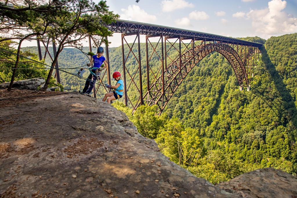
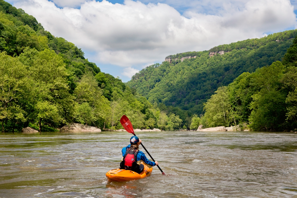

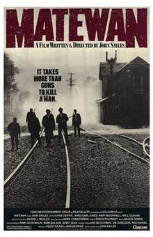
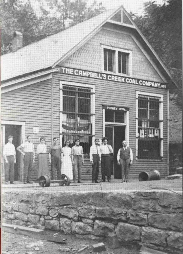

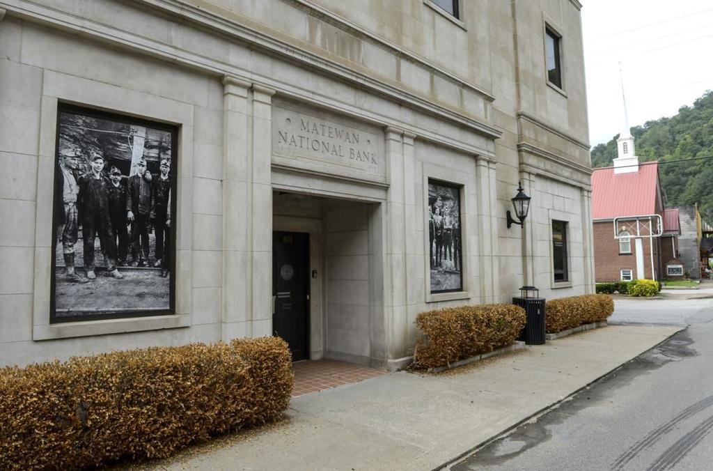
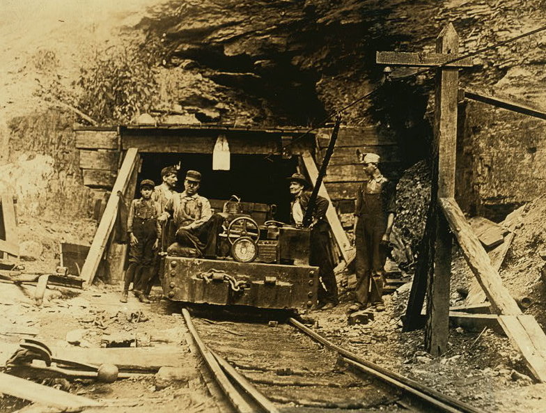
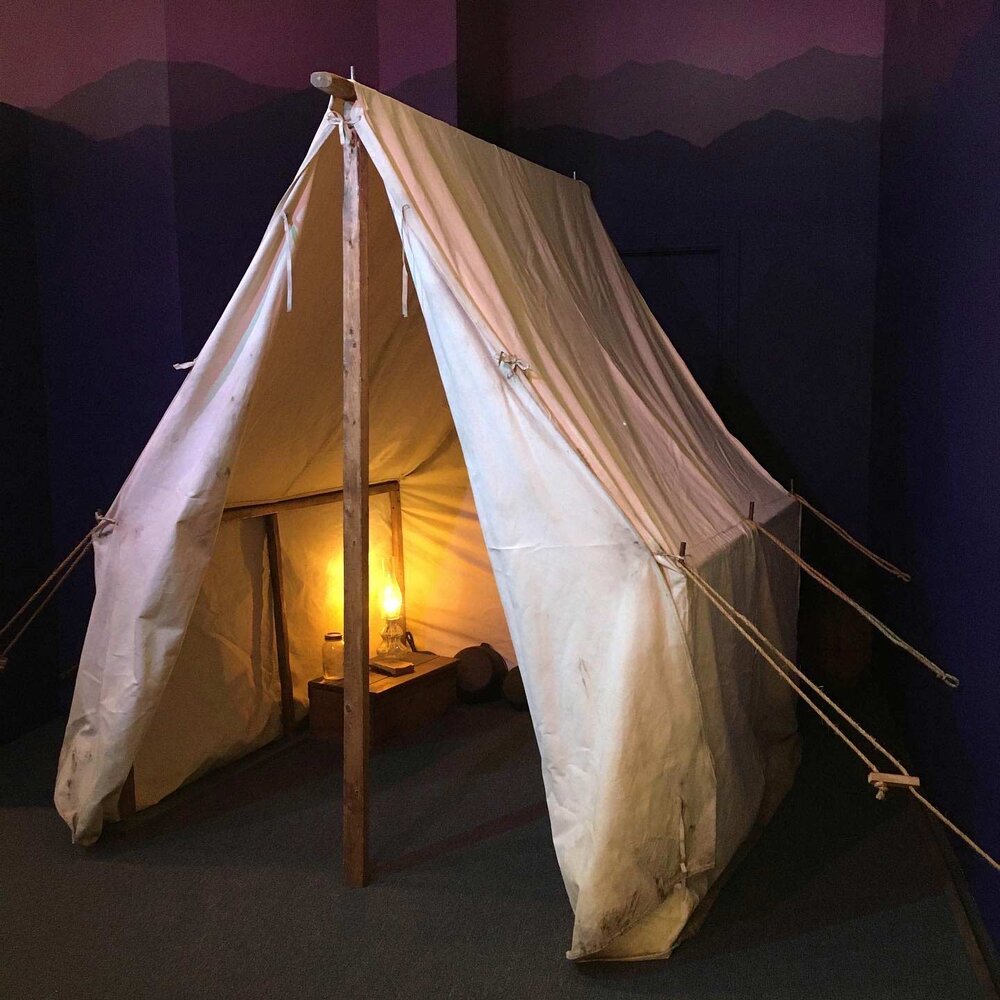

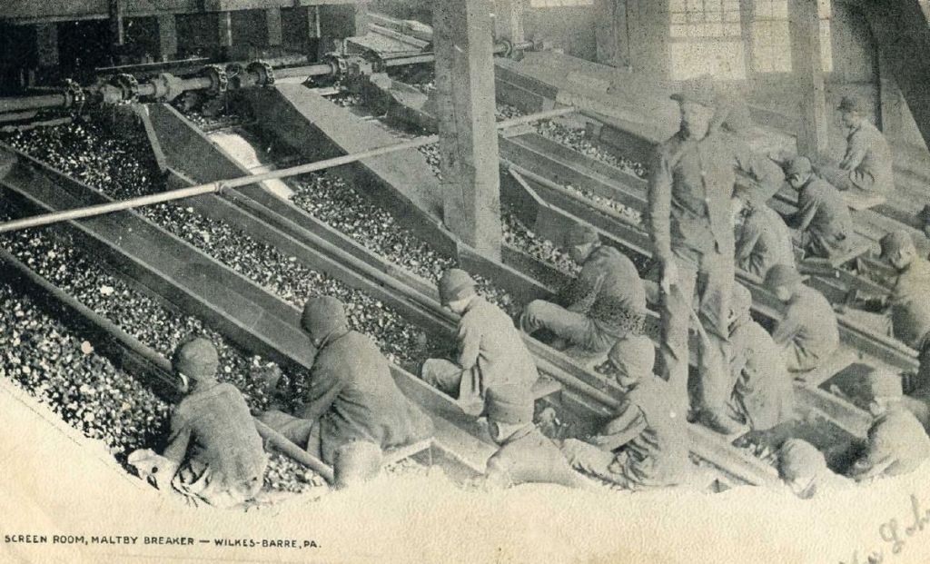
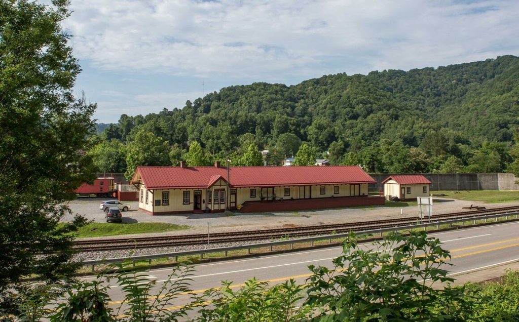


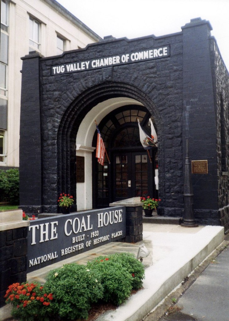

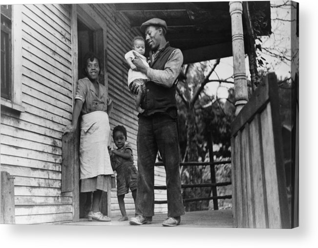
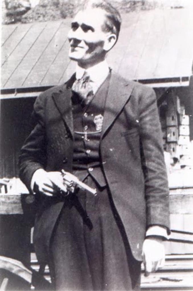
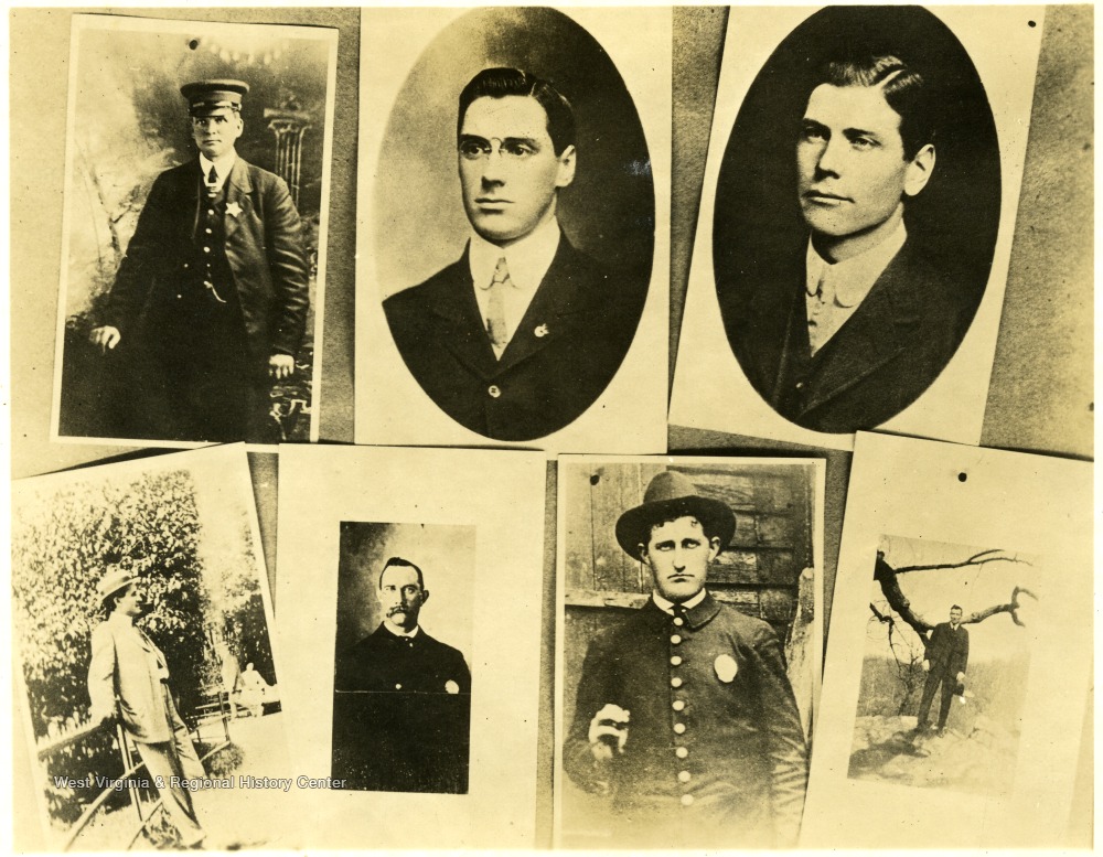
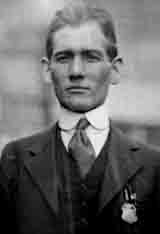
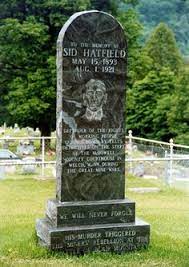

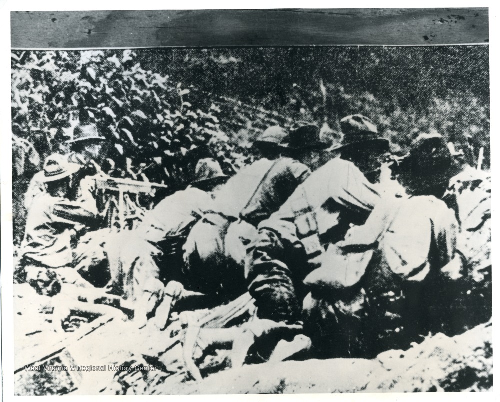
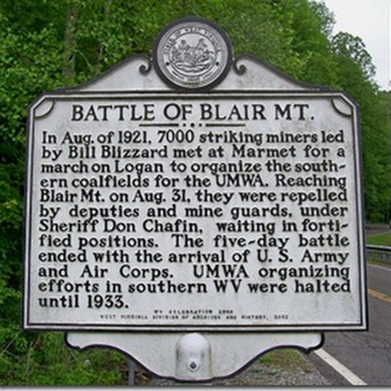

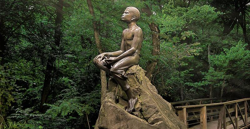


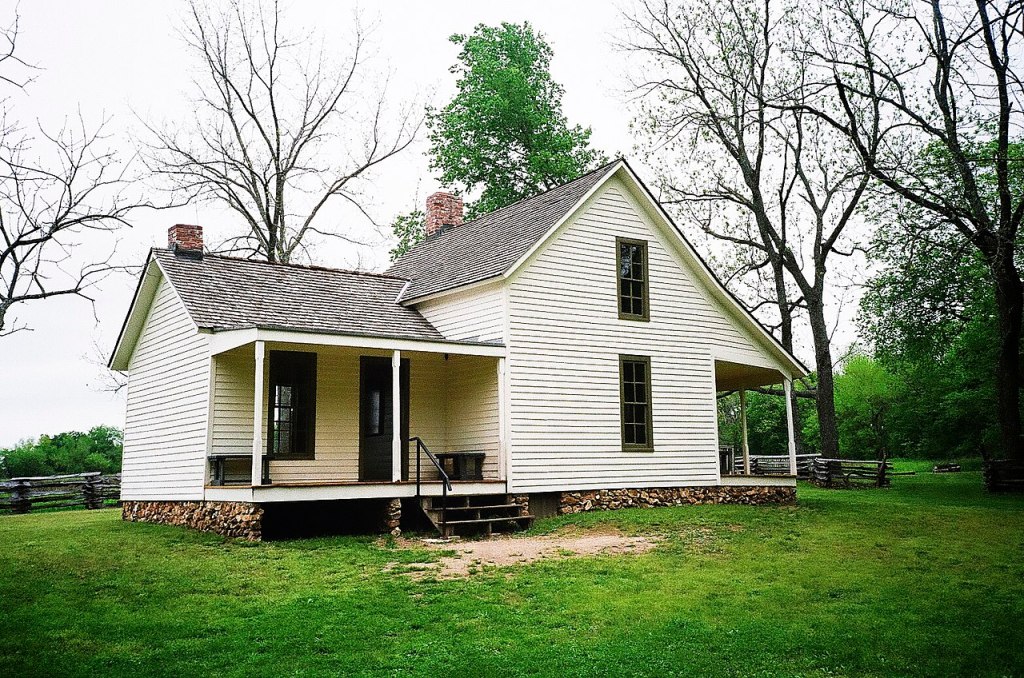
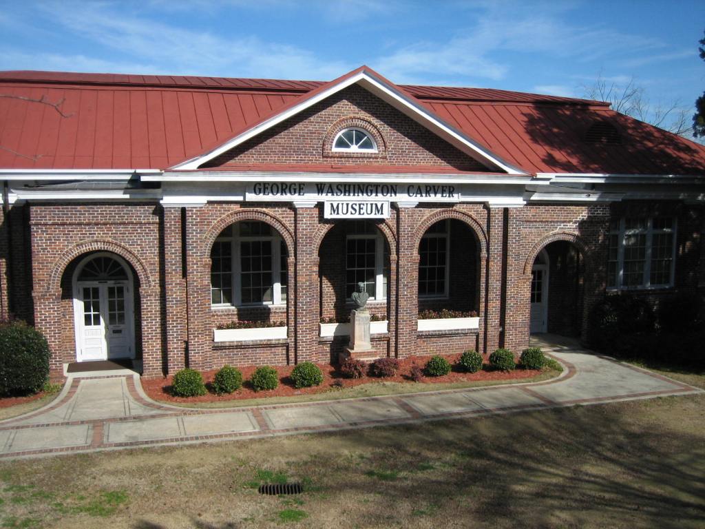


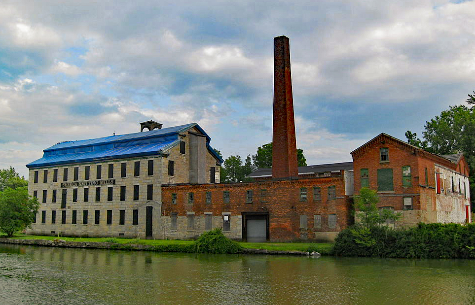
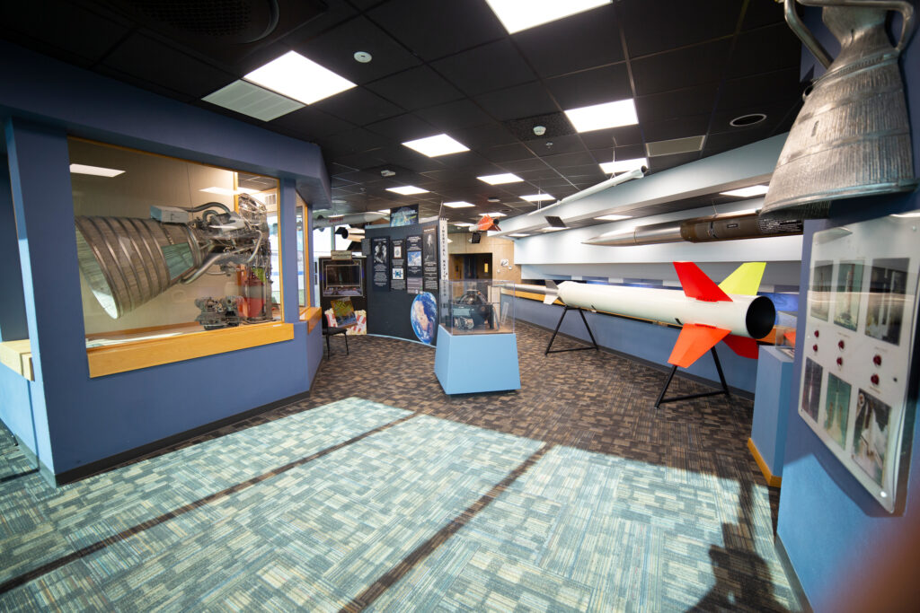
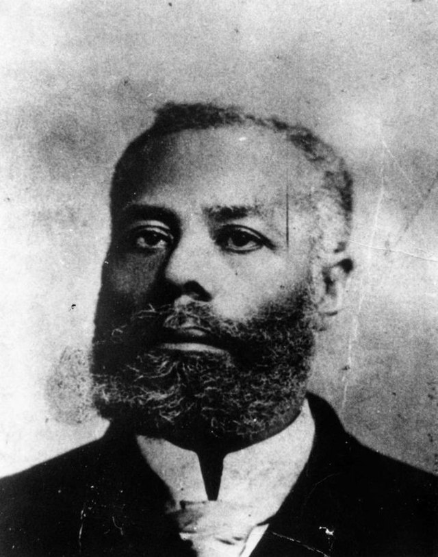

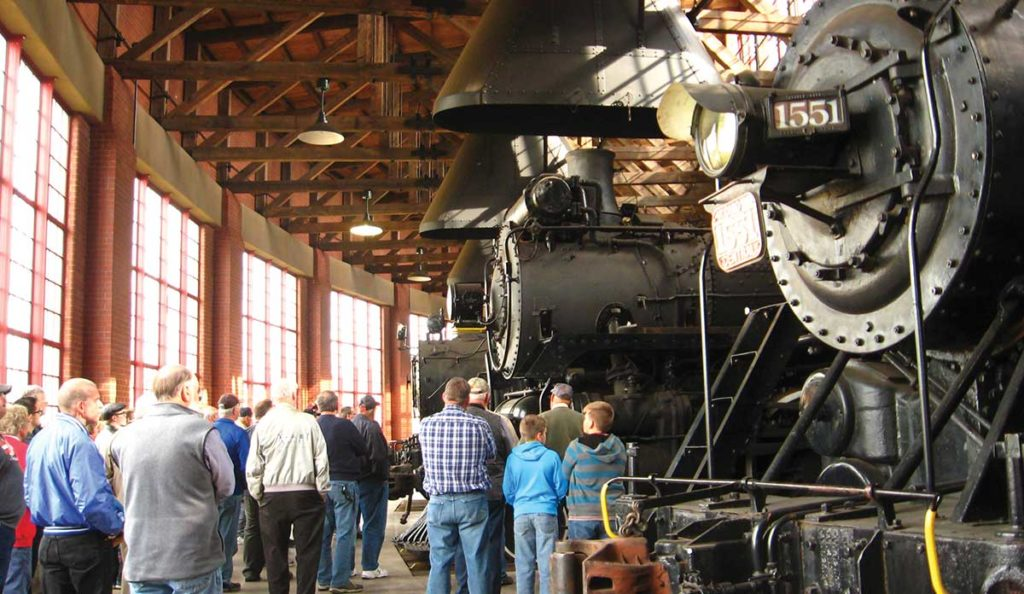


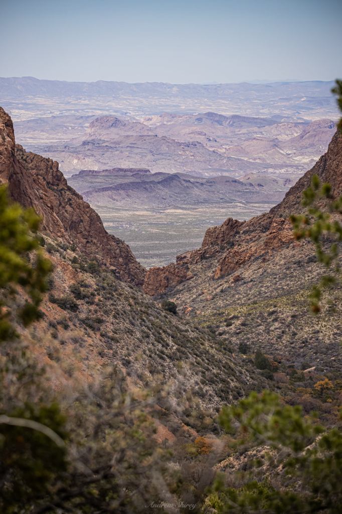

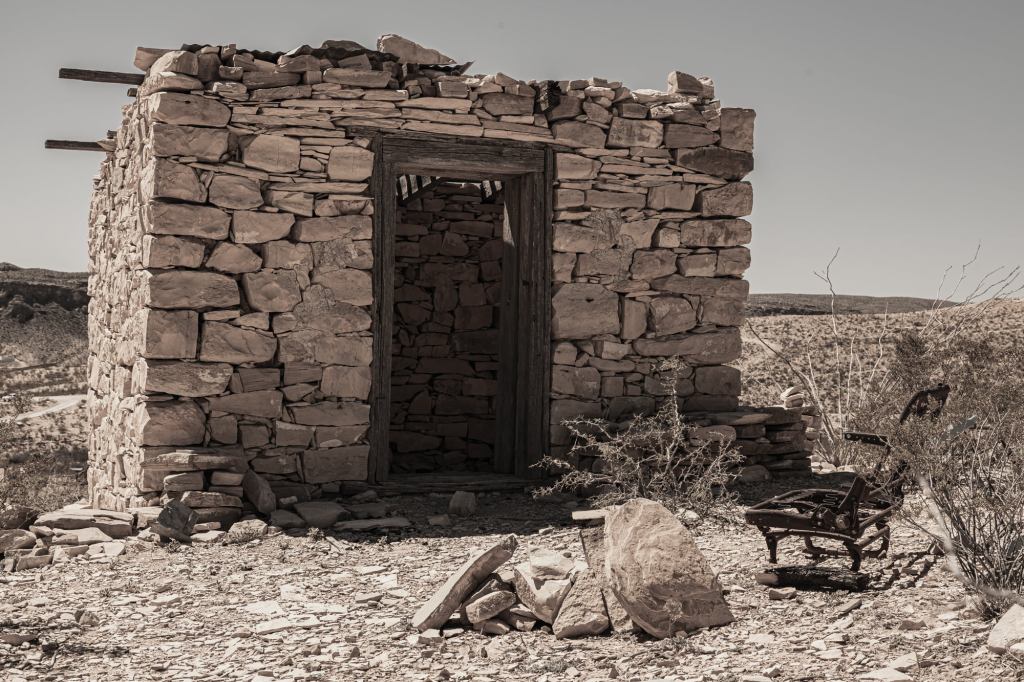
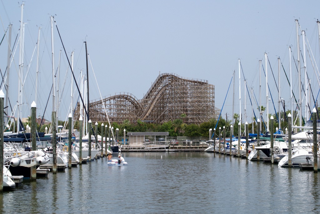


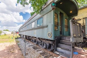
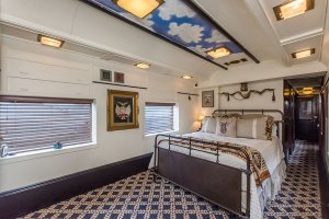

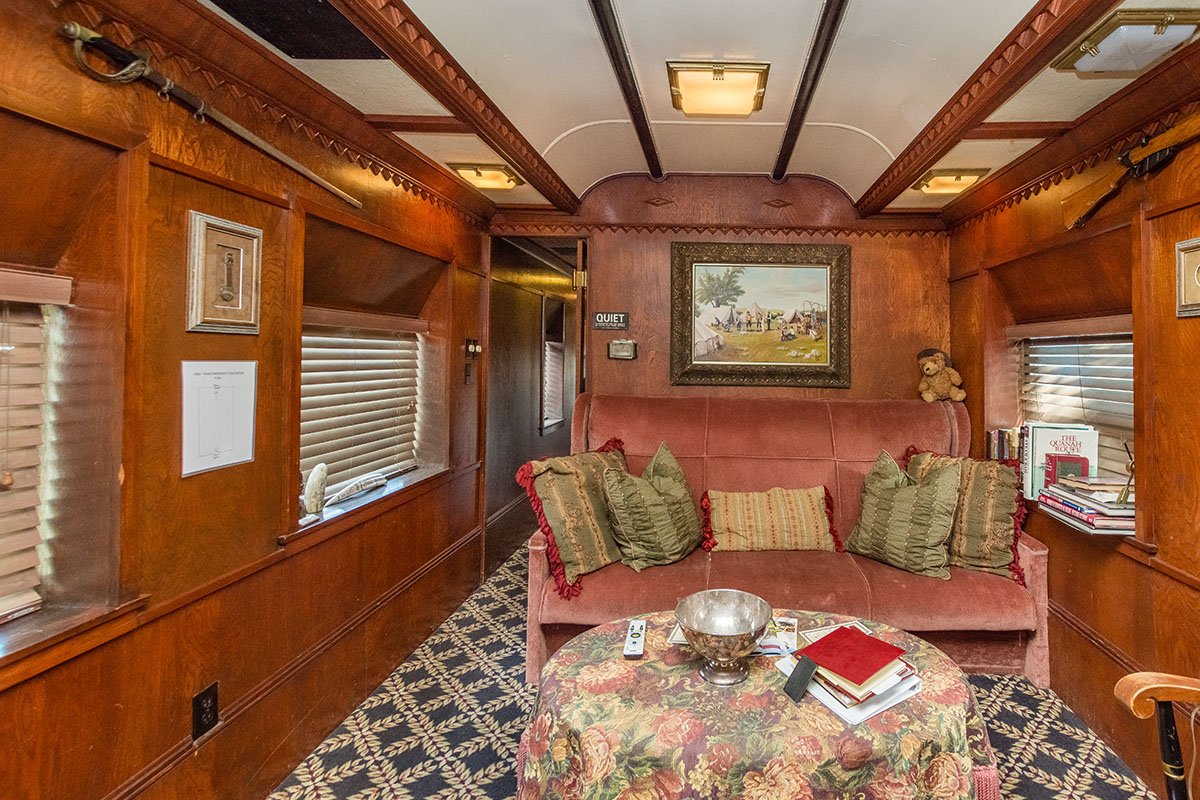

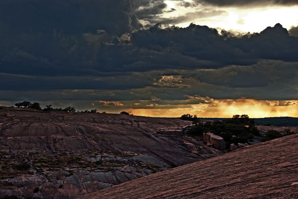


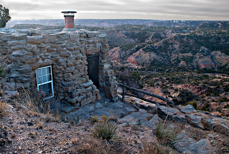
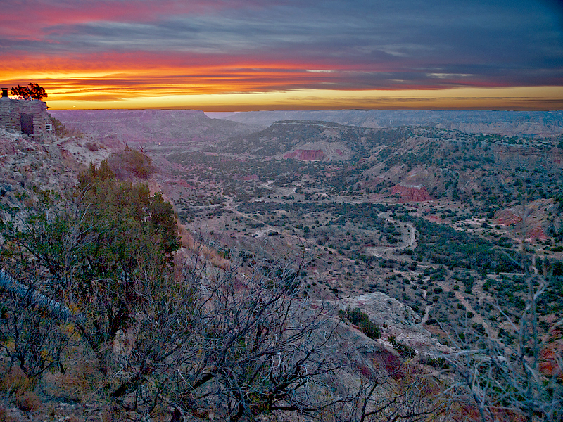
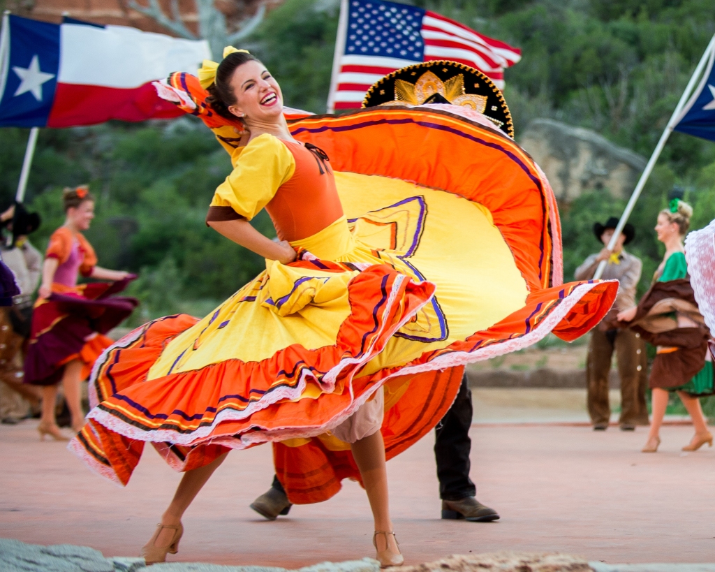

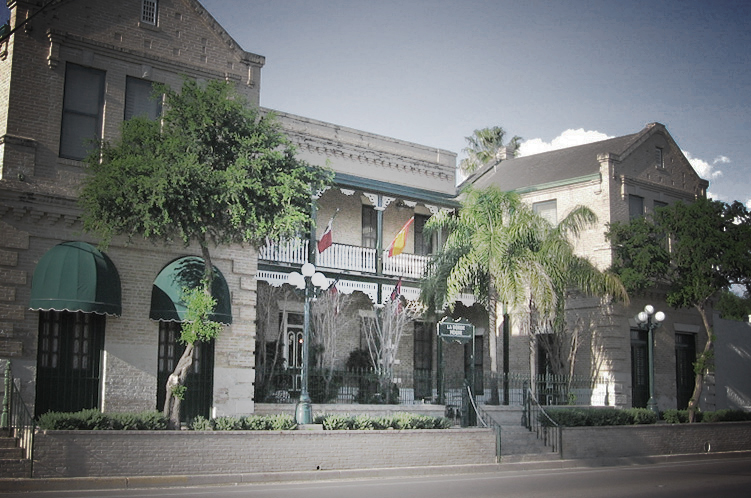
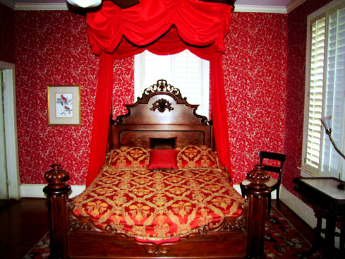
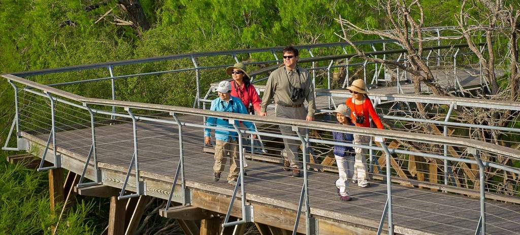
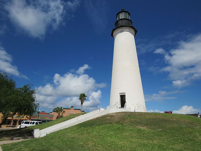
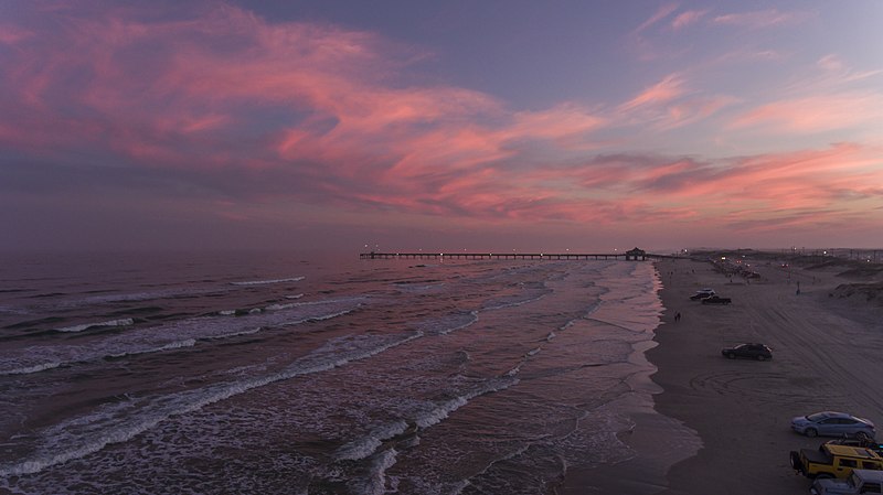
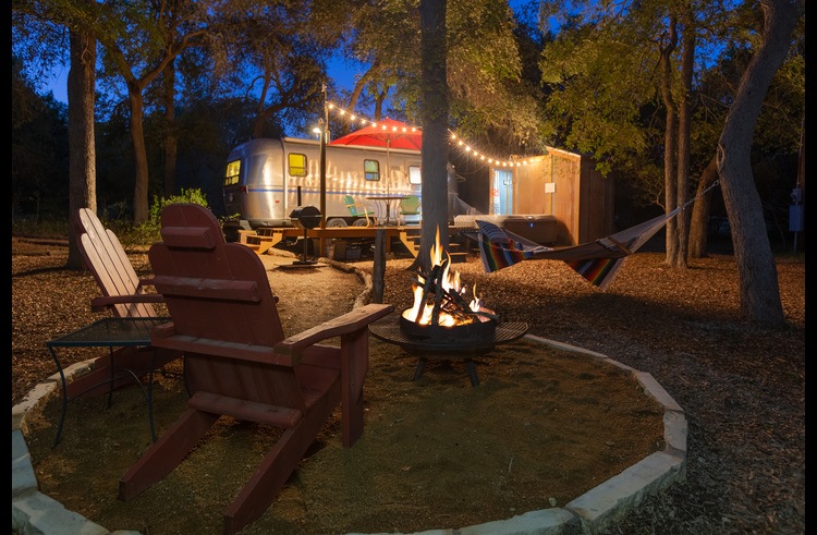
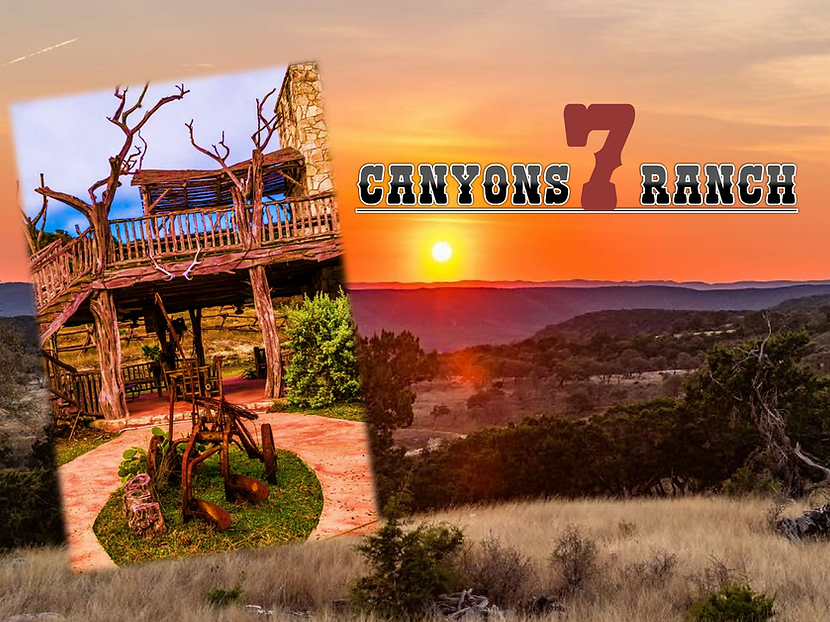
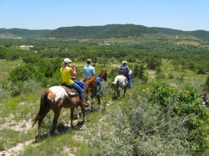


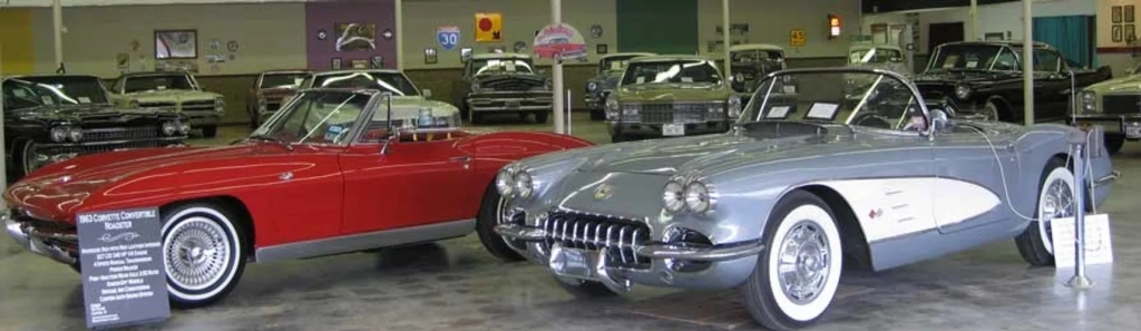
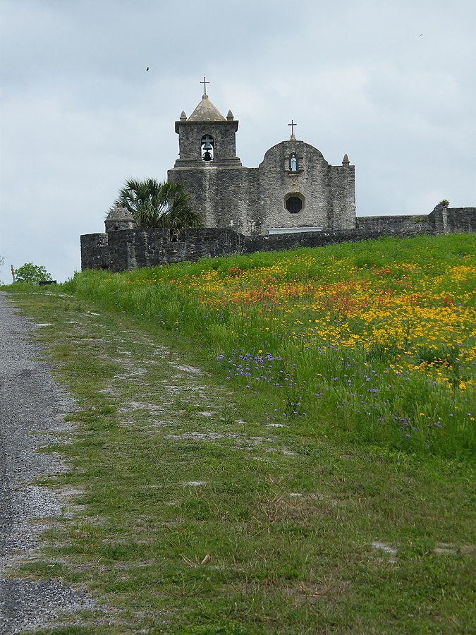


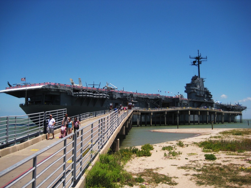

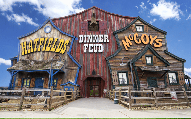
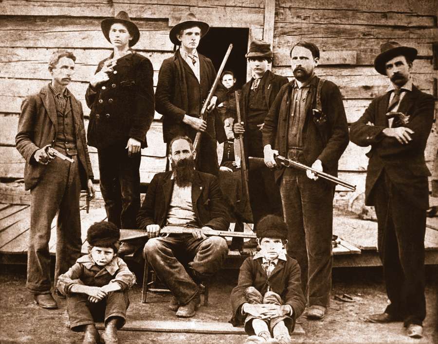
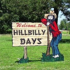
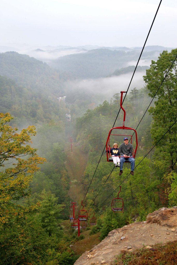
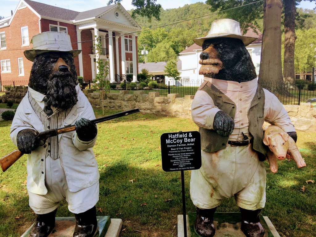

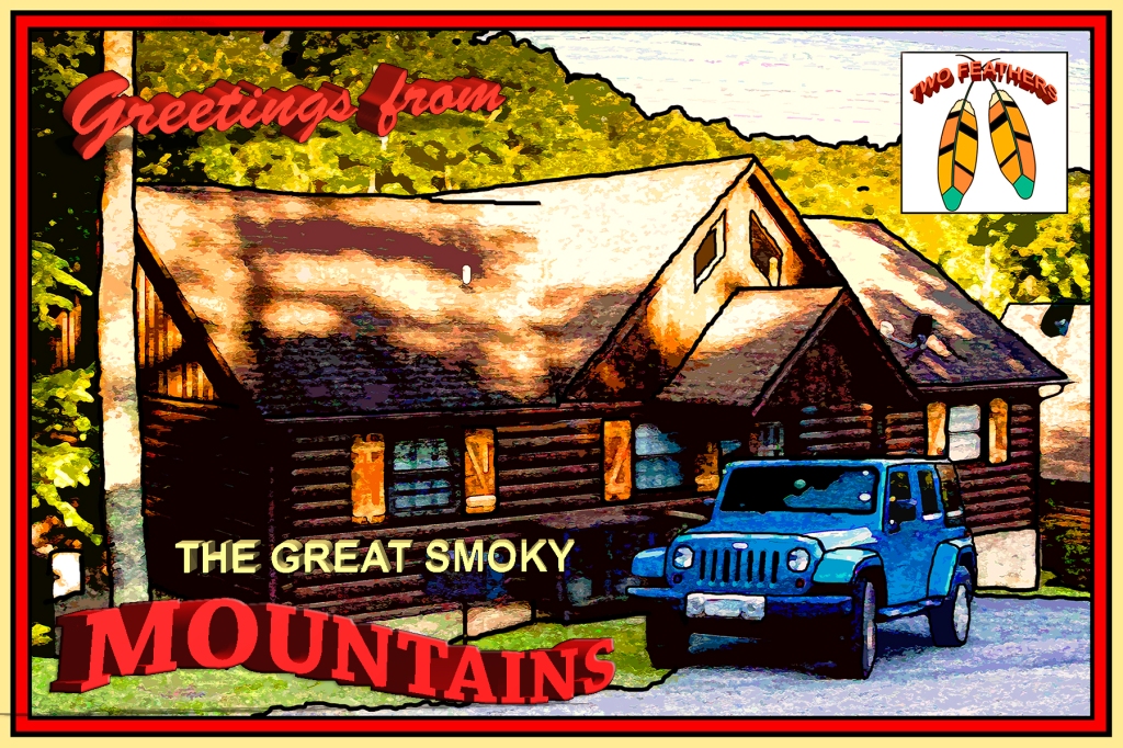
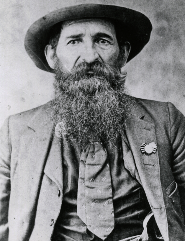
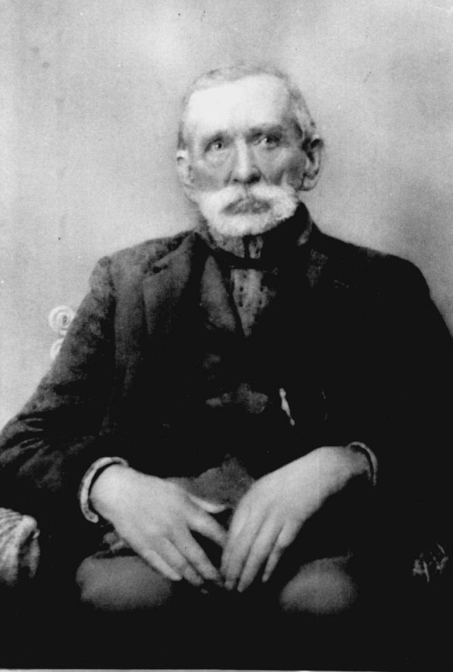


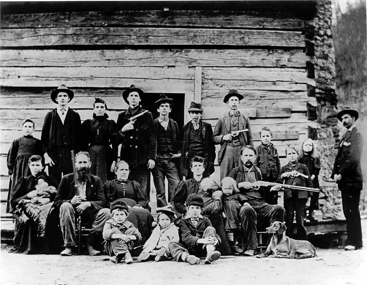


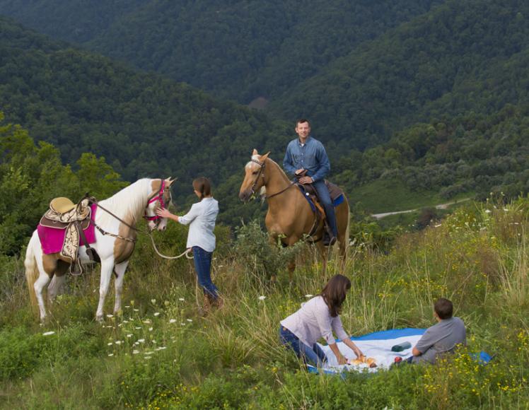


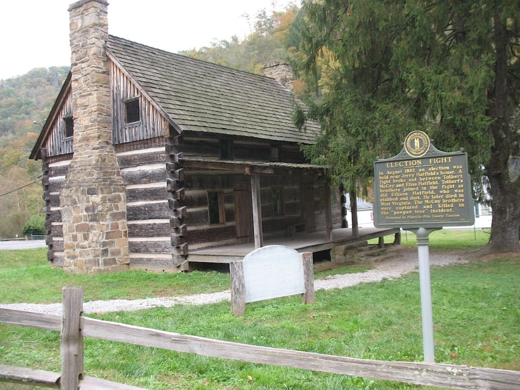
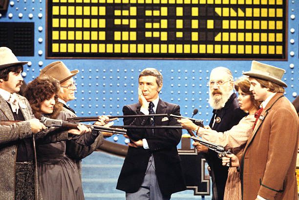
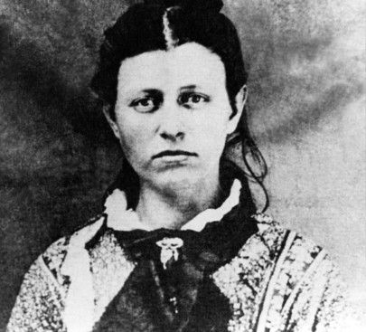

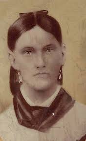
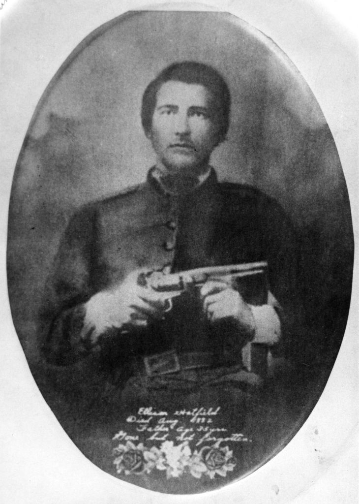

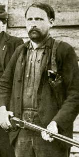
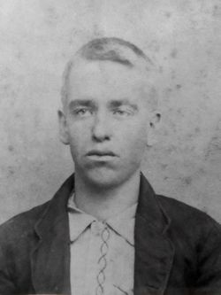
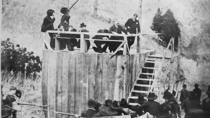
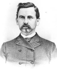
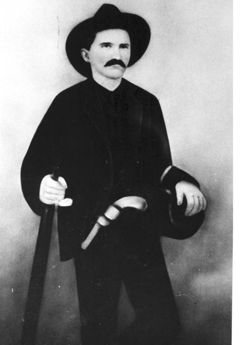
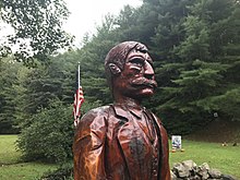
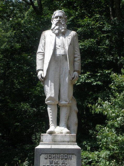

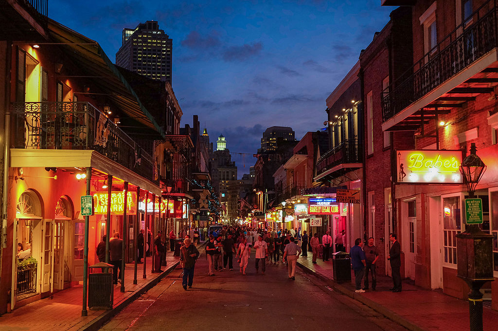
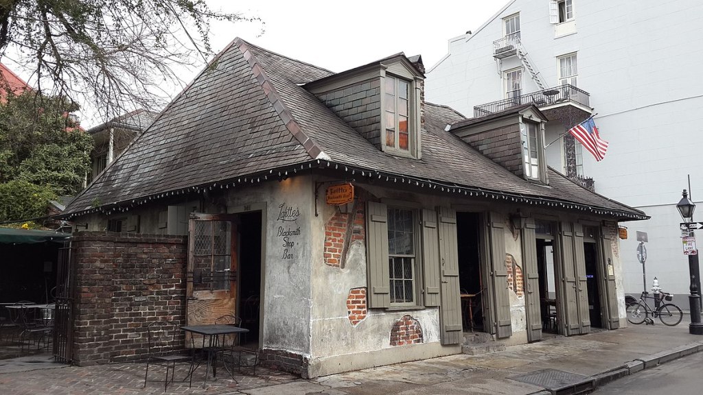
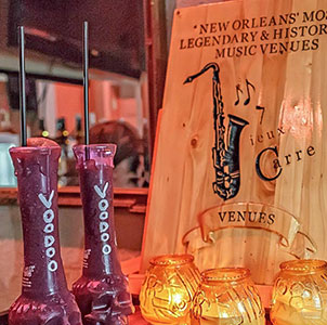
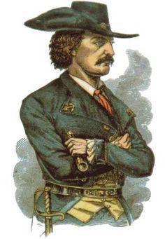
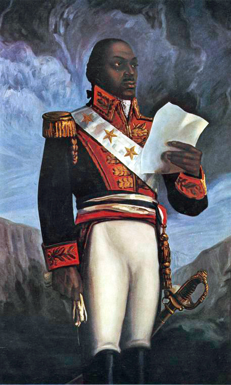
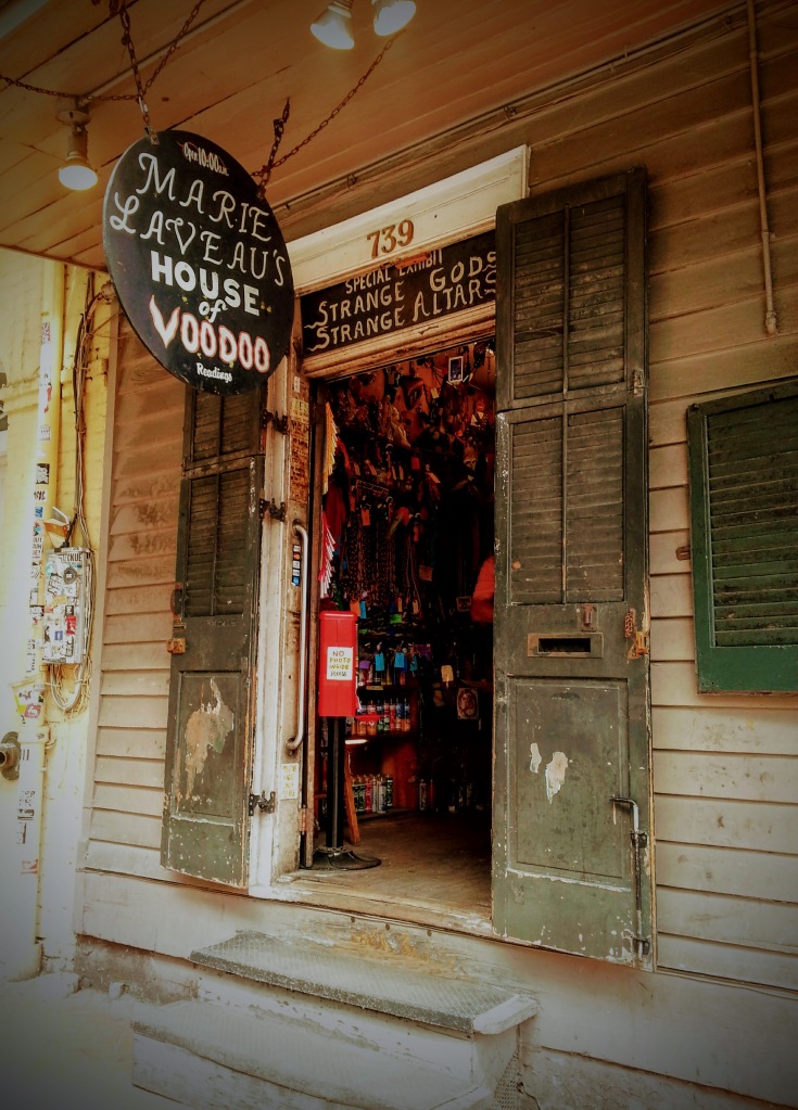
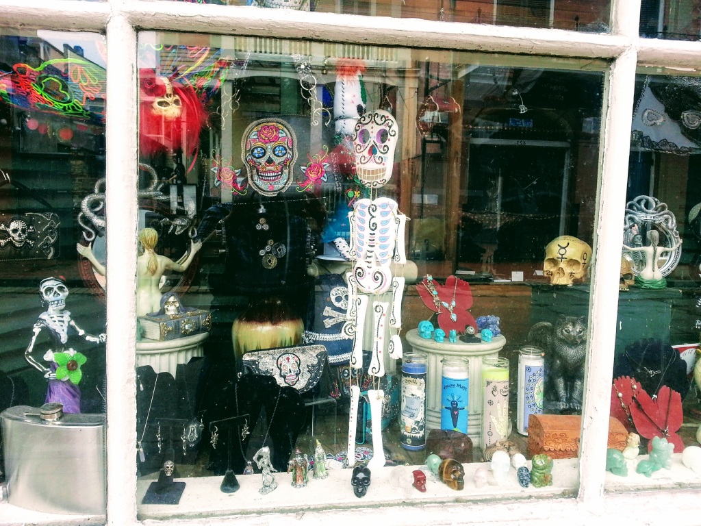
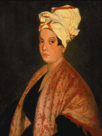


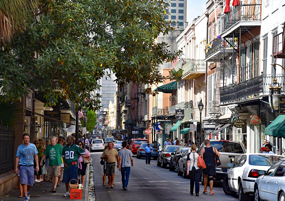

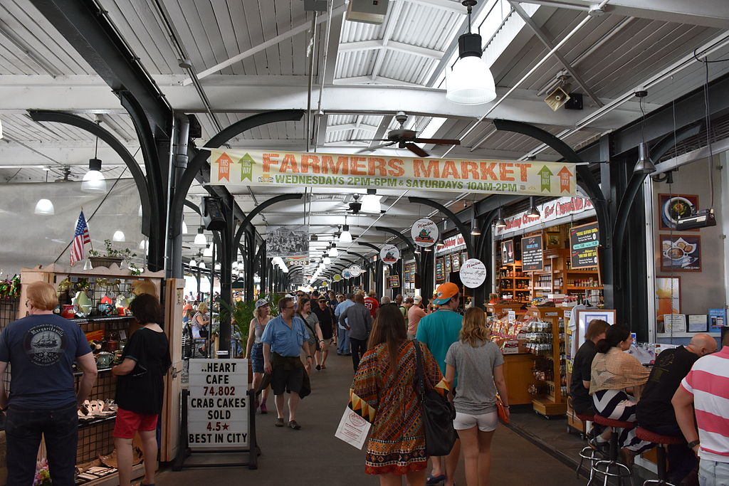

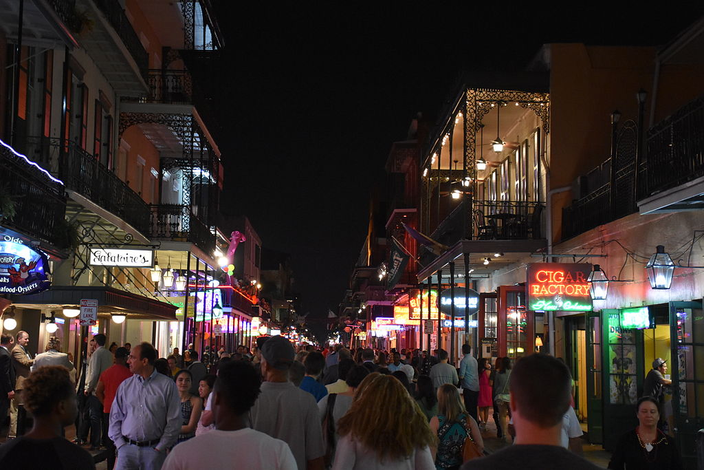
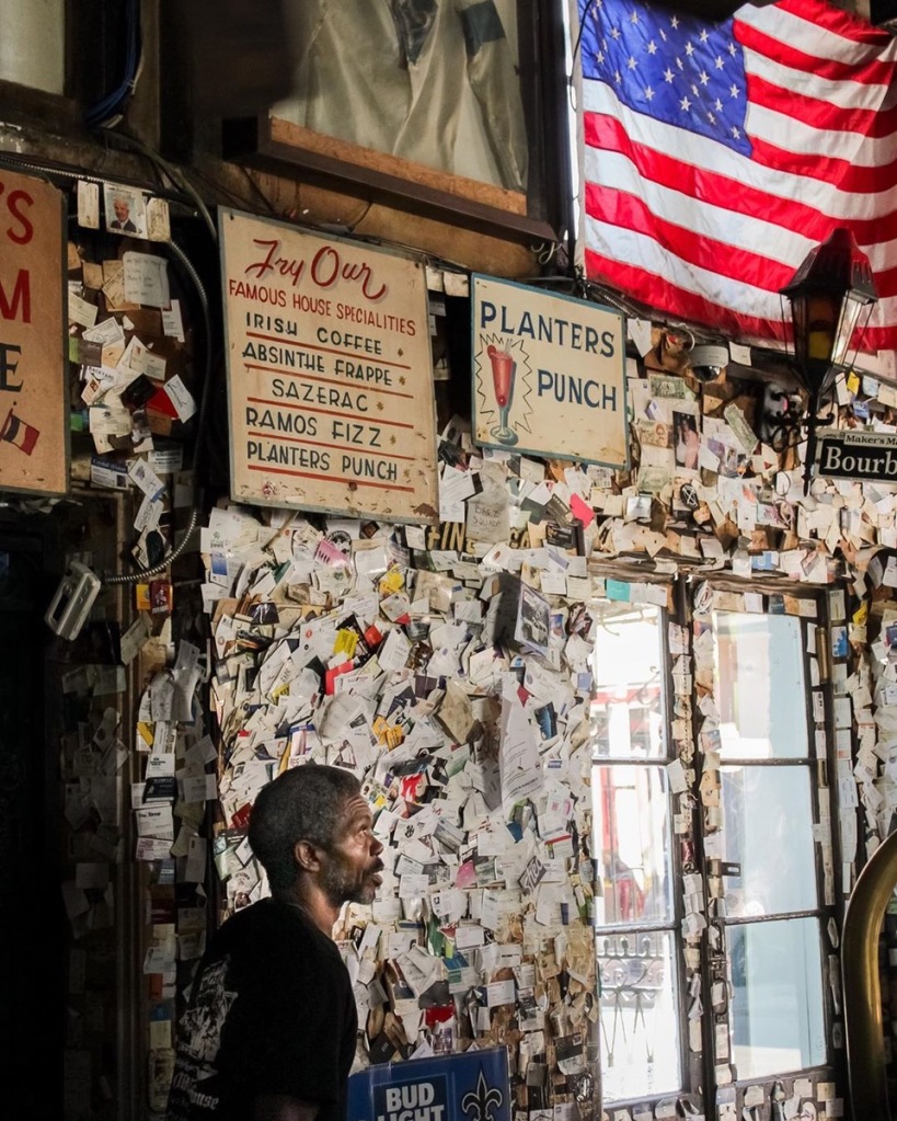
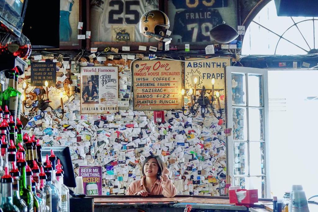
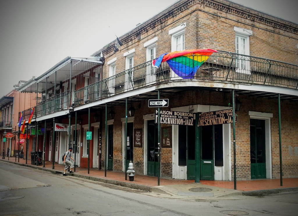
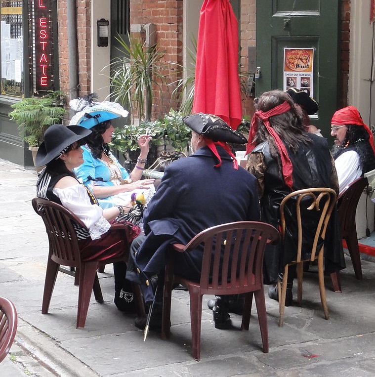

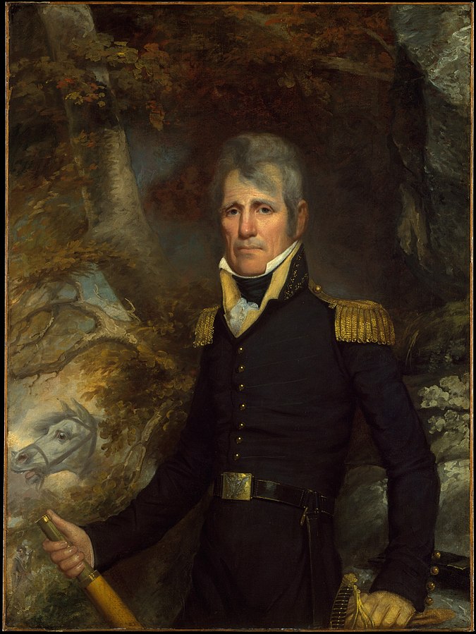
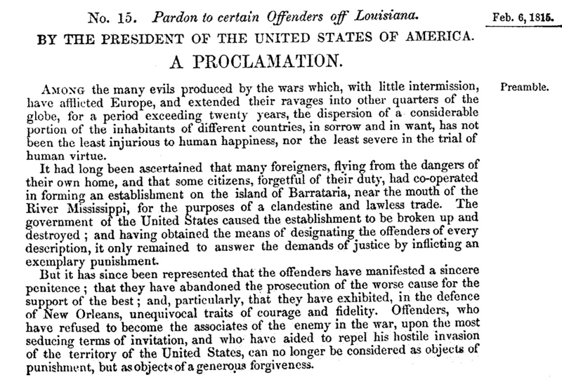
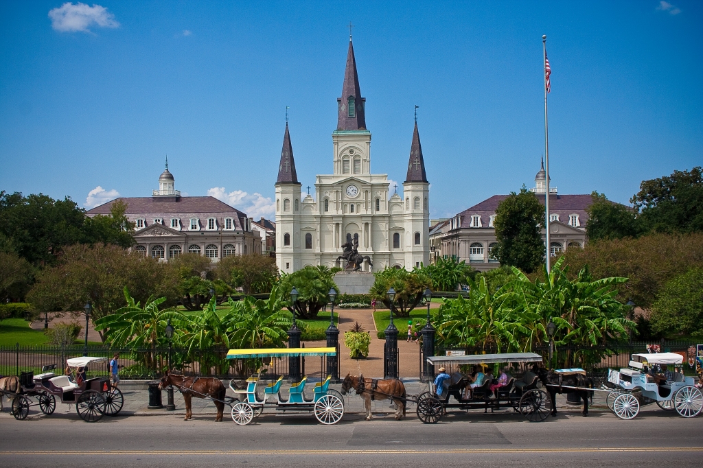
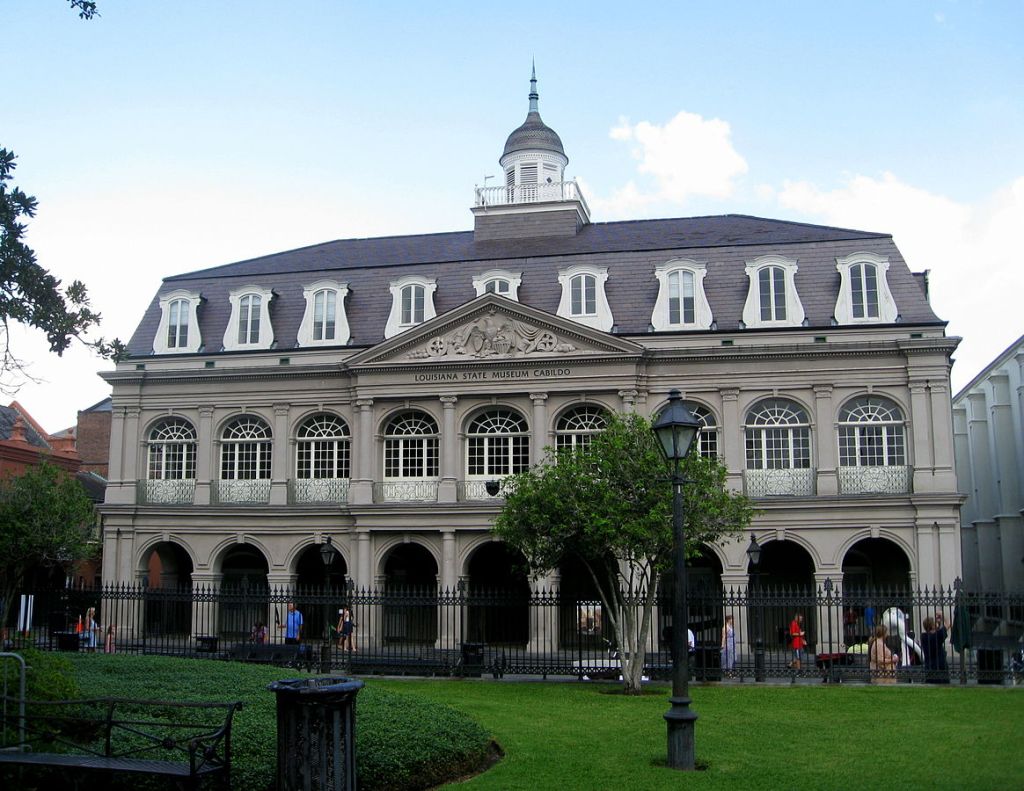


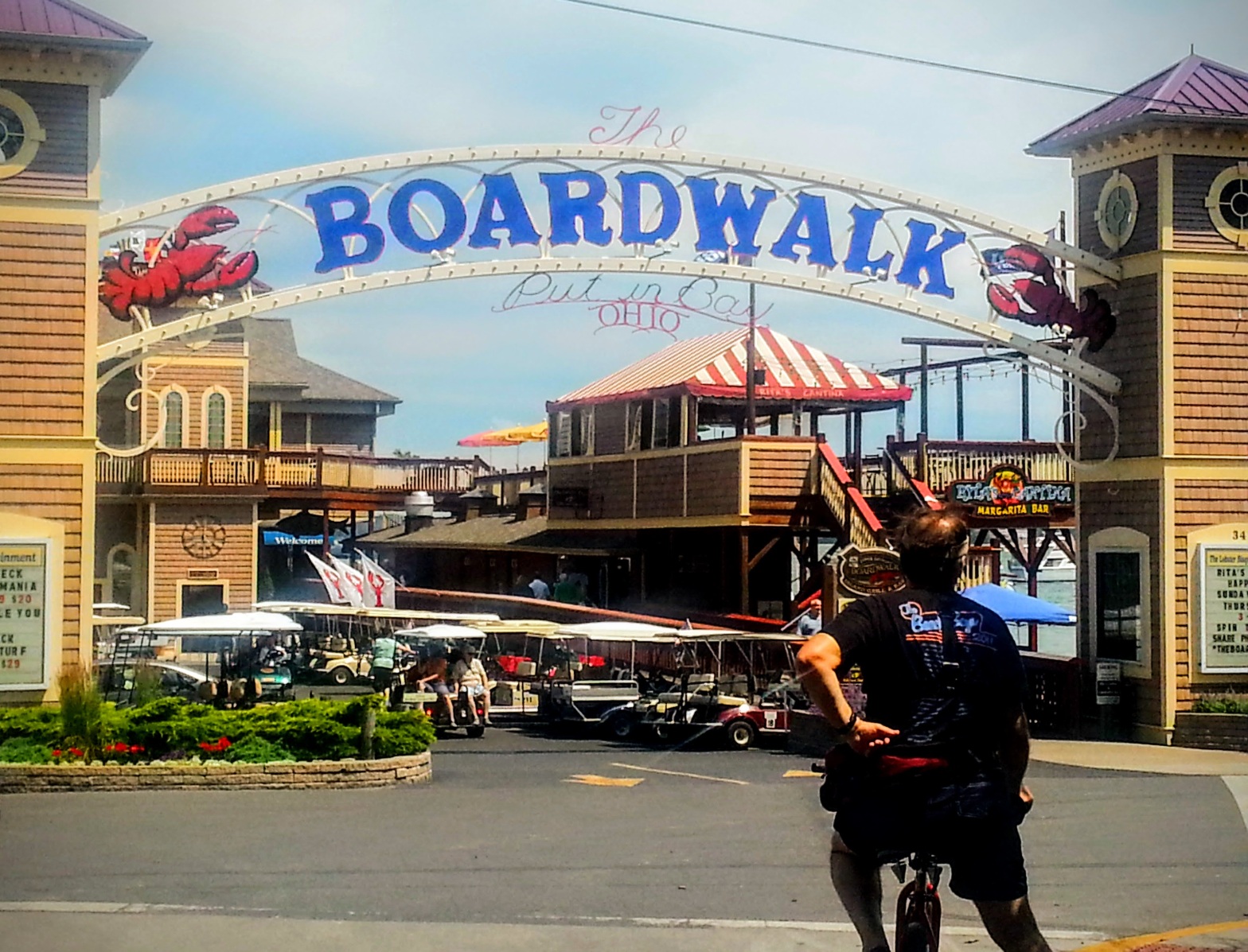


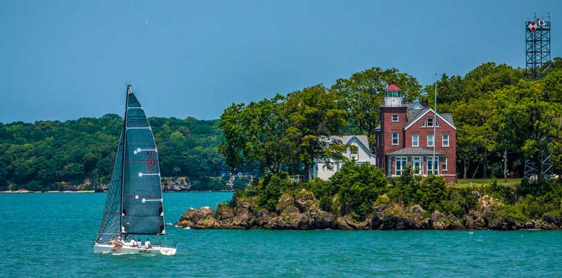


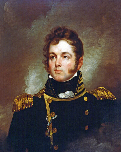
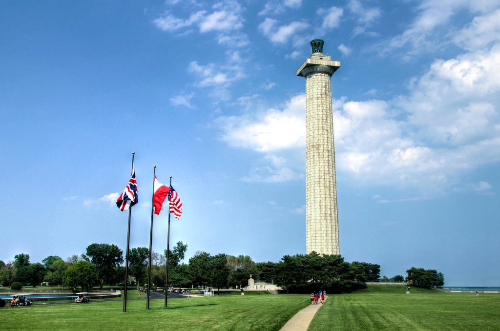


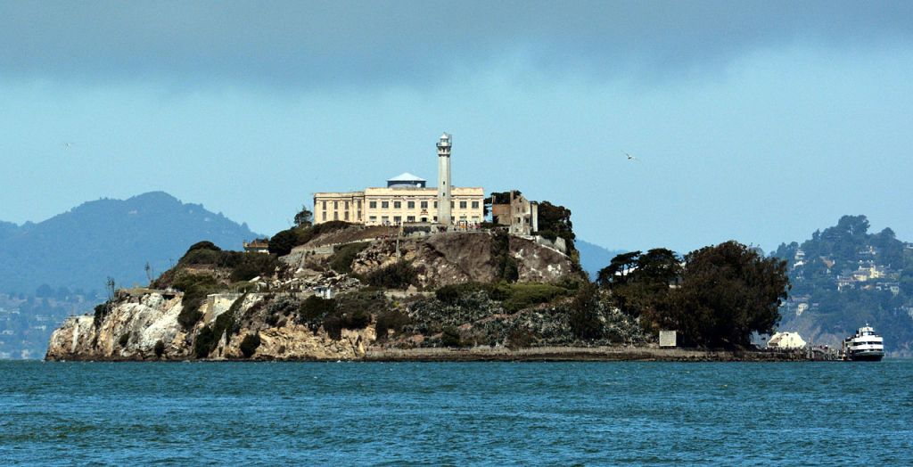


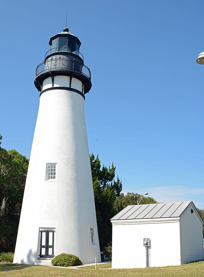
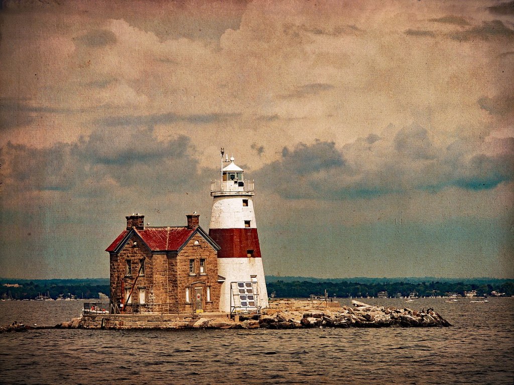
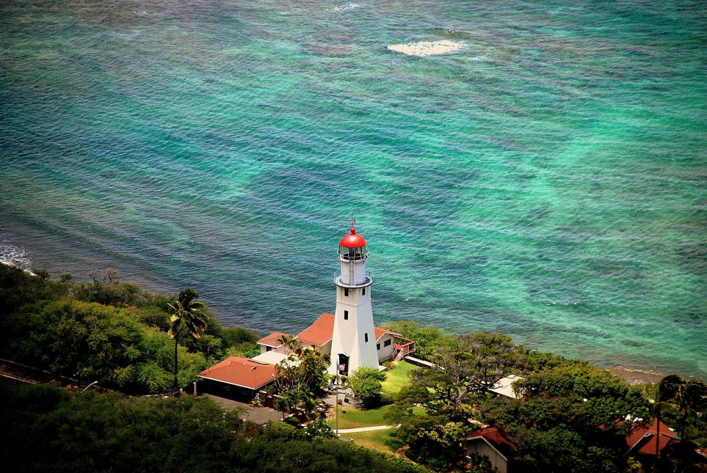
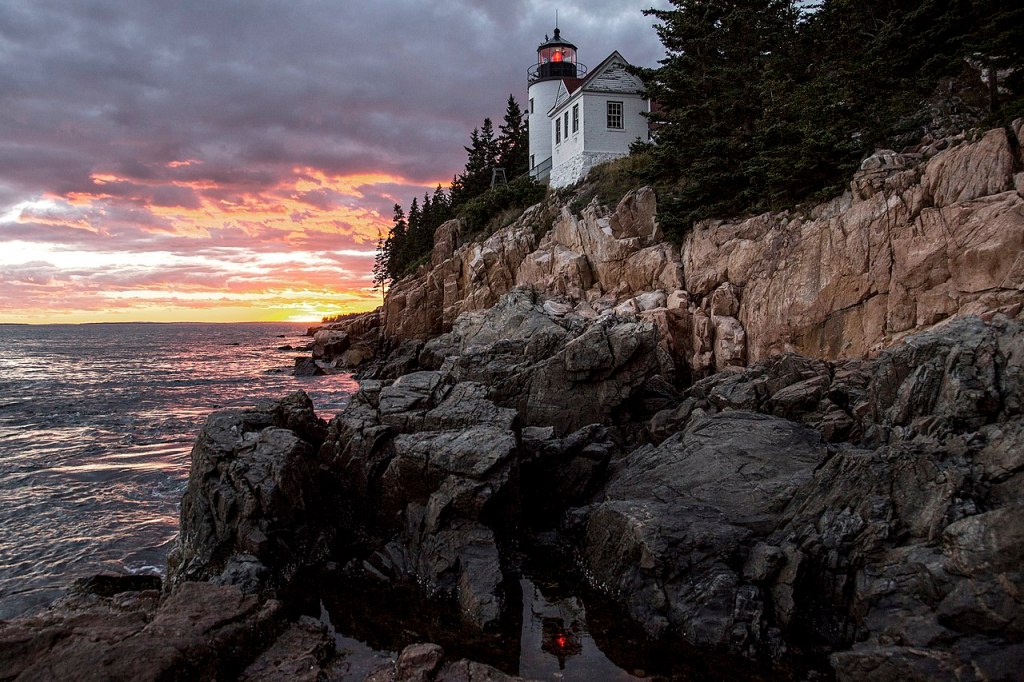
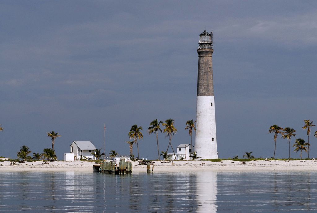
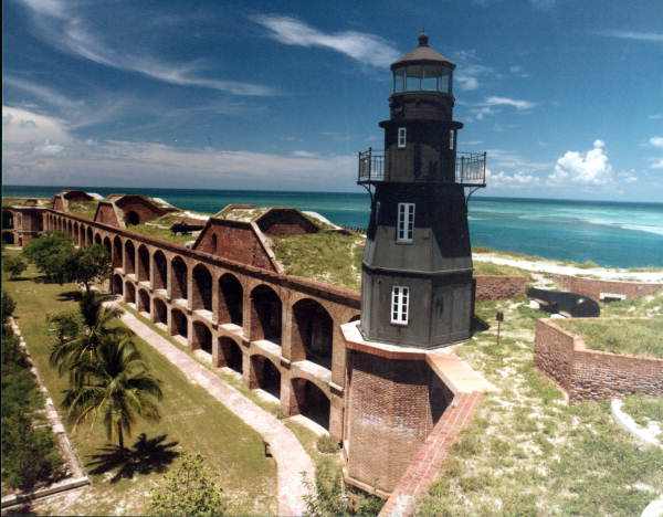

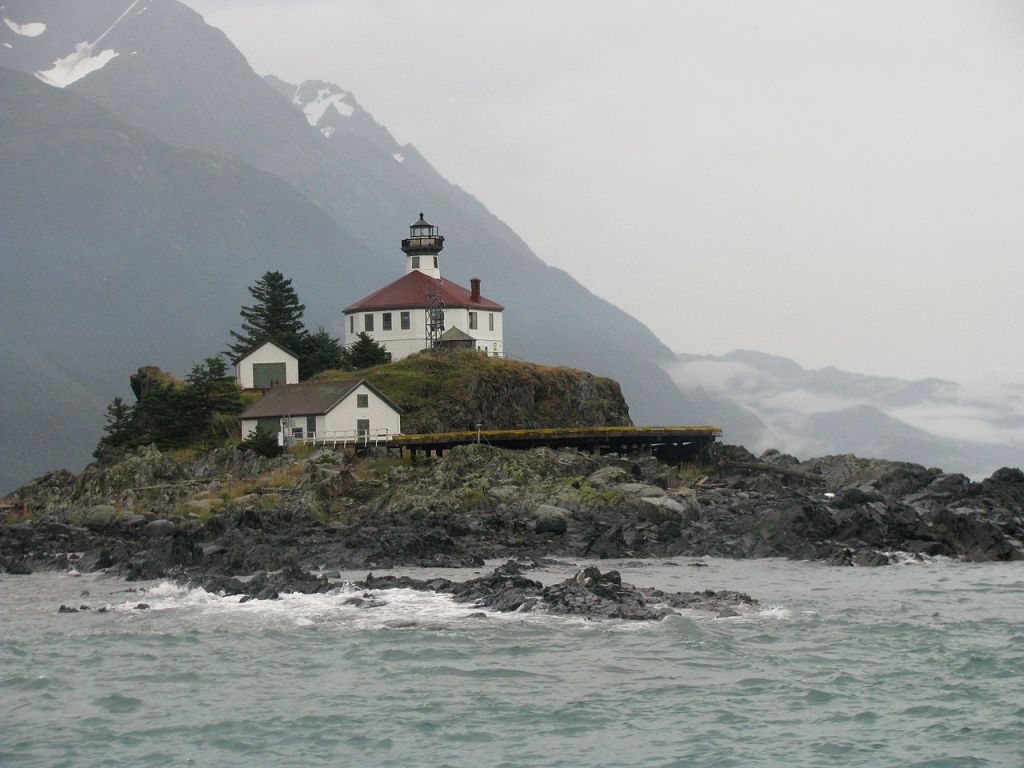


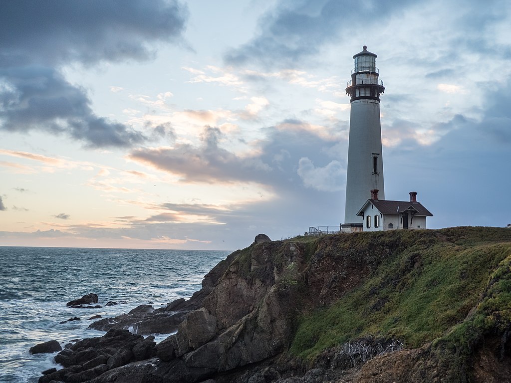


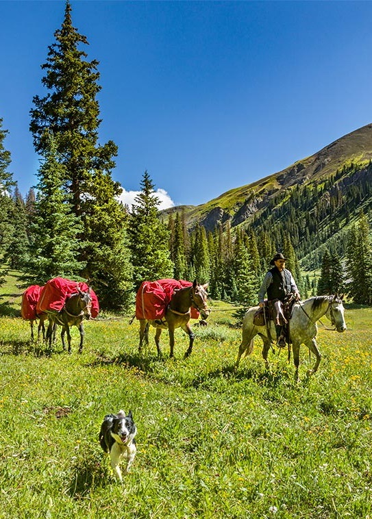


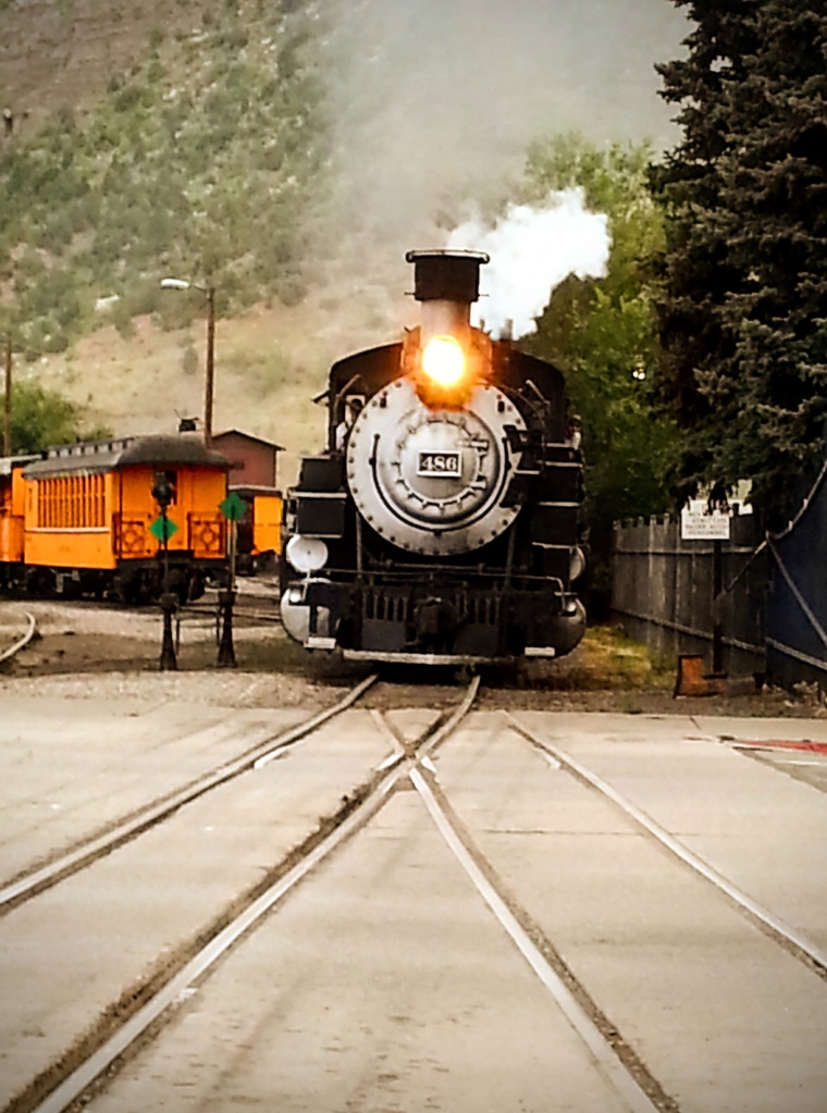


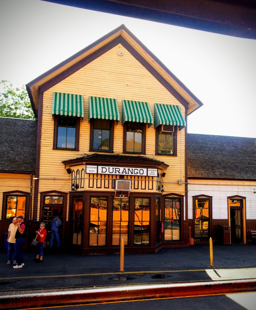


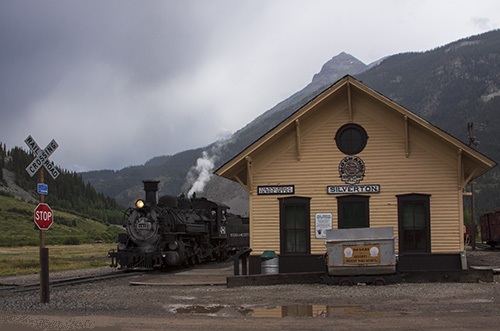
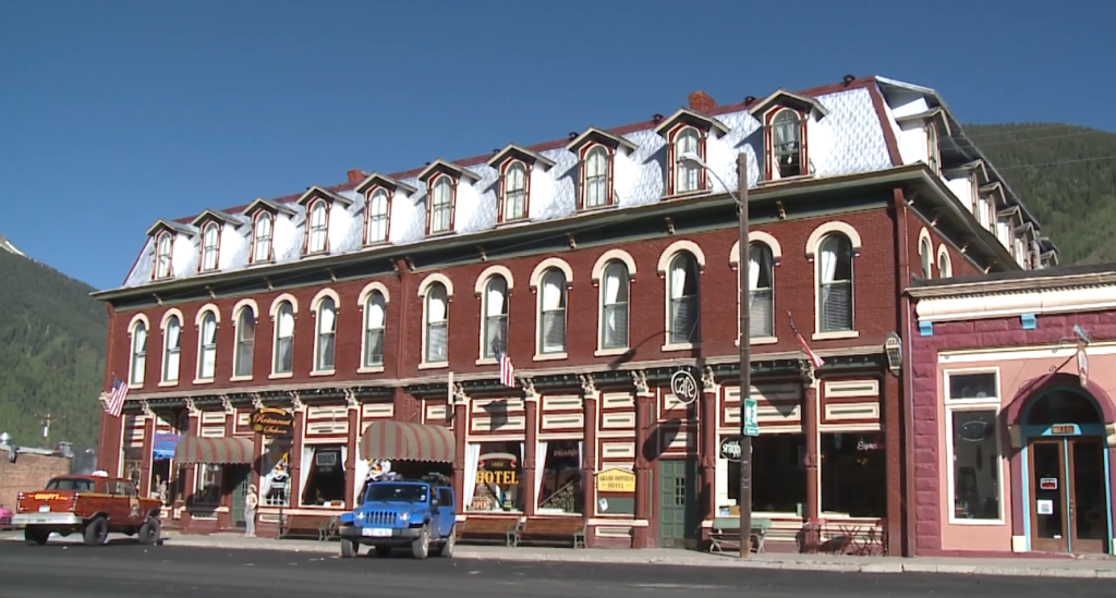
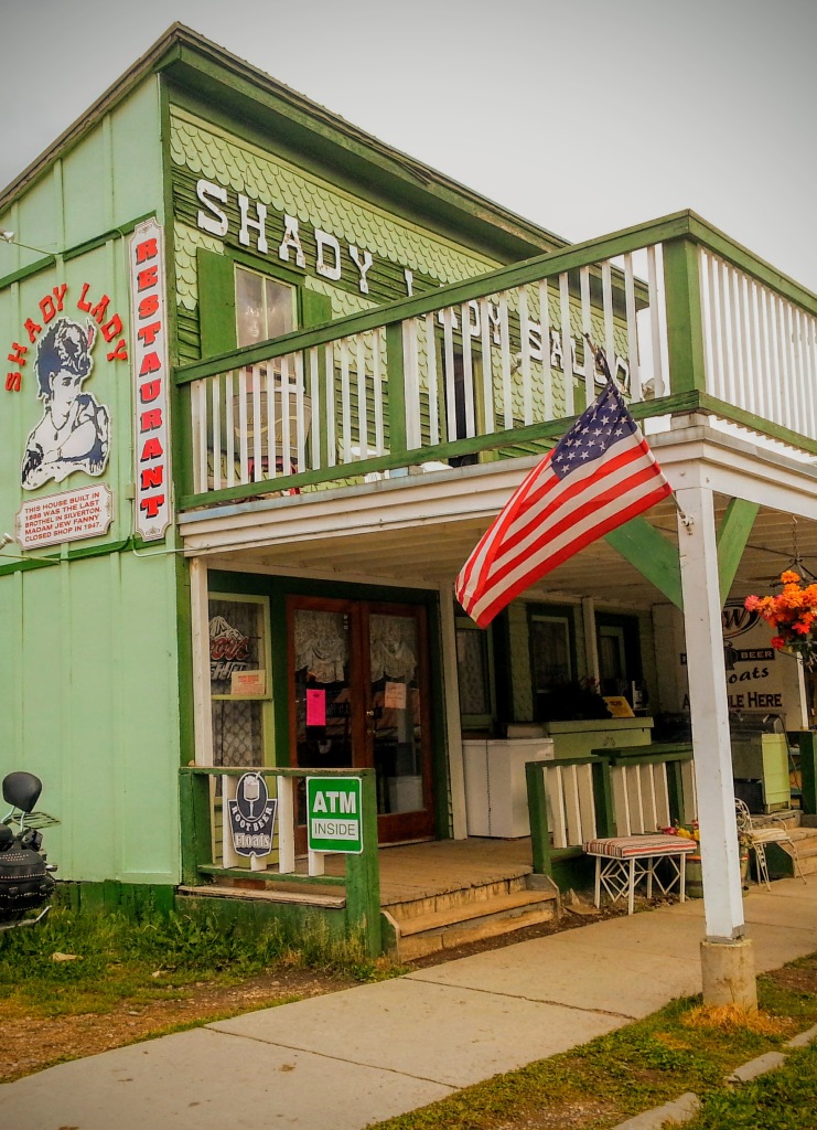

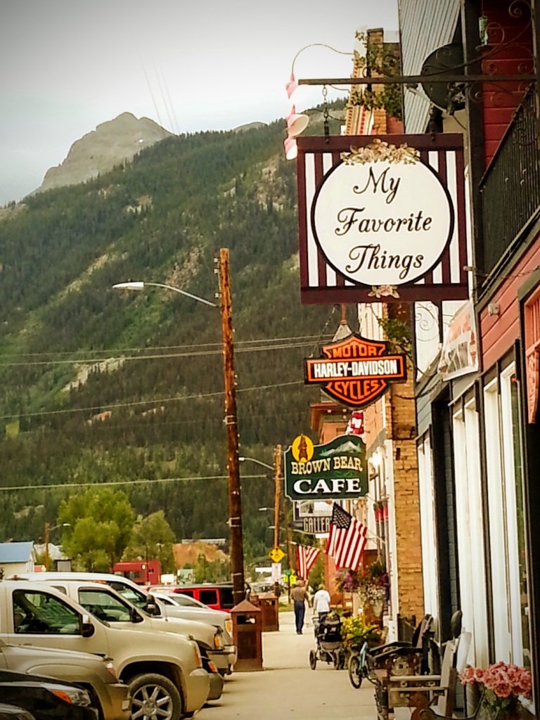


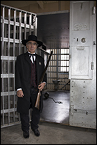
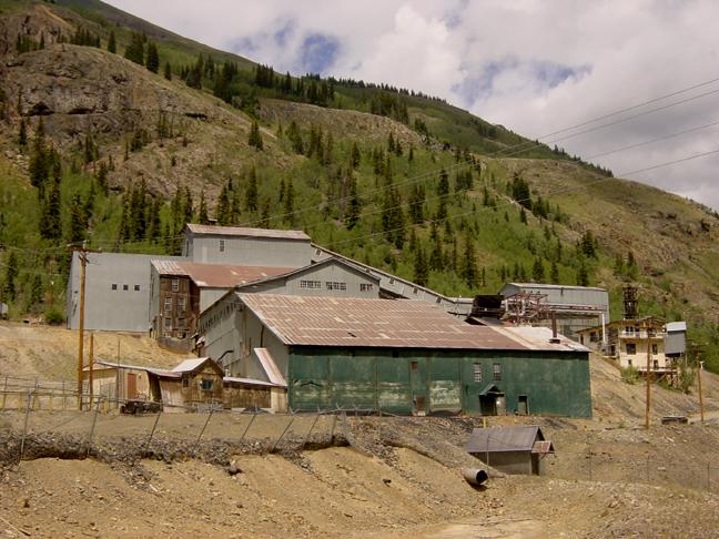

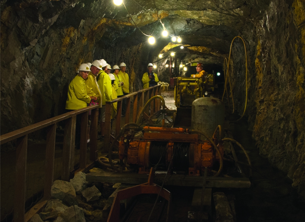
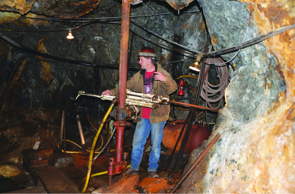


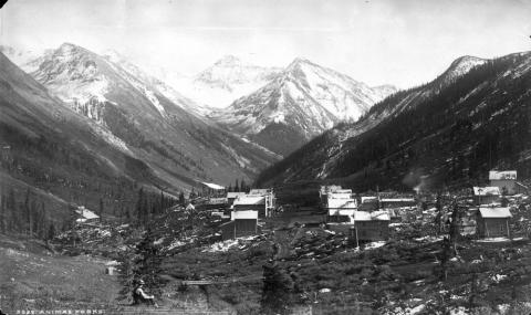


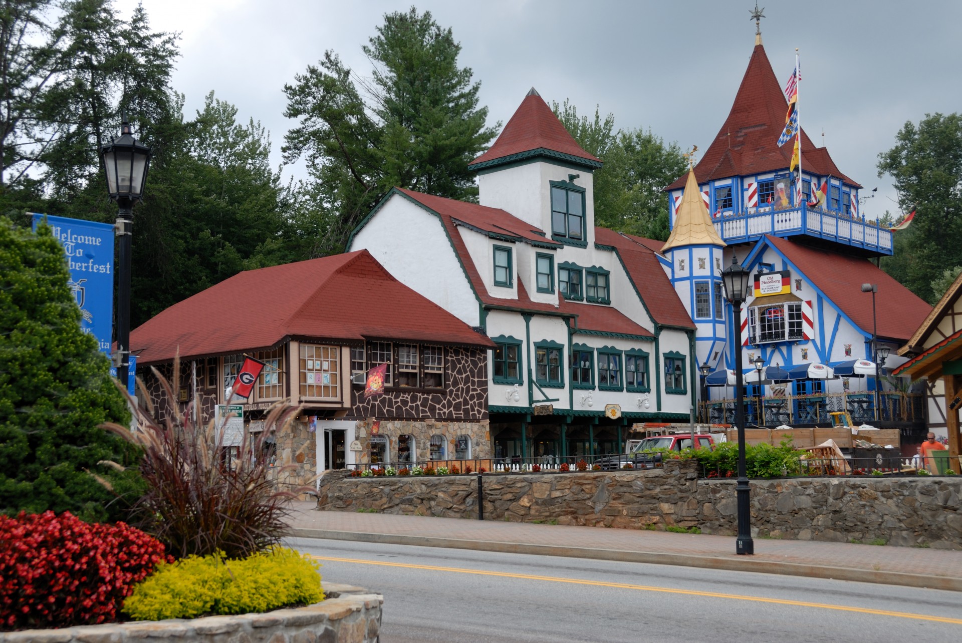

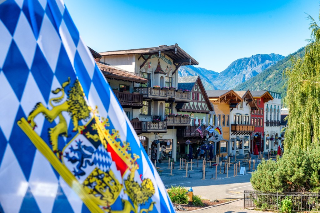
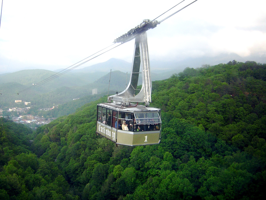

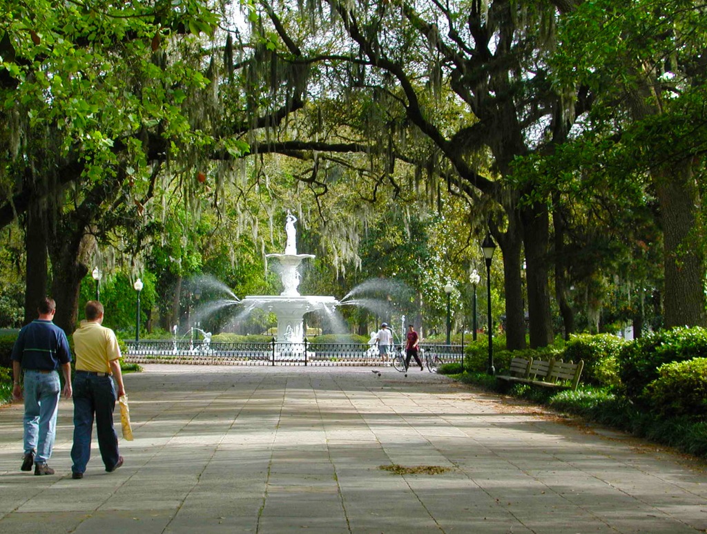


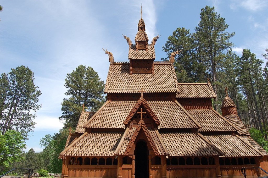


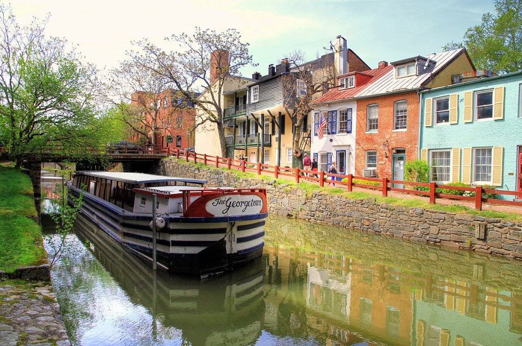


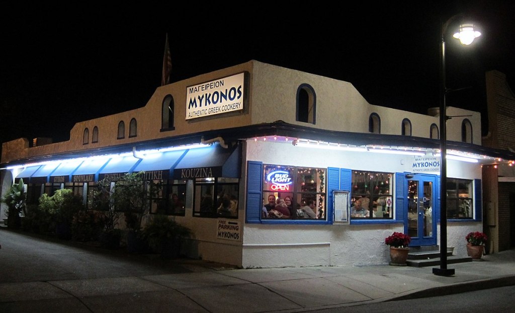


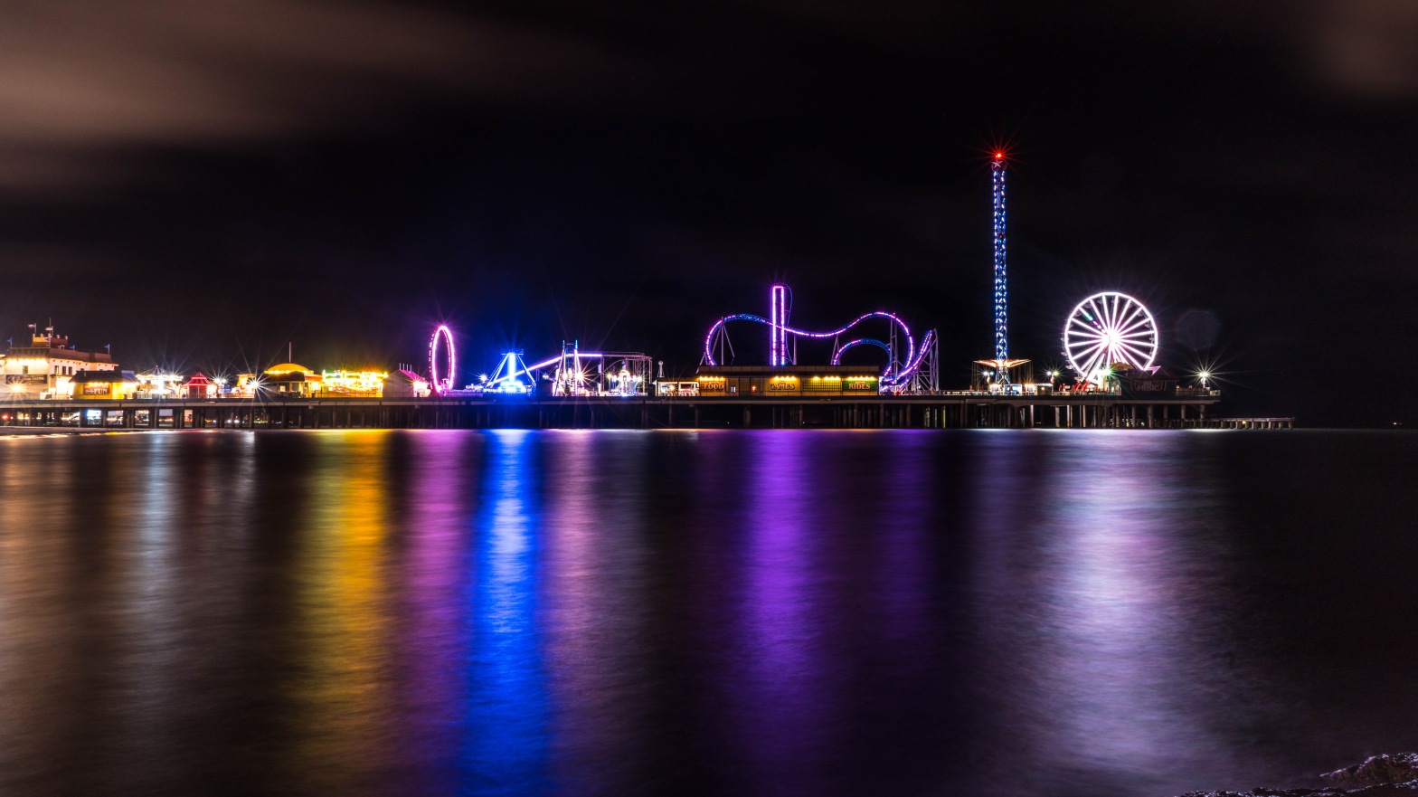


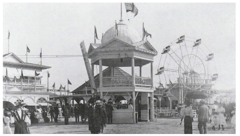


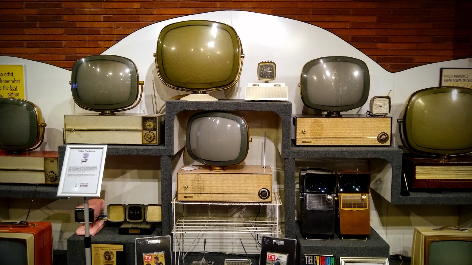


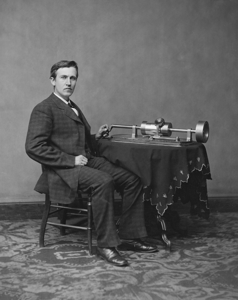


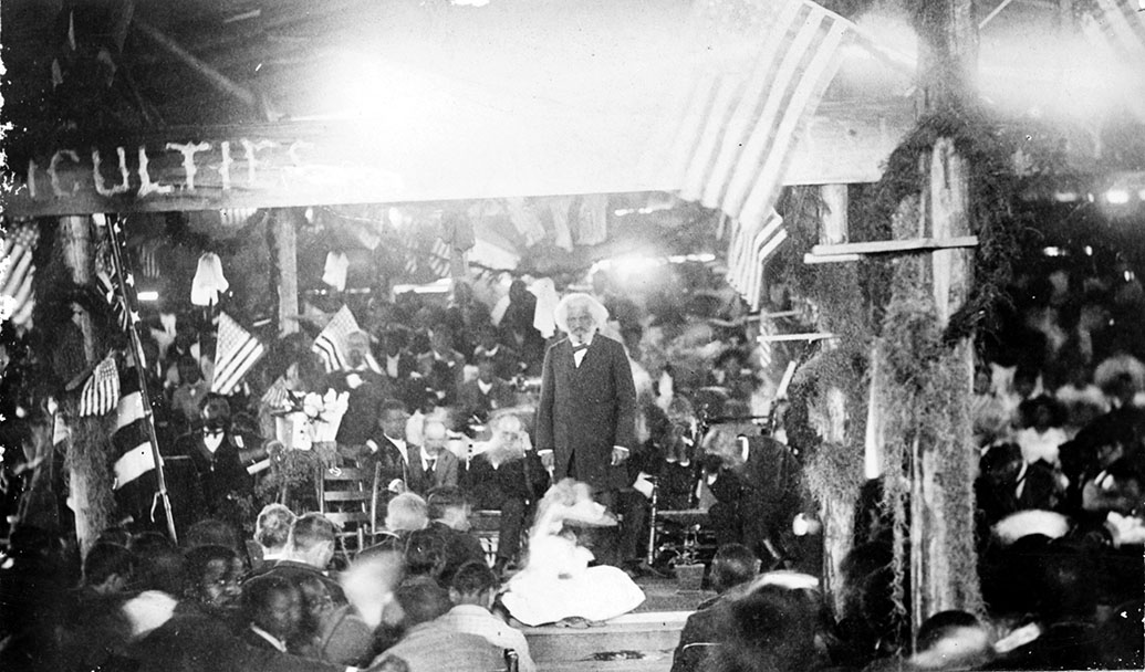
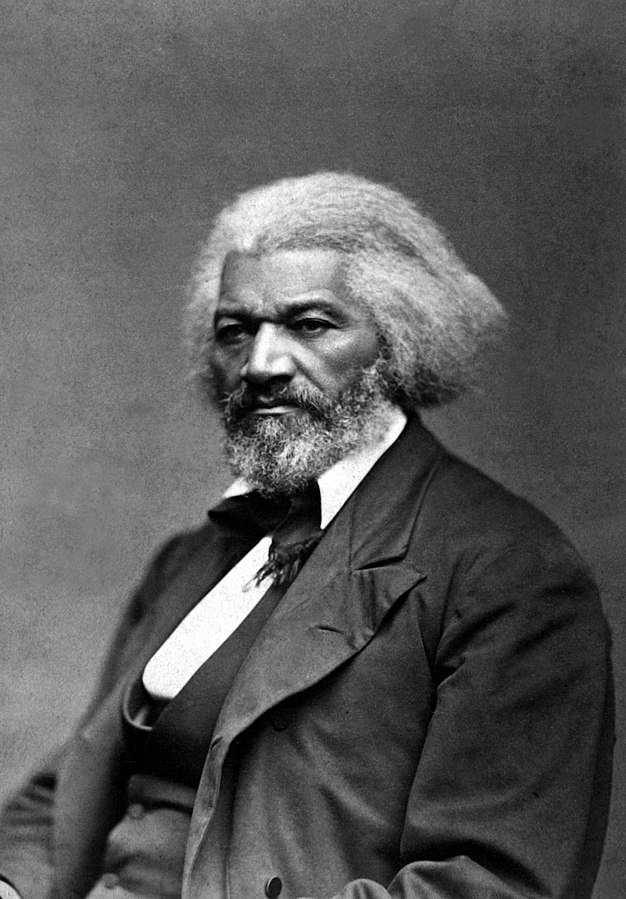
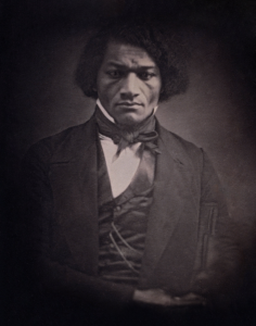
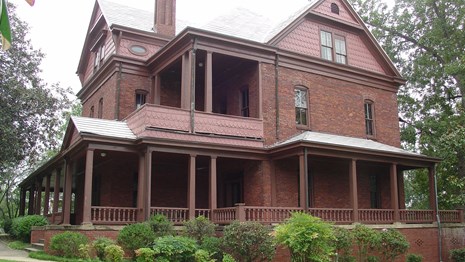
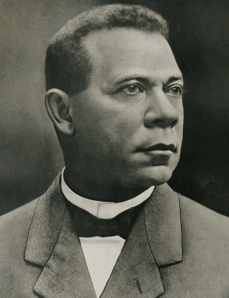
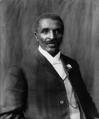

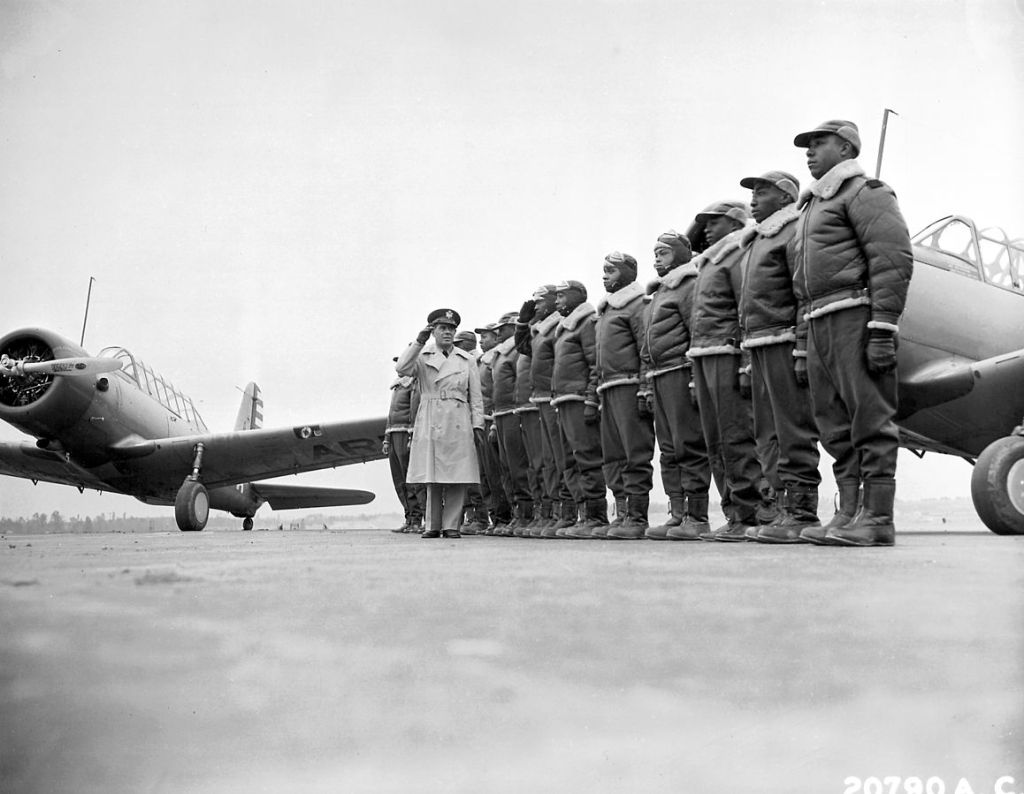
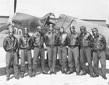

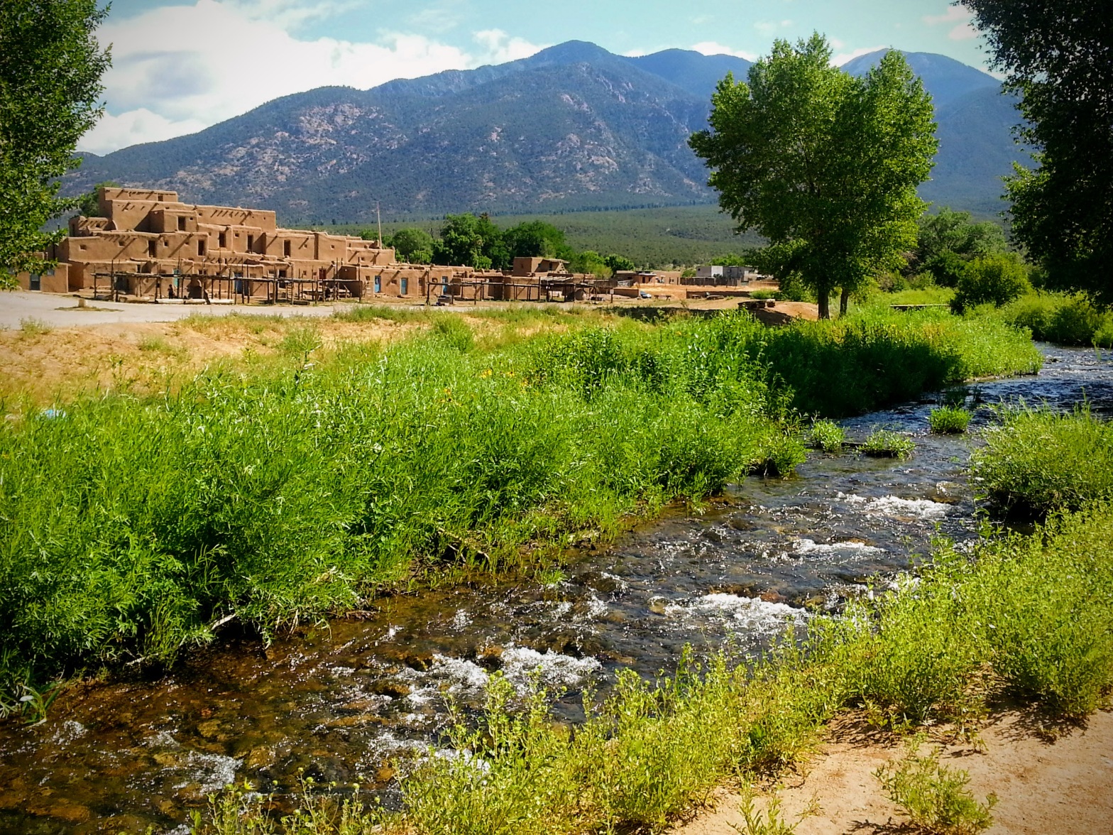
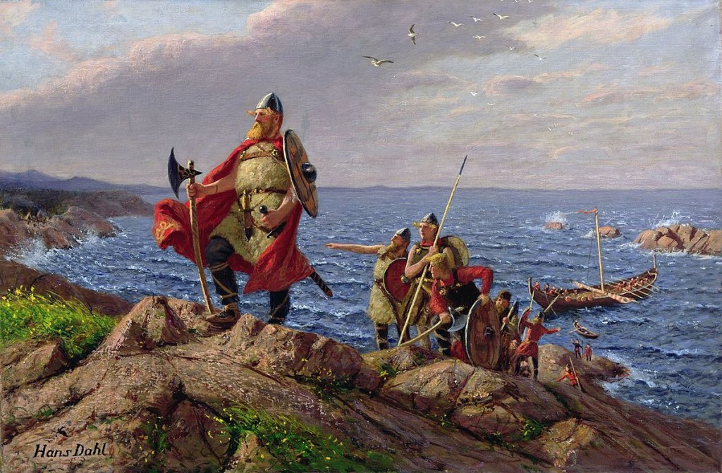


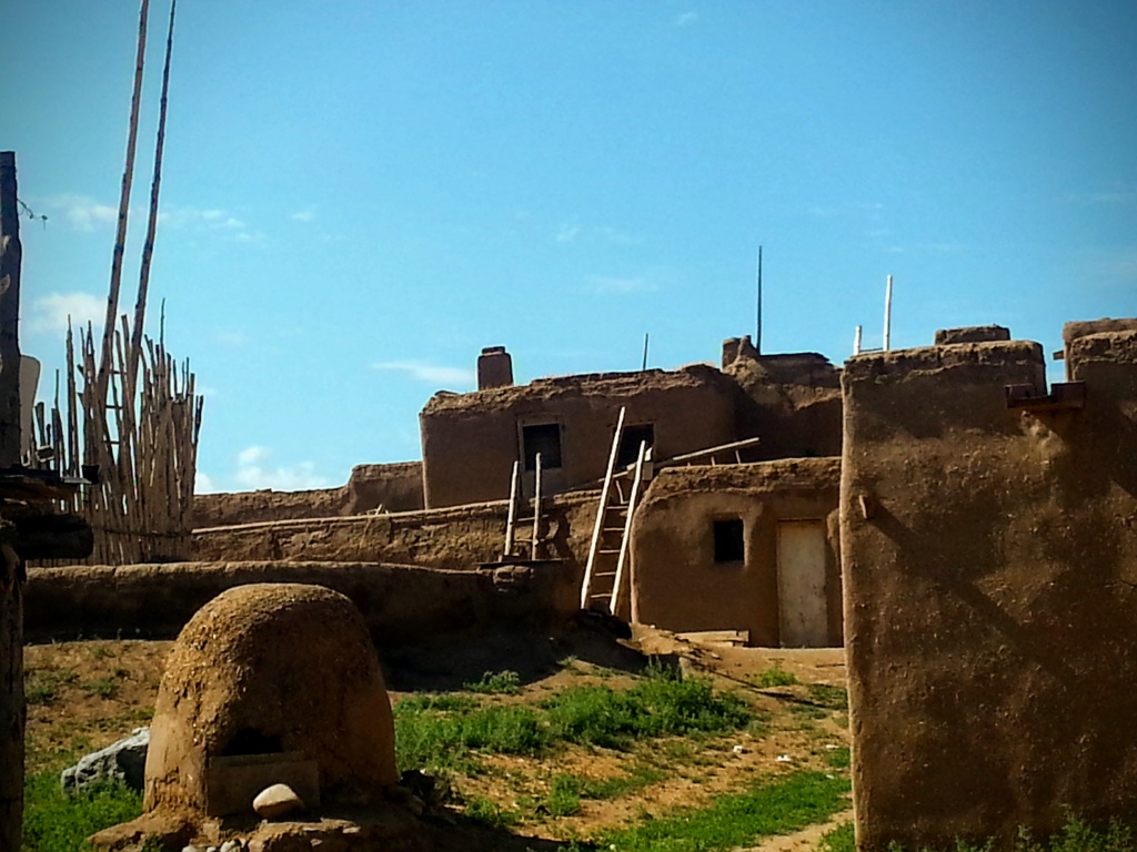


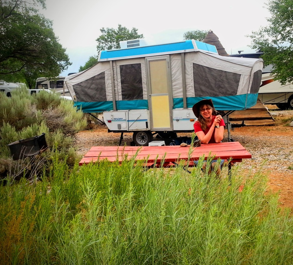

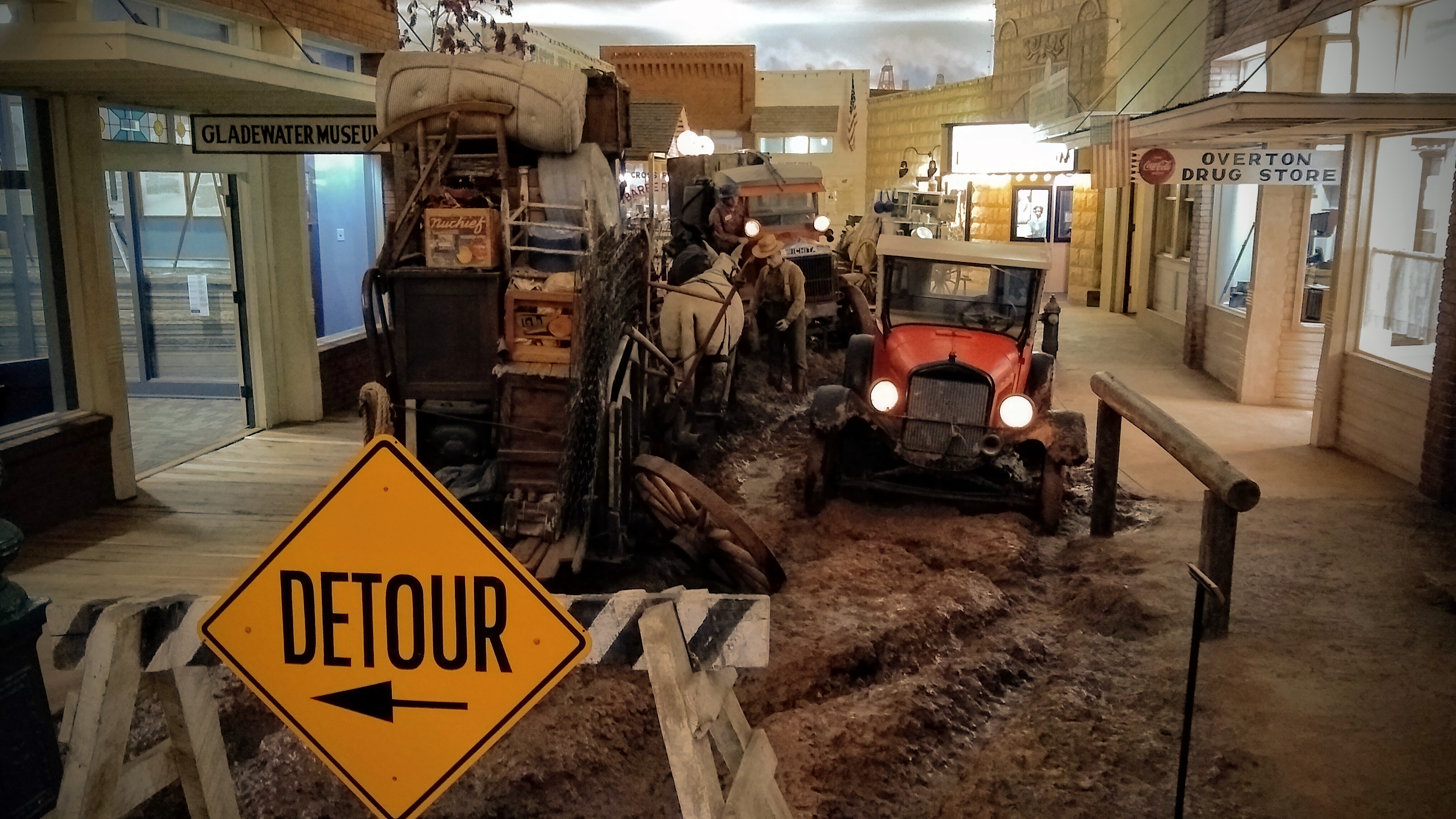
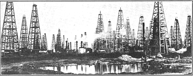
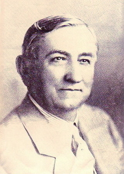
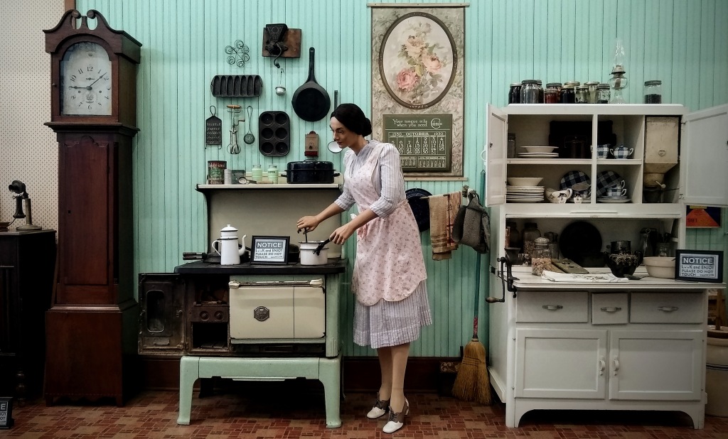

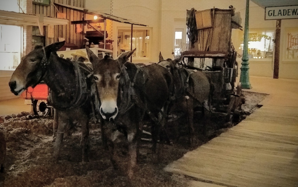
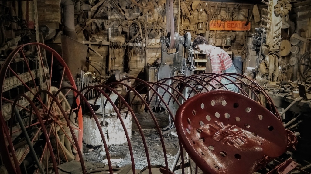
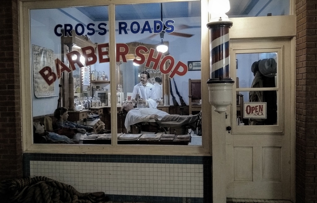


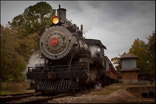


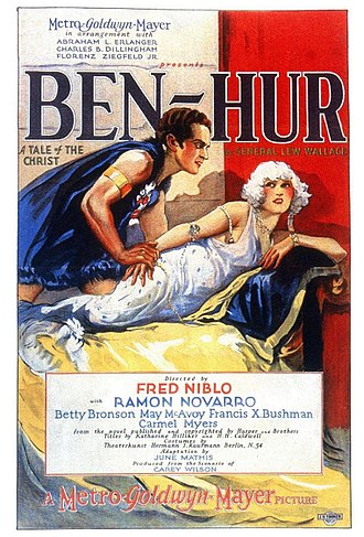
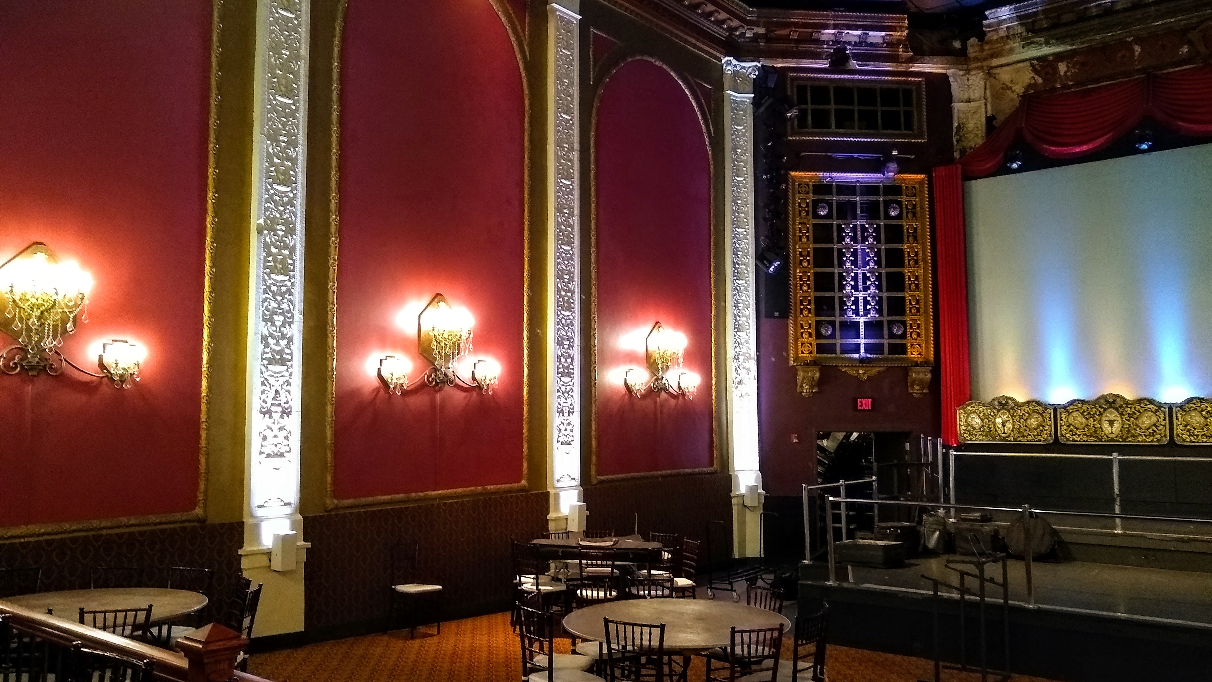


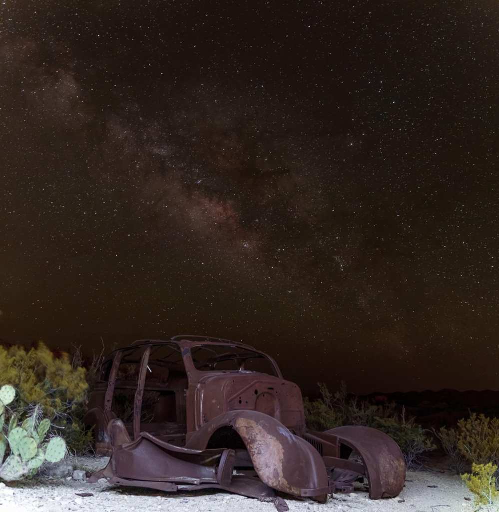

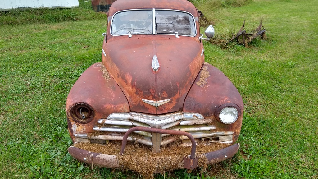
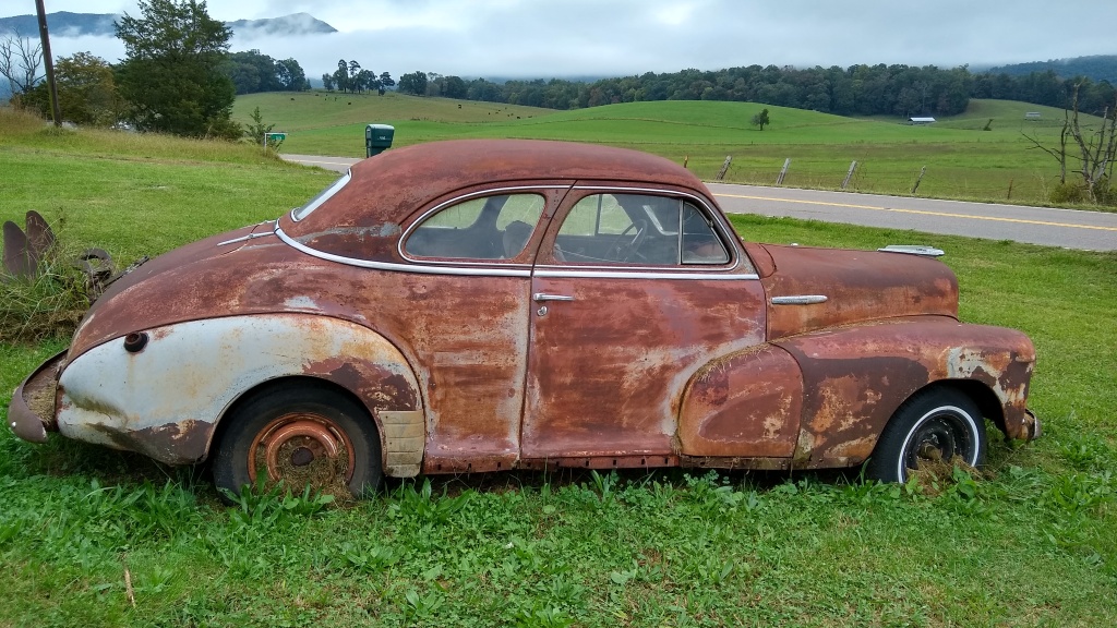

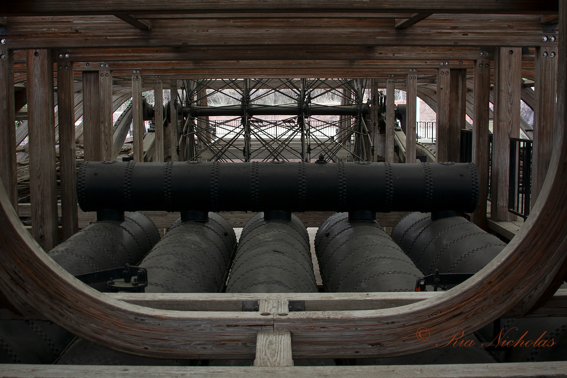
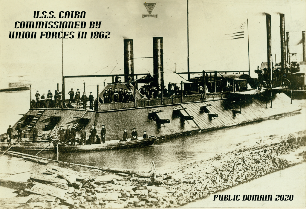
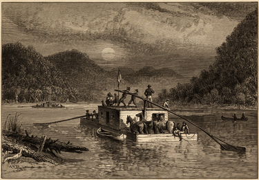
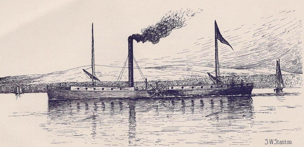


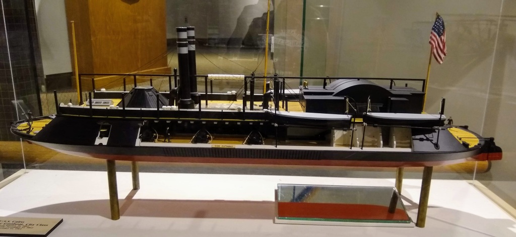
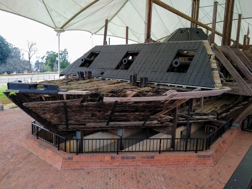
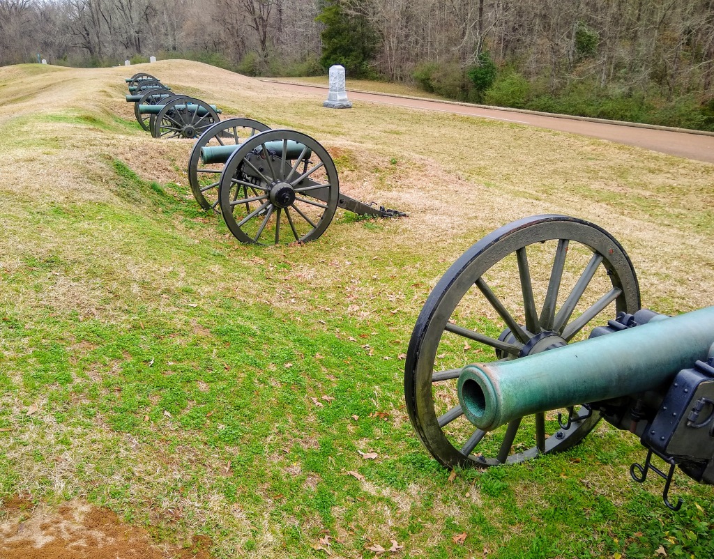


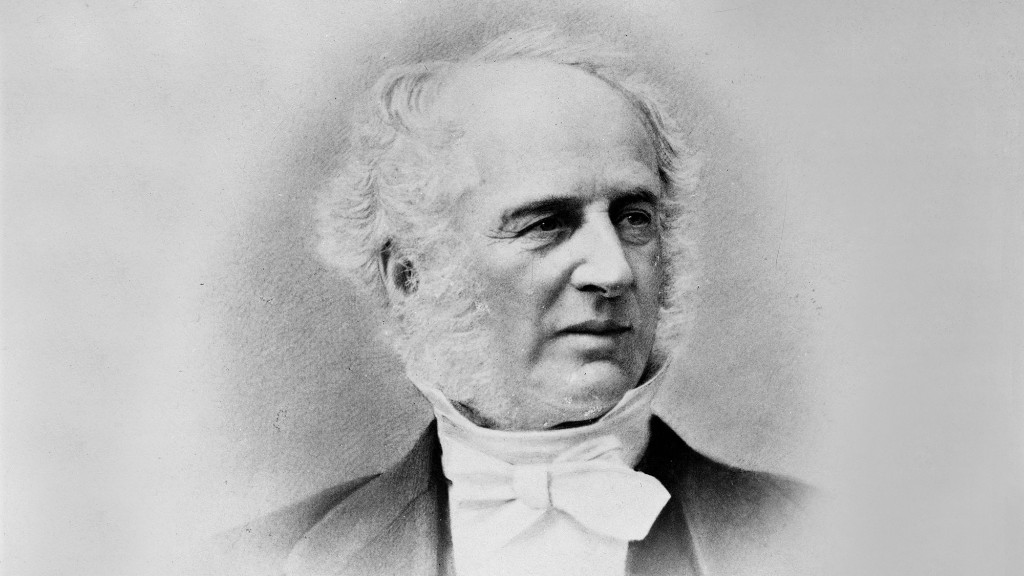

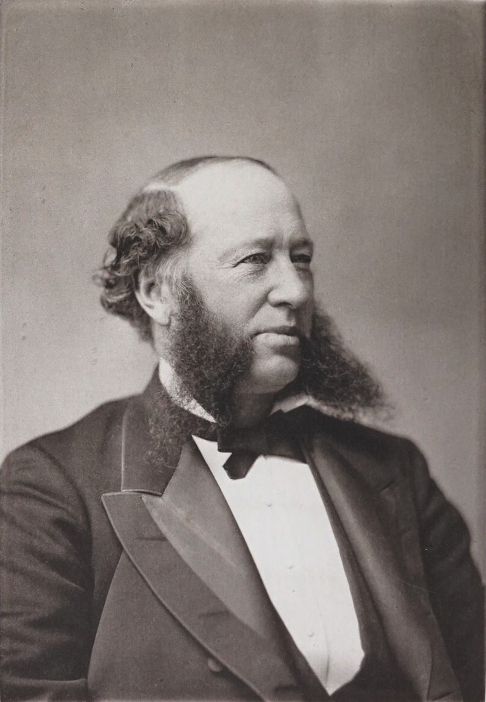

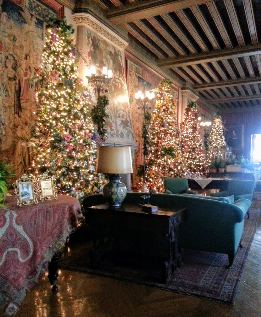

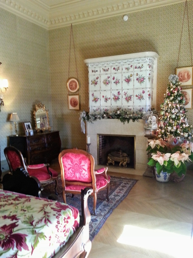


